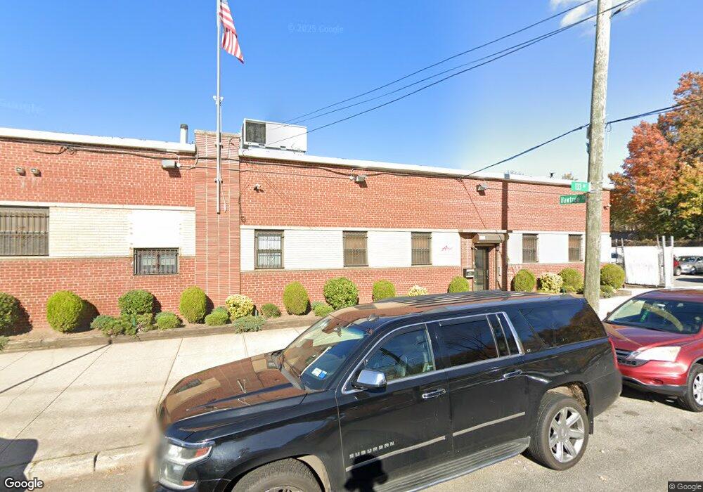
9735 133rd Ave Jamaica, NY 11417
Ozone Park Neighborhood
--
Bed
--
Bath
31,066
Sq Ft
0.82
Acres
About This Home
This home is located at 9735 133rd Ave, Jamaica, NY 11417. 9735 133rd Ave is a home located in Queens County with nearby schools including P.S. 108 - Capt. Vincent G. Fowler, M.S.137 America's School of Heroes, and John Adams High School.
Ownership History
Date
Name
Owned For
Owner Type
Purchase Details
Closed on
Jan 30, 2008
Sold by
New York City Industrial Development Age
Bought by
Trni Associates Llc
Purchase Details
Closed on
Jan 3, 1997
Sold by
Trni Associates Llc
Bought by
The New York City Industrial Development
Create a Home Valuation Report for This Property
The Home Valuation Report is an in-depth analysis detailing your home's value as well as a comparison with similar homes in the area
Home Values in the Area
Average Home Value in this Area
Purchase History
| Date | Buyer | Sale Price | Title Company |
|---|---|---|---|
| Trni Associates Llc | -- | -- | |
| Trni Associates Llc | -- | -- | |
| The New York City Industrial Development | -- | Commonwealth Land Title Ins | |
| Trni Associates Llc | $1,350,000 | Commonwealth Land Title Ins | |
| Trni Associates Llc | -- | Commonwealth Land Title Ins | |
| Trni Associates Llc | -- | Commonwealth Land Title Ins |
Source: Public Records
Tax History Compared to Growth
Tax History
| Year | Tax Paid | Tax Assessment Tax Assessment Total Assessment is a certain percentage of the fair market value that is determined by local assessors to be the total taxable value of land and additions on the property. | Land | Improvement |
|---|---|---|---|---|
| 2025 | $163,611 | $1,564,020 | $393,750 | $1,170,270 |
| 2024 | $163,611 | $1,544,670 | $393,750 | $1,150,920 |
| 2023 | $160,723 | $1,517,400 | $393,750 | $1,123,650 |
| 2022 | $159,392 | $1,663,200 | $393,750 | $1,269,450 |
| 2021 | $123,002 | $1,150,200 | $393,750 | $756,450 |
| 2020 | $154,976 | $1,586,700 | $393,750 | $1,192,950 |
| 2019 | $78,522 | $1,536,300 | $393,750 | $1,142,550 |
| 2018 | $143,226 | $1,362,240 | $393,750 | $968,490 |
| 2017 | $136,470 | $1,297,980 | $393,750 | $904,230 |
| 2016 | $129,664 | $1,297,980 | $393,750 | $904,230 |
| 2015 | $46,671 | $1,161,990 | $393,750 | $768,240 |
| 2014 | $46,671 | $1,050,570 | $393,750 | $656,820 |
Source: Public Records
Map
Nearby Homes
- 132-01 100th St
- 10010 133rd Ave
- 13318 Centreville St
- 96-06 134th Rd
- 9439 134th Ave
- 132-11 Centreville St
- 9426 Sutter Ave
- 10723 96th St
- 10719 96th St
- 95-18 Linden Blvd
- 10317 Plattwood Ave
- 107-16 103rd St
- 13319 Crossbay Blvd
- 150-06 Hawtree St
- 9704 Pitkin Ave
- 9515 Pitkin Ave
- 107-62 93rd St
- 106-38 95th St
- 9407 Pitkin Ave
- 91-25 Gold Rd
- 9725 133rd Ave
- 9732 133rd Ave
- 13303 Hawtree St Unit 2
- 97-32 133rd Ave
- 9730 133rd Ave
- 9728 133rd Ave
- 9721 133rd Ave
- 13303 Hawtree St
- 9721 133rd Ave
- 9728 133rd Ave
- 9724 133rd Ave
- 9717 133rd Ave
- 9720 Plattwood Ave
- 13309 Hawtree St
- 9722 133rd Ave
- 133-09 Hawtree St Unit 1
- 97-15 133rd Ave
- 31-06 100 St
- 9715 133rd Ave
- 9716 Plattwood Ave