Estimated Value: $299,000 - $350,000
3
Beds
3
Baths
2,350
Sq Ft
$139/Sq Ft
Est. Value
About This Home
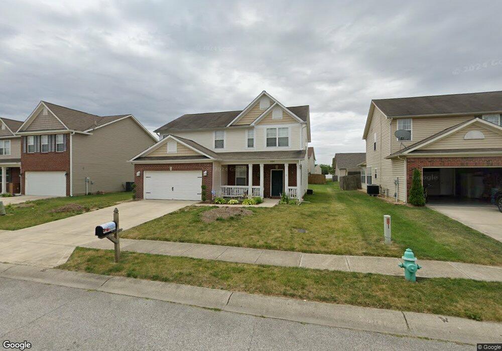
This home is located at 9737 Rhodes Ln, Avon, IN 46123 and is currently estimated at $327,240, approximately $139 per square foot. 9737 Rhodes Ln is a home located in Hendricks County with nearby schools including Maple Elementary School, White Oak Elementary School, and Avon Middle School North.
Ownership History
Date
Name
Owned For
Owner Type
Purchase Details
Closed on
Apr 18, 2006
Sold by
Beazer Homes Indiana Llp
Bought by
Frederick Ronald W and Frederick Theresa L
Current Estimated Value
Home Financials for this Owner
Home Financials are based on the most recent Mortgage that was taken out on this home.
Original Mortgage
$153,880
Outstanding Balance
$89,345
Interest Rate
6.54%
Mortgage Type
FHA
Estimated Equity
$237,895
Create a Home Valuation Report for This Property
The Home Valuation Report is an in-depth analysis detailing your home's value as well as a comparison with similar homes in the area
Home Values in the Area
Average Home Value in this Area
Purchase History
| Date | Buyer | Sale Price | Title Company |
|---|---|---|---|
| Frederick Ronald W | -- | None Available |
Source: Public Records
Mortgage History
| Date | Status | Borrower | Loan Amount |
|---|---|---|---|
| Open | Frederick Ronald W | $153,880 |
Source: Public Records
Tax History Compared to Growth
Tax History
| Year | Tax Paid | Tax Assessment Tax Assessment Total Assessment is a certain percentage of the fair market value that is determined by local assessors to be the total taxable value of land and additions on the property. | Land | Improvement |
|---|---|---|---|---|
| 2024 | $3,538 | $313,900 | $42,800 | $271,100 |
| 2023 | $3,186 | $275,800 | $37,200 | $238,600 |
| 2022 | $3,086 | $265,000 | $35,400 | $229,600 |
| 2021 | $2,327 | $198,500 | $33,700 | $164,800 |
| 2020 | $2,091 | $185,300 | $33,700 | $151,600 |
| 2019 | $1,972 | $174,900 | $31,800 | $143,100 |
| 2018 | $2,062 | $169,600 | $31,800 | $137,800 |
| 2017 | $1,609 | $160,900 | $30,300 | $130,600 |
| 2016 | $1,570 | $157,000 | $30,300 | $126,700 |
| 2014 | $1,422 | $142,200 | $27,800 | $114,400 |
Source: Public Records
Map
Nearby Homes
- Riverton Plan at Brookstone - Crossings
- Fifth Avenue Plan at Brookstone - Landings
- Park Place Plan at Brookstone - Landings
- Greenfield Plan at Brookstone - Crossings
- Boardwalk Plan at Brookstone - Landings
- Hilltop Plan at Brookstone - Crossings
- Westchester Plan at Brookstone - Crossings
- 1274 Newton St
- 1237 Langham St
- 1280 Newton St
- 9583 Beckett St
- 9604 Beckett St
- 9570 Beckett St
- 9652 Beckett St
- 694 Crystal Farms Dr
- 9447 Jackson Way
- 1218 Bedford Dr
- 614 Corbin Way
- 9936 Nightsong Ln
- 569 Dalton Way