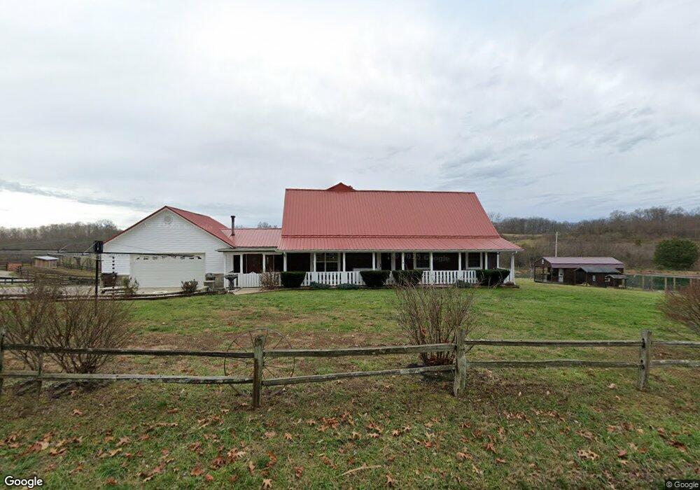
974 Cox Rd Wellston, OH 45692
Estimated Value: $104,000 - $427,000
4
Beds
3
Baths
2,200
Sq Ft
$100/Sq Ft
Est. Value
About This Home
This home is located at 974 Cox Rd, Wellston, OH 45692 and is currently estimated at $219,333, approximately $99 per square foot. 974 Cox Rd is a home located in Jackson County with nearby schools including Bundy Elementary School, Wellston Intermediate School, and Wellston Middle School.
Ownership History
Date
Name
Owned For
Owner Type
Purchase Details
Closed on
Dec 5, 2023
Sold by
Thompson Edward O and Thompson Sherry L
Bought by
Thompson Family Trust and Thompson
Current Estimated Value
Purchase Details
Closed on
Aug 19, 2014
Sold by
Ambrose Patrick O
Bought by
Thompson Edward O and Thompson Sherry L
Purchase Details
Closed on
Oct 31, 2012
Sold by
Cartwright Rodney and Cartwright Kristina
Bought by
Ambrose Patrick O
Home Financials for this Owner
Home Financials are based on the most recent Mortgage that was taken out on this home.
Original Mortgage
$83,200
Interest Rate
3.51%
Mortgage Type
Future Advance Clause Open End Mortgage
Purchase Details
Closed on
Jan 19, 2012
Sold by
Bartoe Michael Wayne and Bartoe Fondaleigh June
Bought by
Cartwright Rodney and Palet Alen
Create a Home Valuation Report for This Property
The Home Valuation Report is an in-depth analysis detailing your home's value as well as a comparison with similar homes in the area
Purchase History
| Date | Buyer | Sale Price | Title Company |
|---|---|---|---|
| Thompson Family Trust | -- | None Listed On Document | |
| Thompson Edward O | $125,000 | Northwest Title | |
| Ambrose Patrick O | $104,000 | None Available | |
| Cartwright Rodney | -- | None Available |
Source: Public Records
Mortgage History
| Date | Status | Borrower | Loan Amount |
|---|---|---|---|
| Previous Owner | Ambrose Patrick O | $83,200 |
Source: Public Records
Tax History
| Year | Tax Paid | Tax Assessment Tax Assessment Total Assessment is a certain percentage of the fair market value that is determined by local assessors to be the total taxable value of land and additions on the property. | Land | Improvement |
|---|---|---|---|---|
| 2025 | $108 | $3,360 | $3,360 | $0 |
| 2024 | $107 | $3,360 | $3,360 | $0 |
| 2023 | $107 | $3,360 | $3,360 | $0 |
| 2022 | $121 | $3,080 | $3,080 | $0 |
| 2021 | $103 | $3,080 | $3,080 | $0 |
| 2020 | $53 | $3,080 | $3,080 | $0 |
| 2019 | $100 | $2,800 | $2,800 | $0 |
| 2018 | $96 | $2,800 | $2,800 | $0 |
| 2017 | $91 | $2,800 | $2,800 | $0 |
| 2016 | $92 | $2,800 | $2,800 | $0 |
| 2015 | $92 | $2,800 | $2,800 | $0 |
| 2013 | $75 | $2,280 | $2,280 | $0 |
| 2012 | $76 | $2,280 | $2,280 | $0 |
Source: Public Records
Map
Nearby Homes
- 1230 Cox Rd
- 62174 Chillicothe St
- 62410 Chillicothe St
- 225 Elm St
- 0 Ohio 160 Unit 2434325
- 0 Ohio 160 Unit 198998
- 0 Ohio 160 Unit 2433549
- 0 Ohio 160 Unit 2434326
- 0 Ohio 160 Unit 225045622
- 0 Ohio 160 Unit 198997
- 0 Ohio 160 Unit 225045627
- Lot J Main St
- 208 Velma Dr
- 523 W C St
- 0 D St
- 319 N Park Ave
- 101 E D St
- 0 Ohio 93
- 188 Oak Ridge Rd
- 521 W Broadway St
Your Personal Tour Guide
Ask me questions while you tour the home.