Estimated Value: $263,000 - $279,000
3
Beds
2
Baths
1,245
Sq Ft
$219/Sq Ft
Est. Value
About This Home
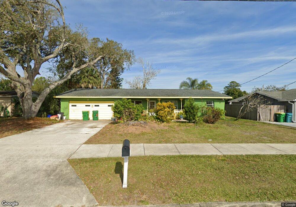
This home is located at 974 Fay Blvd, Cocoa, FL 32927 and is currently estimated at $272,667, approximately $219 per square foot. 974 Fay Blvd is a home located in Brevard County with nearby schools including Atlantis Elementary School, Space Coast Junior/Senior High School, and East Atlantic Prep of Brevard County.
Ownership History
Date
Name
Owned For
Owner Type
Purchase Details
Closed on
Mar 18, 2022
Sold by
Jean Clark Barbara
Bought by
Sablan Erik Steven and Clark Barbara Jean
Current Estimated Value
Home Financials for this Owner
Home Financials are based on the most recent Mortgage that was taken out on this home.
Original Mortgage
$85,000
Outstanding Balance
$68,839
Interest Rate
3.39%
Mortgage Type
New Conventional
Estimated Equity
$203,828
Purchase Details
Closed on
May 14, 2021
Sold by
Clark Barbara Jean
Bought by
Clark Barbara Jean and Messer Elizabeth Anne
Create a Home Valuation Report for This Property
The Home Valuation Report is an in-depth analysis detailing your home's value as well as a comparison with similar homes in the area
Home Values in the Area
Average Home Value in this Area
Purchase History
| Date | Buyer | Sale Price | Title Company |
|---|---|---|---|
| Sablan Erik Steven | -- | None Listed On Document | |
| Clark Barbara Jean | $7,000 | None Available |
Source: Public Records
Mortgage History
| Date | Status | Borrower | Loan Amount |
|---|---|---|---|
| Open | Sablan Erik Steven | $85,000 |
Source: Public Records
Tax History Compared to Growth
Tax History
| Year | Tax Paid | Tax Assessment Tax Assessment Total Assessment is a certain percentage of the fair market value that is determined by local assessors to be the total taxable value of land and additions on the property. | Land | Improvement |
|---|---|---|---|---|
| 2025 | $1,658 | $131,610 | -- | -- |
| 2024 | $2,751 | $129,430 | -- | -- |
| 2023 | $2,751 | $179,410 | $0 | $0 |
| 2022 | $2,382 | $148,240 | $0 | $0 |
| 2021 | $780 | $44,460 | $0 | $0 |
| 2020 | $728 | $43,850 | $0 | $0 |
| 2019 | $666 | $42,870 | $0 | $0 |
| 2018 | $656 | $42,080 | $0 | $0 |
| 2017 | $643 | $41,220 | $0 | $0 |
| 2016 | $635 | $40,380 | $18,000 | $22,380 |
| 2015 | $629 | $40,100 | $15,000 | $25,100 |
| 2014 | $629 | $39,790 | $11,000 | $28,790 |
Source: Public Records
Map
Nearby Homes
- 958 Fay Blvd
- 995 Barclay Dr
- 992 Barclay Dr
- 463 Camel Cir
- 520 Arabella Ln
- 641 Lindsay Ave
- 691 Aloha Ave
- 453 Camel Cir
- 780 Alcazar Ave
- 6575 Dallas Ave
- 1008 Jersey St
- 1010 Illinois Rd
- 672 Altura Dr
- 3920 Juanita St
- 3870 Scotland St
- 0 Fay Blvd Unit 1011912
- 6485 Dallas Ave
- 3955 Juanita St
- 361 Payne Ave
- 986 MacCo Rd