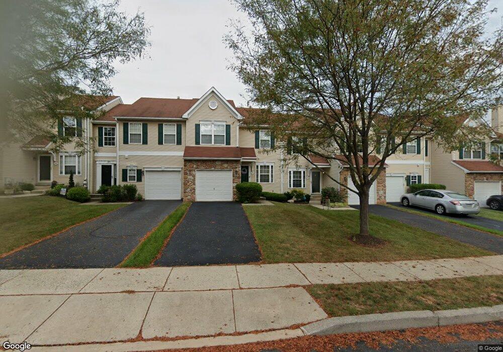
974 Katie Cir Royersford, PA 19468
Estimated Value: $422,000 - $468,000
3
Beds
3
Baths
1,785
Sq Ft
$248/Sq Ft
Est. Value
About This Home
This home is located at 974 Katie Cir, Royersford, PA 19468 and is currently estimated at $441,795, approximately $247 per square foot. 974 Katie Cir is a home located in Montgomery County with nearby schools including Royersford Elementary School, Spring-Ford Middle School 5/6/7 Grade Center, and Spring-Ford Middle School 8th Grade Center.
Ownership History
Date
Name
Owned For
Owner Type
Purchase Details
Closed on
Jul 25, 2003
Sold by
Macleod Andrew M and Macleod Karel J
Bought by
Laboriel Suyapa D
Current Estimated Value
Purchase Details
Closed on
May 27, 1914
Sold by
Sukonik Indian Creek Corp
Bought by
Macleod Andrew M and Macleod Karel J
Create a Home Valuation Report for This Property
The Home Valuation Report is an in-depth analysis detailing your home's value as well as a comparison with similar homes in the area
Home Values in the Area
Average Home Value in this Area
Purchase History
| Date | Buyer | Sale Price | Title Company |
|---|---|---|---|
| Laboriel Suyapa D | $193,000 | -- | |
| Macleod Andrew M | $145,290 | -- |
Source: Public Records
Tax History Compared to Growth
Tax History
| Year | Tax Paid | Tax Assessment Tax Assessment Total Assessment is a certain percentage of the fair market value that is determined by local assessors to be the total taxable value of land and additions on the property. | Land | Improvement |
|---|---|---|---|---|
| 2025 | $5,477 | $142,090 | $14,640 | $127,450 |
| 2024 | $5,477 | $142,090 | $14,640 | $127,450 |
| 2023 | $5,228 | $142,090 | $14,640 | $127,450 |
| 2022 | $5,051 | $142,090 | $14,640 | $127,450 |
| 2021 | $4,747 | $142,090 | $14,640 | $127,450 |
| 2020 | $4,622 | $142,090 | $14,640 | $127,450 |
| 2019 | $4,534 | $142,090 | $14,640 | $127,450 |
| 2018 | $3,615 | $142,090 | $14,640 | $127,450 |
| 2017 | $4,446 | $142,090 | $14,640 | $127,450 |
| 2016 | $4,391 | $142,090 | $14,640 | $127,450 |
| 2015 | $4,194 | $142,090 | $14,640 | $127,450 |
| 2014 | $4,106 | $142,090 | $14,640 | $127,450 |
Source: Public Records
Map
Nearby Homes
- 184 Providence Forge Rd
- 96 Providence Forge Rd
- 149 Roboda Blvd
- 36 Roboda Blvd
- 51 Roboda Blvd
- Granton Plan at Lewis Pointe
- 107 Beacon Ct Unit 10104
- 103 Beacon Ct Unit 10102
- 104 Beacon Ct Unit 10403
- 123 Beacon Ct Unit 10205
- 19 Iroquois Dr
- 604 Green St
- 804 Maple Ave
- 484 Fruit Farm Rd
- 209 Old State Rd
- 335 Arch St
- 518 Walnut St
- 414 2nd Ave
- 0 Main St Unit PAMC2088436
- 235 2nd Ave Unit 2