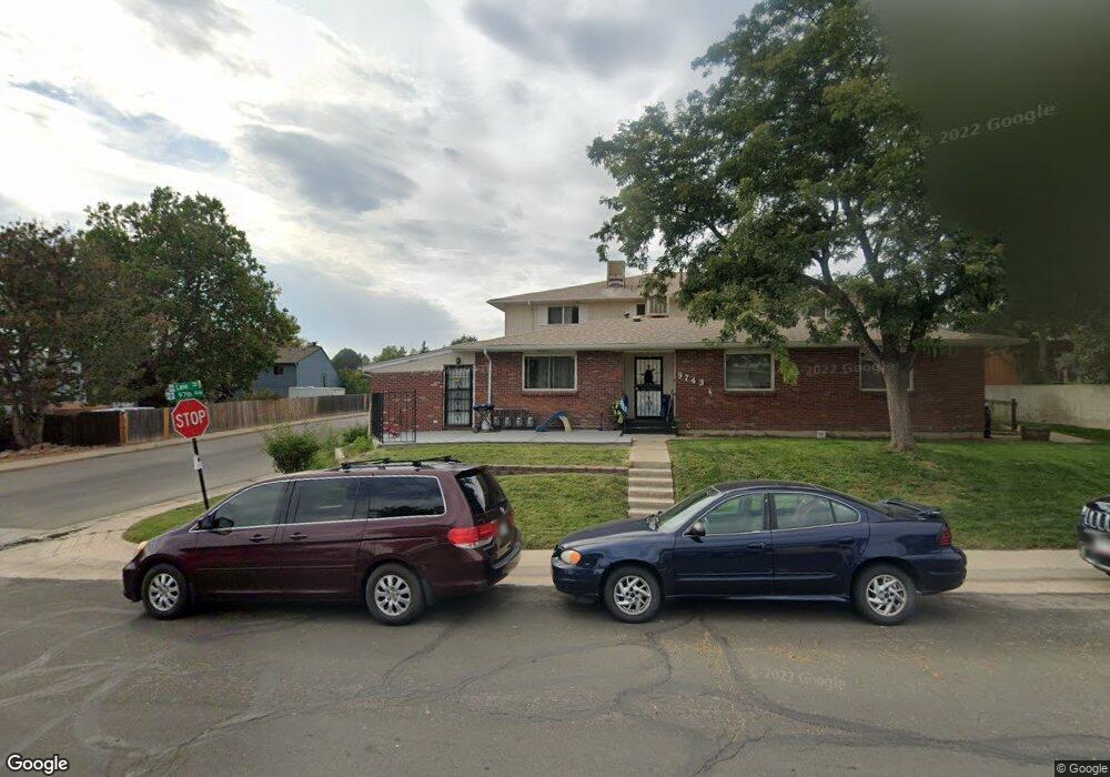
9743 Lane St Thornton, CO 80260
Hillcrest NeighborhoodEstimated Value: $322,000 - $379,000
3
Beds
2
Baths
1,528
Sq Ft
$229/Sq Ft
Est. Value
About This Home
This home is located at 9743 Lane St, Thornton, CO 80260 and is currently estimated at $349,474, approximately $228 per square foot. 9743 Lane St is a home located in Adams County with nearby schools including Hillcrest Elementary School, Silver Hills Middle School, and Northglenn High School.
Ownership History
Date
Name
Owned For
Owner Type
Purchase Details
Closed on
Mar 15, 2012
Sold by
The Bank Of New York Mellon
Bought by
Cannon Properties Llc
Current Estimated Value
Purchase Details
Closed on
Aug 18, 2005
Sold by
Elwood Marcia Joan and Kester Arlene Sue
Bought by
Pelshaw Michael and Pelshaw Christina
Home Financials for this Owner
Home Financials are based on the most recent Mortgage that was taken out on this home.
Original Mortgage
$154,000
Interest Rate
6%
Mortgage Type
New Conventional
Purchase Details
Closed on
May 3, 1999
Sold by
Marie Sternenberger Anna
Bought by
Elwood Marcia Joan and Kester Arlene Sue
Create a Home Valuation Report for This Property
The Home Valuation Report is an in-depth analysis detailing your home's value as well as a comparison with similar homes in the area
Home Values in the Area
Average Home Value in this Area
Purchase History
| Date | Buyer | Sale Price | Title Company |
|---|---|---|---|
| Cannon Properties Llc | $84,000 | Stewart Title | |
| Pelshaw Michael | $154,000 | -- | |
| Elwood Marcia Joan | -- | -- |
Source: Public Records
Mortgage History
| Date | Status | Borrower | Loan Amount |
|---|---|---|---|
| Previous Owner | Pelshaw Michael | $154,000 |
Source: Public Records
Tax History Compared to Growth
Tax History
| Year | Tax Paid | Tax Assessment Tax Assessment Total Assessment is a certain percentage of the fair market value that is determined by local assessors to be the total taxable value of land and additions on the property. | Land | Improvement |
|---|---|---|---|---|
| 2024 | $2,031 | $20,690 | $4,000 | $16,690 |
| 2023 | $2,010 | $23,340 | $3,110 | $20,230 |
| 2022 | $1,941 | $17,620 | $3,200 | $14,420 |
| 2021 | $2,005 | $17,620 | $3,200 | $14,420 |
| 2020 | $2,065 | $18,510 | $3,290 | $15,220 |
| 2019 | $2,069 | $18,510 | $3,290 | $15,220 |
| 2018 | $1,711 | $14,870 | $610 | $14,260 |
| 2017 | $1,556 | $14,870 | $610 | $14,260 |
| 2016 | $1,168 | $10,870 | $680 | $10,190 |
| 2015 | $1,167 | $10,870 | $680 | $10,190 |
| 2014 | -- | $6,770 | $680 | $6,090 |
Source: Public Records
Map
Nearby Homes
- 9759 Lane St Unit 2718
- 9769 Croke Dr
- 9824 Lane St
- 9857 Lane St
- 9848 Lane St
- 9842 Lane St
- 9648 Lane St
- 1160 W 99th Ave
- 9947 Croke Dr
- 9963 Lane St
- 864 W 96th Place
- 2100 W 100th Ave Unit 351
- 2100 W 100th Ave
- 2100 W 100th Ave Unit 124
- 2100 W 100th Ave Unit 347
- 2100 W 100th Ave Unit 357
- 2100 W 100th Ave Unit 73
- 2100 W 100th Ave Unit 94
- 2100 W 100th Ave Unit 59
- 2100 W 100th Ave Unit 166
- 9749 Lane St
- 9745 Lane St
- 9747 Lane St
- 9753 Lane St
- 9755 Lane St
- 9757 Lane St
- 9758 Orangewood Dr
- 9754 Orangewood Dr
- 9756 Orangewood Dr Unit 2720B2
- 9752 Orangewood Dr
- 9765 Lane St
- 9693 Lane St
- 9763 Lane St
- 9744 Lane St
- 9766 Orangewood Dr
- 9764 Orangewood Dr
- 9762 Orangewood Dr
- 9767 Lane St
- 9769 Lane St
- 9746 Lane St