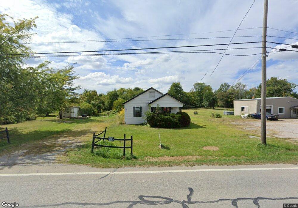
9745 Us Highway 68 Georgetown, OH 45121
Estimated Value: $127,809 - $134,000
2
Beds
1
Bath
1,040
Sq Ft
$125/Sq Ft
Est. Value
About This Home
This home is located at 9745 Us Highway 68, Georgetown, OH 45121 and is currently estimated at $130,202, approximately $125 per square foot. 9745 Us Highway 68 is a home located in Brown County with nearby schools including Georgetown Elementary School and Georgetown Jr/Sr High School.
Ownership History
Date
Name
Owned For
Owner Type
Purchase Details
Closed on
Dec 18, 2025
Sold by
Copperhead Chuckwagon Llc
Bought by
Scheckells Isaac R
Current Estimated Value
Home Financials for this Owner
Home Financials are based on the most recent Mortgage that was taken out on this home.
Original Mortgage
$132,554
Outstanding Balance
$132,428
Interest Rate
6.22%
Mortgage Type
FHA
Estimated Equity
-$2,226
Purchase Details
Closed on
Jan 9, 2025
Sold by
Craig Rentals Llc
Bought by
Copperhead Chuckwagon Llc
Purchase Details
Closed on
Feb 5, 2021
Sold by
Craig Damon and Craig Kimberly
Bought by
Craig Rentals Llc
Purchase Details
Closed on
Aug 30, 2019
Sold by
Federal Home Loan Mortgage Corporation
Bought by
Craig Damon
Purchase Details
Closed on
Dec 27, 2018
Sold by
Bowling Dealie and Nationstar Mortgage Llc
Bought by
Federal Home Loan Mortgage Corporation
Create a Home Valuation Report for This Property
The Home Valuation Report is an in-depth analysis detailing your home's value as well as a comparison with similar homes in the area
Purchase History
| Date | Buyer | Sale Price | Title Company |
|---|---|---|---|
| Scheckells Isaac R | $135,000 | Valmer Land Title | |
| Copperhead Chuckwagon Llc | $67,000 | None Listed On Document | |
| Craig Rentals Llc | -- | None Available | |
| Craig Damon | -- | Allodial Title Llc | |
| Federal Home Loan Mortgage Corporation | $26,667 | None Available |
Source: Public Records
Mortgage History
| Date | Status | Borrower | Loan Amount |
|---|---|---|---|
| Open | Scheckells Isaac R | $132,554 |
Source: Public Records
Tax History
| Year | Tax Paid | Tax Assessment Tax Assessment Total Assessment is a certain percentage of the fair market value that is determined by local assessors to be the total taxable value of land and additions on the property. | Land | Improvement |
|---|---|---|---|---|
| 2024 | $728 | $23,250 | $6,090 | $17,160 |
| 2023 | $728 | $17,620 | $4,530 | $13,090 |
| 2022 | $584 | $17,620 | $4,530 | $13,090 |
| 2021 | $577 | $17,620 | $4,530 | $13,090 |
| 2020 | $217 | $15,320 | $3,940 | $11,380 |
| 2019 | $215 | $15,320 | $3,940 | $11,380 |
| 2018 | $213 | $15,320 | $3,940 | $11,380 |
| 2017 | $179 | $14,220 | $4,330 | $9,890 |
| 2016 | $179 | $14,220 | $4,330 | $9,890 |
| 2015 | $172 | $14,220 | $4,330 | $9,890 |
| 2014 | $172 | $13,830 | $3,940 | $9,890 |
| 2013 | $172 | $13,830 | $3,940 | $9,890 |
Source: Public Records
Map
Nearby Homes
- 0 Barnes Rd Unit 1851215
- 2 N Kenwood Ave
- 9705 W Fork Rd
- 1 N Kenwood Ave
- 427 Kenwood Ave
- 508 Mount Orab Pike
- 399 Elmwood Ct
- 401 Elmwood Ct
- 60 New St
- 405 N Main St
- 406 E North St
- 3070 Watson Rd
- AC Stony Hollow Rd
- 505 S Water St
- 666 E State St
- 10702 Smoky Row Rd
- 708 E State St
- 0 St Rt 221 & Footbridge Unit 1826509
- 25 Douglas Ln
- 9291 Daugherty Marks Rd
- 9735 Us Highway 68
- 9779 Us Highway 68
- 9779 Us Highway 68
- 9770 Us Highway 68
- 9770 Us Rt 68
- 9797 Us Highway 68
- 9797 Us Highway 68
- 9797 Us Highway 68
- 9808 Us Route 68
- 0 US Rt 68 Unit 1225013
- 0 US Rt 68 Unit 664381
- 0 US Rt 68 Unit 1659564
- 9874 Us Highway 68
- 9874 Us Highway 68
- 9867 Us Highway 68
- 9895 Us Highway 68
- 9941 Us Highway 68
- 9956 Us Highway 68
- 9956 Us Highway 68
- 9956 Us Highway 68
Your Personal Tour Guide
Ask me questions while you tour the home.