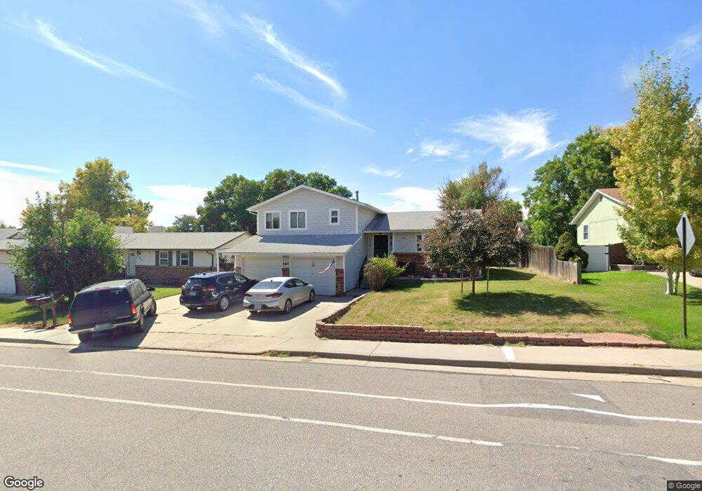
9747 Race St Thornton, CO 80229
Quimby NeighborhoodEstimated Value: $471,578 - $513,000
3
Beds
2
Baths
1,828
Sq Ft
$268/Sq Ft
Est. Value
About This Home
This home is located at 9747 Race St, Thornton, CO 80229 and is currently estimated at $490,395, approximately $268 per square foot. 9747 Race St is a home located in Adams County with nearby schools including Trailside Academy.
Ownership History
Date
Name
Owned For
Owner Type
Purchase Details
Closed on
Apr 3, 2025
Sold by
Smith Corina L
Bought by
Smith Christopher L
Current Estimated Value
Create a Home Valuation Report for This Property
The Home Valuation Report is an in-depth analysis detailing your home's value as well as a comparison with similar homes in the area
Home Values in the Area
Average Home Value in this Area
Purchase History
| Date | Buyer | Sale Price | Title Company |
|---|---|---|---|
| Smith Christopher L | -- | None Listed On Document |
Source: Public Records
Tax History Compared to Growth
Tax History
| Year | Tax Paid | Tax Assessment Tax Assessment Total Assessment is a certain percentage of the fair market value that is determined by local assessors to be the total taxable value of land and additions on the property. | Land | Improvement |
|---|---|---|---|---|
| 2024 | $2,807 | $29,250 | $5,810 | $23,440 |
| 2023 | $2,154 | $33,560 | $5,550 | $28,010 |
| 2022 | $1,661 | $23,610 | $5,700 | $17,910 |
| 2021 | $1,567 | $23,610 | $5,700 | $17,910 |
| 2020 | $1,445 | $22,680 | $5,860 | $16,820 |
| 2019 | $1,453 | $22,680 | $5,860 | $16,820 |
| 2018 | $1,052 | $17,780 | $5,760 | $12,020 |
| 2017 | $1,031 | $17,780 | $5,760 | $12,020 |
| 2016 | $743 | $14,930 | $3,020 | $11,910 |
| 2015 | $648 | $14,930 | $3,020 | $11,910 |
| 2014 | -- | $12,260 | $2,390 | $9,870 |
Source: Public Records
Map
Nearby Homes
- 9755 High St
- 9933 Harris St
- 9860 Gilpin St
- 2253 E 100th Place
- 1880 Ruth Dr
- 1781 Rowena St
- 10121 Gaylord St
- 2636 E 99th Ave
- 1900 E 95th Ave
- 2645 E 98th Way
- 10068 Elizabeth St
- 10221 York Place
- 9727 Clayton Cir
- 2684 E 97th Ave
- 9953 Travis St
- 9410 Lilly Ct
- 9361 Gail Ct
- 9491 Dorothy Blvd
- 9984 Travis St
- 2840 E 98th Ave