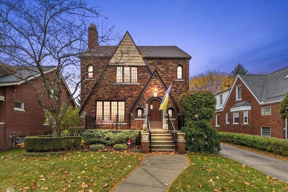
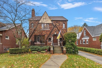
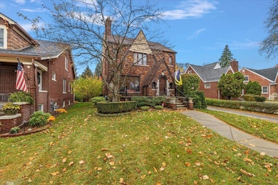
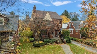
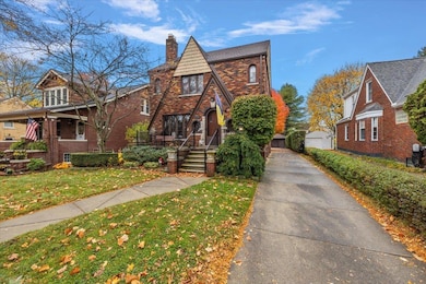
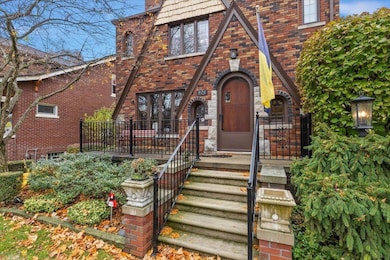
975 Fisher Rd Grosse Pointe, MI 48230
Estimated payment $3,144/month
Highlights
- Hot Property
- Wood Flooring
- Formal Dining Room
- Richard Elementary School Rated A
- Tudor Architecture
- 2 Car Detached Garage
About This Home
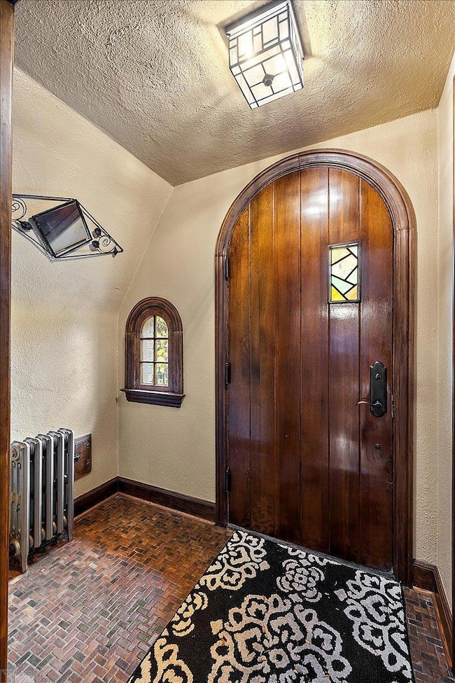
OUTSTANDING ENGLISH TUDOR WITH GREAT CURB APPEAL AND UPDATES FOR TODAY'S FAMILY. UPDATED KITCHEN AND BATHS, HARDWOOD FLOORING THROUGH-OUT, THREE GENEROUS SIZED BEDROOMS UP WITH A WALK-UP THIRD FLOOR READY FOR FINISHING FOR ADDED SQUARE FOOTAGE. FINISHED BASEMENT WITH A SECOND FULL BATH AND FAMILY ROOM SPACE. THE BACKYARD IS HUGE AND WILL ALLOW FOR MOST ANYTHING YOU WANT TO DO. NEWER DETACHED GARAGE AS WELL.
Listing Agent
Lucido and Associates, Inc License #MISPE-6502119186 Listed on: 11/10/2025
Home Details
Home Type
- Single Family
Est. Annual Taxes
Year Built
- Built in 1930
Lot Details
- 8,712 Sq Ft Lot
- Lot Dimensions are 50x182
Parking
- 2 Car Detached Garage
Home Design
- Tudor Architecture
- Brick Exterior Construction
Interior Spaces
- 2-Story Property
- Family Room
- Living Room with Fireplace
- Formal Dining Room
- Wood Flooring
- Finished Basement
Kitchen
- Eat-In Kitchen
- Oven or Range
- Dishwasher
- Disposal
Bedrooms and Bathrooms
- 3 Bedrooms
- 2.5 Bathrooms
Schools
- Gp South High School
Utilities
- Central Air
- Boiler Heating System
- Heating System Uses Natural Gas
Community Details
- Tschaeches Grosse Pointe Sub. Subdivision
Listing and Financial Details
- Assessor Parcel Number 37-001-0027-000
Map
Home Values in the Area
Average Home Value in this Area
Tax History
| Year | Tax Paid | Tax Assessment Tax Assessment Total Assessment is a certain percentage of the fair market value that is determined by local assessors to be the total taxable value of land and additions on the property. | Land | Improvement |
|---|---|---|---|---|
| 2025 | $4,041 | $232,200 | $0 | $0 |
| 2024 | $4,041 | $222,200 | $0 | $0 |
| 2023 | $3,853 | $203,400 | $0 | $0 |
| 2022 | $3,679 | $181,000 | $0 | $0 |
| 2021 | $5,552 | $172,400 | $0 | $0 |
| 2019 | $5,492 | $168,800 | $0 | $0 |
| 2018 | $3,344 | $155,900 | $0 | $0 |
| 2017 | $3,531 | $154,000 | $0 | $0 |
| 2016 | $5,033 | $150,500 | $0 | $0 |
| 2015 | $9,545 | $127,700 | $0 | $0 |
| 2013 | $9,247 | $96,900 | $0 | $0 |
| 2012 | -- | $90,300 | $0 | $0 |
Property History
| Date | Event | Price | List to Sale | Price per Sq Ft |
|---|---|---|---|---|
| 11/10/2025 11/10/25 | For Sale | $499,900 | -- | $177 / Sq Ft |
Purchase History
| Date | Type | Sale Price | Title Company |
|---|---|---|---|
| Warranty Deed | $322,000 | Capital Title Ins Agency | |
| Deed | $124,500 | -- |
Source: Michigan Multiple Listing Service
MLS Number: 50193876
APN: 37-001-01-0027-000
Disclaimer: Certain information contained herein is derived from information provided by parties other than Homes.com. All information provided is deemed reliable, but is not guaranteed to be accurate and should be independently verified.
![]() Source MLS: MiRealSource
Source MLS: MiRealSource
Provided through IDX via MiRealSource. Courtesy of MiRealSource Shareholder. Copyright MiRealSource.
The information published and disseminated by MiRealSource is communicated verbatim, without change by MiRealSource, as filed with MiRealSource by its members. The accuracy of all information, regardless of source, is not guaranteed or warranted. All information should be independently verified.
Copyright 2025 MiRealSource. All rights reserved. The information provided hereby constitutes proprietary information of MiRealSource, Inc. and its shareholders, affiliates and licensees and may not be reproduced or transmitted in any form or by any means, electronic or mechanical, including photocopy, recording, scanning or any information storage and retrieval system, without written permission from MiRealSource, Inc.
- 415 Lothrop Rd
- 380 Merriweather Rd
- 4598 Lodewyck St
- 876 Washington Rd
- 441 Manor St
- 18119 Cornwall St
- 827 Fisher Rd
- 352 Mckinley Ave
- 343 Mount Vernon Ave
- 4522 Hereford St
- 317 Mount Vernon Ave
- 314 Mount Vernon Ave
- 869 Rivard Blvd
- 4865 Marseilles St
- 471 Touraine Rd
- 872 University Place
- 302 Mount Vernon Ave
- 4845 University Place
- 4695 Hereford St
- 432 Calvin Ave
- 309 Merriweather Rd
- 17560 Mack Ave Unit 18
- 276 Lewiston Rd
- 5021 Anatole St
- 906 Neff Rd
- 4972 Lafontaine St
- 5134 Hereford St
- 5214 Hereford St
- 3500 Bluehill St
- 17161 Denver St
- 774 Neff Rd
- 4837 Cadieux Rd Unit Apartment 11
- 4865 Cadieux Rd Unit Apartment 4
- 4865 Cadieux Rd Unit Apartment 1
- 5731 Neff Ave
- 5942 Radnor St
- 133 Muir Rd
- 645 Neff Rd
- 125 Muir Rd Unit LOWER
- 21756 Moross Rd
