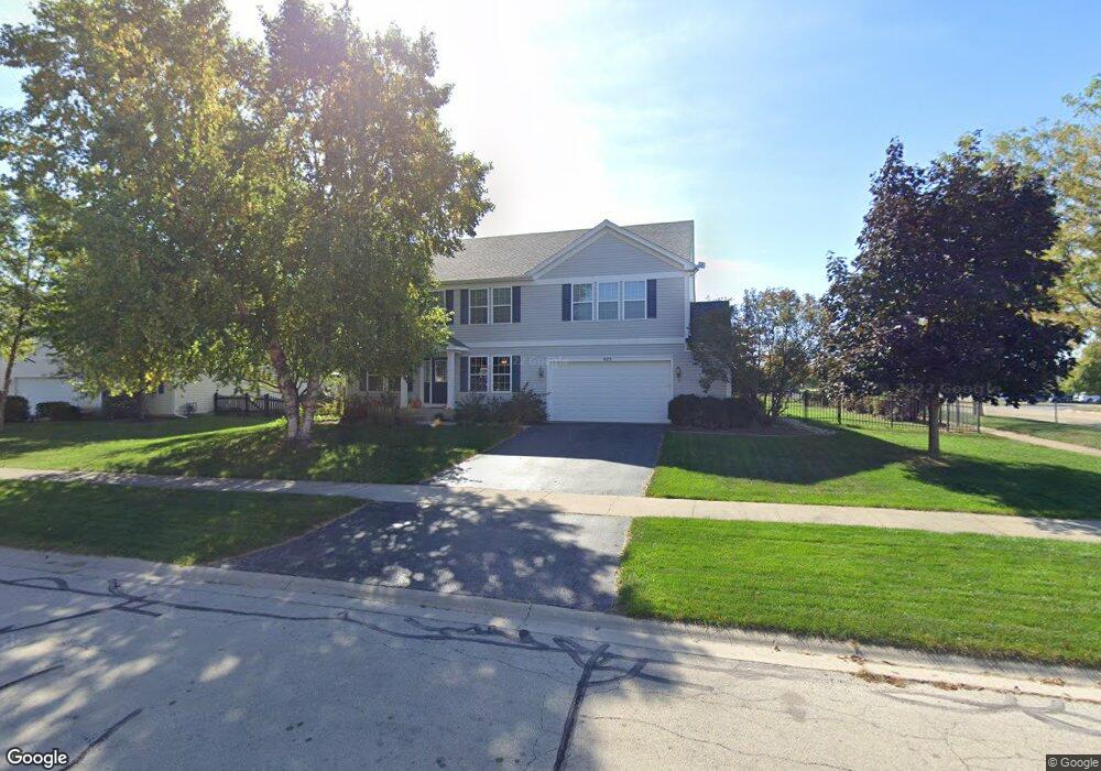
975 Pattee Ave Unit 5 Elburn, IL 60119
Estimated Value: $411,000 - $478,000
4
Beds
3
Baths
3,200
Sq Ft
$139/Sq Ft
Est. Value
About This Home
This home is located at 975 Pattee Ave Unit 5, Elburn, IL 60119 and is currently estimated at $446,240, approximately $139 per square foot. 975 Pattee Ave Unit 5 is a home located in Kane County with nearby schools including Kaneland Blackberry Creek Elementary School, Harter Middle School, and Kaneland High School.
Ownership History
Date
Name
Owned For
Owner Type
Purchase Details
Closed on
Sep 22, 2004
Sold by
Kennedy Homes Lp
Bought by
Lima Scott M and Lima Patrice N
Current Estimated Value
Home Financials for this Owner
Home Financials are based on the most recent Mortgage that was taken out on this home.
Original Mortgage
$252,300
Outstanding Balance
$125,412
Interest Rate
5.93%
Mortgage Type
Purchase Money Mortgage
Estimated Equity
$320,828
Create a Home Valuation Report for This Property
The Home Valuation Report is an in-depth analysis detailing your home's value as well as a comparison with similar homes in the area
Home Values in the Area
Average Home Value in this Area
Purchase History
| Date | Buyer | Sale Price | Title Company |
|---|---|---|---|
| Lima Scott M | $315,500 | First American Title |
Source: Public Records
Mortgage History
| Date | Status | Borrower | Loan Amount |
|---|---|---|---|
| Open | Lima Scott M | $252,300 | |
| Closed | Lima Scott M | $46,000 |
Source: Public Records
Tax History
| Year | Tax Paid | Tax Assessment Tax Assessment Total Assessment is a certain percentage of the fair market value that is determined by local assessors to be the total taxable value of land and additions on the property. | Land | Improvement |
|---|---|---|---|---|
| 2024 | $9,828 | $122,490 | $17,164 | $105,326 |
| 2023 | $9,461 | $110,551 | $15,491 | $95,060 |
| 2022 | $9,038 | $101,018 | $14,217 | $86,801 |
| 2021 | $8,705 | $96,686 | $13,607 | $83,079 |
| 2020 | $8,544 | $94,420 | $13,288 | $81,132 |
| 2019 | $8,548 | $93,034 | $13,093 | $79,941 |
| 2018 | $8,575 | $91,616 | $13,093 | $78,523 |
| 2017 | $8,577 | $90,574 | $12,944 | $77,630 |
| 2016 | $7,447 | $77,407 | $12,602 | $64,805 |
| 2015 | -- | $69,404 | $8,711 | $60,693 |
| 2014 | -- | $69,558 | $9,563 | $59,995 |
| 2013 | -- | $69,558 | $9,563 | $59,995 |
Source: Public Records
Map
Nearby Homes
- 1038 Veteran Ave
- 931 Patriot Pkwy
- 1076 Freedom Rd
- 1155 Corrigan St
- 1167 Freedom Rd
- 1123 Sears Cir
- 815 Kindberg Ct
- 713 Elizabeth St
- 607 Virginia St
- 660 Avon Ct
- 645 Virginia St
- 1457 Spalding Ave
- 1494 Keller St
- 42W613 Meadowsweet Dr
- 000 Illinois 47
- 875 Station Blvd
- 516 Banbury Ave
- Lot 77 Houtz Cir
- 41W945 Northway Dr
- 0S790 Rowe Rd
- 997 Pattee Ave
- 976 Griffith Ave Unit 5
- 998 Griffith Ave
- 1011 Pattee Ave
- 1010 Griffith Ave
- 980 Pattee Ave
- 1023 Pattee Ave
- 1002 Pattee Ave
- 1032 Griffith Ave
- 965 Griffith Ave
- 1024 Pattee Ave
- 987 Griffith Ave
- 1035 Pattee Ave
- 1054 Griffith Ave
- 1009 Griffith Ave
- 1036 Pattee Ave Unit 11
- 1057 Pattee Ave
- 1066 Griffith Ave
- 1148 Swan Dr
- 1058 Pattee Ave Unit 11
Your Personal Tour Guide
Ask me questions while you tour the home.