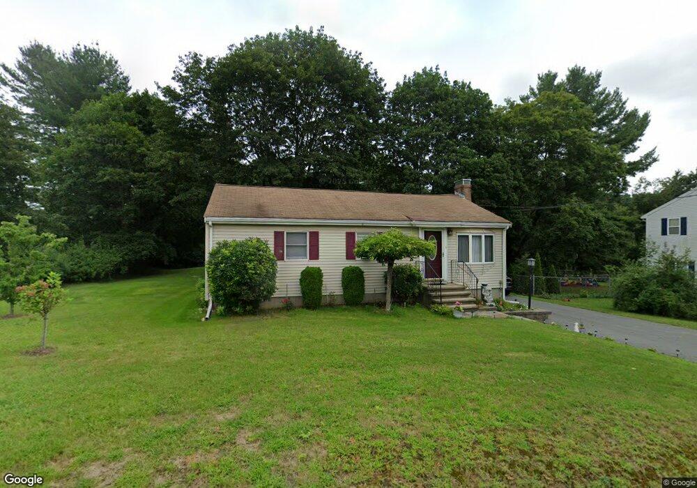
975 Shawsheen St Tewksbury, MA 01876
Estimated Value: $566,000 - $613,000
3
Beds
1
Bath
1,162
Sq Ft
$510/Sq Ft
Est. Value
About This Home
This home is located at 975 Shawsheen St, Tewksbury, MA 01876 and is currently estimated at $592,659, approximately $510 per square foot. 975 Shawsheen St is a home located in Middlesex County with nearby schools including Heath-Brook Elementary School, John W. Wynn Middle School, and John F. Ryan Elementary School.
Ownership History
Date
Name
Owned For
Owner Type
Purchase Details
Closed on
Aug 16, 2006
Sold by
Lawyer David J
Bought by
Aurilio Anthony F and Aurilio Sandra A
Current Estimated Value
Purchase Details
Closed on
Nov 1, 1999
Sold by
White John R and White Joan M
Bought by
Lawyer David J
Create a Home Valuation Report for This Property
The Home Valuation Report is an in-depth analysis detailing your home's value as well as a comparison with similar homes in the area
Home Values in the Area
Average Home Value in this Area
Purchase History
| Date | Buyer | Sale Price | Title Company |
|---|---|---|---|
| Aurilio Anthony F | $327,000 | -- | |
| Aurilio Anthony F | $327,000 | -- | |
| Lawyer David J | $178,000 | -- | |
| Lawyer David J | $178,000 | -- |
Source: Public Records
Mortgage History
| Date | Status | Borrower | Loan Amount |
|---|---|---|---|
| Open | Lawyer David J | $311,686 | |
| Closed | Lawyer David J | $309,132 |
Source: Public Records
Tax History Compared to Growth
Tax History
| Year | Tax Paid | Tax Assessment Tax Assessment Total Assessment is a certain percentage of the fair market value that is determined by local assessors to be the total taxable value of land and additions on the property. | Land | Improvement |
|---|---|---|---|---|
| 2025 | $6,217 | $470,300 | $265,400 | $204,900 |
| 2024 | $6,007 | $448,600 | $253,000 | $195,600 |
| 2023 | $5,899 | $418,400 | $230,000 | $188,400 |
| 2022 | $5,615 | $369,400 | $199,900 | $169,500 |
| 2021 | $5,290 | $336,500 | $181,900 | $154,600 |
| 2020 | $5,243 | $328,300 | $173,100 | $155,200 |
| 2019 | $4,939 | $311,800 | $164,800 | $147,000 |
| 2018 | $4,468 | $277,000 | $164,800 | $112,200 |
| 2017 | $4,250 | $260,600 | $164,800 | $95,800 |
| 2016 | $4,123 | $252,200 | $164,800 | $87,400 |
| 2015 | $3,906 | $238,600 | $159,800 | $78,800 |
| 2014 | $3,644 | $226,200 | $159,800 | $66,400 |
Source: Public Records
Map
Nearby Homes
- 261 Apache Way
- 906 Old Shawsheen St
- 71 Apache Way Unit 71
- 109 Apache Way
- 127 Caddy Ct
- 93 Fairway Dr
- 7 Wamesit Rd
- 16 Eagle Dr
- 640 South St
- 610 South St
- 110 Royal Crest Cir
- 22 Carleton Rd
- 14 Hinckley Rd
- 6 Stonebury Way Unit 6
- 54 Delwood Rd
- 20 Oakland Ave
- 5 Kensington Way Unit 5
- 93 Vale St
- 111 Patrick Rd Unit 111
- 142 Patrick Rd
- 991 Shawsheen St
- 967 Shawsheen St
- 959 Shawsheen St
- 29 Mill St
- 300 Apache Way
- 299 Apache Way
- 298 Apache Way
- 297 Apache Way
- 296 Apache Way
- 295 Apache Way
- 297 Apache Way Unit 297
- 282 Apache Way
- 281 Apache Way
- 280 Apache Way
- 279 Apache Way
- 280 Apache Way Unit 280
- 951 Shawsheen St
- 1001 Shawsheen St
- 294 Apache Way
- 293 Apache Way