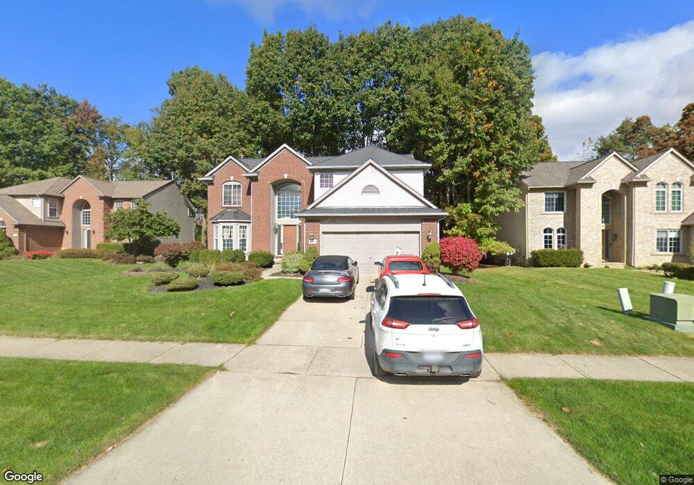
9750 David Ln White Lake, MI 48386
Estimated Value: $450,975 - $558,000
4
Beds
3
Baths
2,525
Sq Ft
$194/Sq Ft
Est. Value
About This Home
This home is located at 9750 David Ln, White Lake, MI 48386 and is currently estimated at $489,244, approximately $193 per square foot. 9750 David Ln is a home located in Oakland County with nearby schools including St. Patrick School and Lakecrest Baptist School.
Ownership History
Date
Name
Owned For
Owner Type
Purchase Details
Closed on
Oct 7, 2019
Sold by
Vranish Mark A
Bought by
Vranish Mark A and Vranish Christopher T
Current Estimated Value
Purchase Details
Closed on
Jan 10, 2012
Sold by
Vranish Marsha L and Vranish Mark A
Bought by
Vranish Mark A
Home Financials for this Owner
Home Financials are based on the most recent Mortgage that was taken out on this home.
Original Mortgage
$161,000
Outstanding Balance
$106,943
Interest Rate
3.34%
Mortgage Type
New Conventional
Estimated Equity
$382,301
Purchase Details
Closed on
Sep 20, 2002
Sold by
Upland Properties Inc
Bought by
Vransih Marsha L
Create a Home Valuation Report for This Property
The Home Valuation Report is an in-depth analysis detailing your home's value as well as a comparison with similar homes in the area
Home Values in the Area
Average Home Value in this Area
Purchase History
| Date | Buyer | Sale Price | Title Company |
|---|---|---|---|
| Vranish Mark A | -- | None Available | |
| Vranish Mark A | -- | None Available | |
| Vransih Marsha L | $283,280 | -- |
Source: Public Records
Mortgage History
| Date | Status | Borrower | Loan Amount |
|---|---|---|---|
| Open | Vranish Mark A | $161,000 |
Source: Public Records
Tax History Compared to Growth
Tax History
| Year | Tax Paid | Tax Assessment Tax Assessment Total Assessment is a certain percentage of the fair market value that is determined by local assessors to be the total taxable value of land and additions on the property. | Land | Improvement |
|---|---|---|---|---|
| 2024 | $2,638 | $191,310 | $0 | $0 |
| 2023 | $2,516 | $163,720 | $0 | $0 |
| 2022 | $3,880 | $156,800 | $0 | $0 |
| 2021 | $3,629 | $156,170 | $0 | $0 |
| 2020 | $2,304 | $153,270 | $0 | $0 |
| 2019 | $3,530 | $143,330 | $0 | $0 |
| 2018 | $3,451 | $126,280 | $0 | $0 |
| 2017 | $3,327 | $126,280 | $0 | $0 |
| 2016 | $3,320 | $122,150 | $0 | $0 |
| 2015 | -- | $118,240 | $0 | $0 |
| 2014 | -- | $101,180 | $0 | $0 |
| 2011 | -- | $93,150 | $0 | $0 |
Source: Public Records
Map
Nearby Homes
- 1940 Laflamme Ct
- 1965 Laflamme Ct
- 228 Greenhill Dr
- 1800 Teggerdine Rd
- 181 Highland Terrace
- 21 Highland Terrace
- 9470 Pontiac Lake Rd
- 9910 Highland Rd
- 010770 Highland Rd
- 1052 Maple Heights Dr
- 820 Hilltop Dr
- 00000 Teggerdine Rd
- 694 Robar Cir
- 9136 Buckingham St
- 2019 Kingston St
- Vacant Land Tackles Dr
- 9521 Steephollow Dr
- 9058 Rhyan Rd
- 9056 Rhyan Rd
- 1-E Haley Rd
- 9740 David Ln
- 9760 David Ln
- 9730 David Ln Unit 83
- 9771 David Ln Unit 102
- 9731 David Ln Unit 84
- 9770 David Ln Unit 106
- 9801 David Ln Unit 101
- 9780 David Ln Unit 107
- 1872 Kristina Dr Unit 85
- 9790 David Ln Unit 108
- 9710 David Ln Unit 81
- 9811 David Ln Unit 100
- 1912 Howland Blvd Unit Bldg-Unit
- 1912 Howland Blvd
- 9800 David Ln
- 9711 David Ln Unit 86
- 1866 Kristina Dr
- 1850 Mead Ln
- 1920 Howland Blvd
- 9810 David Ln Unit 110