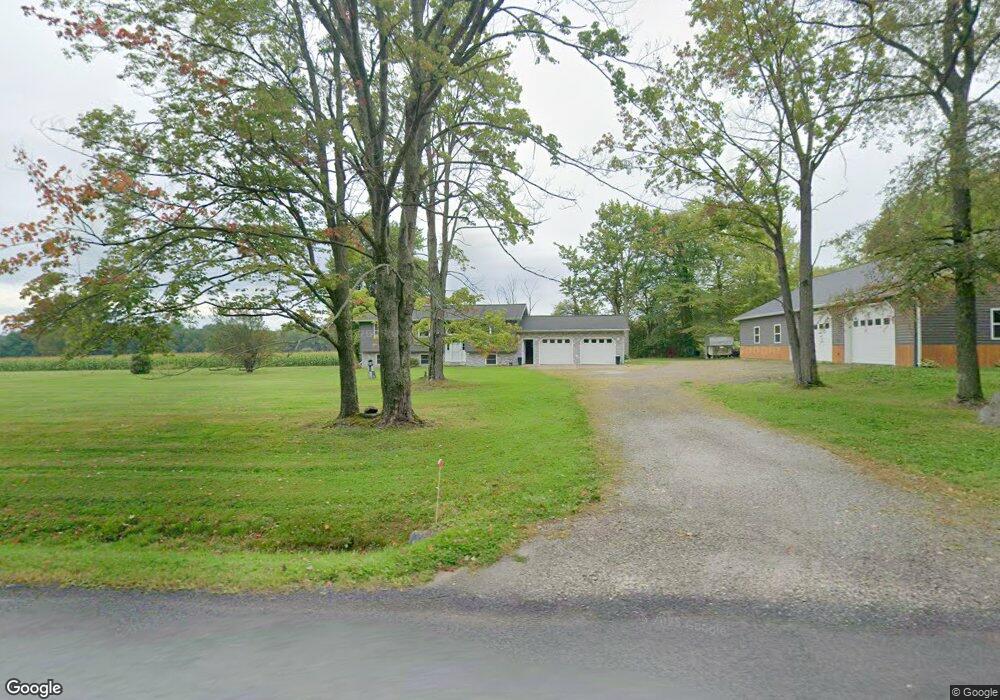
9750 Sherman Rd Albion, PA 16401
Estimated Value: $198,000 - $347,000
3
Beds
2
Baths
1,542
Sq Ft
$182/Sq Ft
Est. Value
About This Home
This home is located at 9750 Sherman Rd, Albion, PA 16401 and is currently estimated at $280,010, approximately $181 per square foot. 9750 Sherman Rd is a home located in Erie County with nearby schools including Northwestern Senior High School and Cranesville Christian Academy.
Ownership History
Date
Name
Owned For
Owner Type
Purchase Details
Closed on
May 8, 2025
Sold by
Casbohm Cheryl A
Bought by
Casbohm Chris E
Current Estimated Value
Purchase Details
Closed on
Aug 22, 1986
Sold by
Not Provided
Bought by
Casbohm Chris E
Create a Home Valuation Report for This Property
The Home Valuation Report is an in-depth analysis detailing your home's value as well as a comparison with similar homes in the area
Home Values in the Area
Average Home Value in this Area
Purchase History
| Date | Buyer | Sale Price | Title Company |
|---|---|---|---|
| Casbohm Chris E | -- | None Listed On Document | |
| Casbohm Chris E | $55,000 | -- |
Source: Public Records
Tax History Compared to Growth
Tax History
| Year | Tax Paid | Tax Assessment Tax Assessment Total Assessment is a certain percentage of the fair market value that is determined by local assessors to be the total taxable value of land and additions on the property. | Land | Improvement |
|---|---|---|---|---|
| 2025 | $4,312 | $182,300 | $28,200 | $154,100 |
| 2024 | $4,166 | $182,300 | $28,200 | $154,100 |
| 2023 | $3,794 | $182,300 | $28,200 | $154,100 |
| 2022 | $3,744 | $182,300 | $28,200 | $154,100 |
| 2021 | $2,771 | $141,000 | $28,200 | $112,800 |
| 2020 | $2,736 | $141,000 | $28,200 | $112,800 |
| 2019 | $2,686 | $141,000 | $28,200 | $112,800 |
| 2018 | $2,594 | $141,000 | $28,200 | $112,800 |
| 2017 | $2,594 | $141,000 | $28,200 | $112,800 |
| 2016 | $2,957 | $141,000 | $28,200 | $112,800 |
| 2015 | $2,922 | $141,000 | $28,200 | $112,800 |
| 2014 | $1,722 | $141,000 | $28,200 | $112,800 |
Source: Public Records
Map
Nearby Homes
- 11120 West Rd
- 9958 Bateman Ave
- Lot3 West Rd
- Lot1 West Rd
- 9840 Bateman Ave
- 9834 Bateman Ave
- 10023 Reservoir Rd
- 0 Winchester Dr Unit 178085
- 0 Winchester Dr Unit 178083
- 95 3rd Ave
- 16 Highland Ave
- 60 Park Ave
- 86 S Main St
- 0 Route 6n
- 22 Cherry St
- 8350 Carbury Rd
- 10650 Bowmantown Rd
- 9749 9801 Moses Rd
- 8574 Kinsey Rd
- 9876 E Peach St
- 9724 Sherman Rd
- 9815 Sherman Rd
- 9875 Sherman Rd
- 9937 Sherman Rd
- 9542 Sherman Rd
- 9500 Sherman Rd
- 9673 Crane Rd
- 9710 Crane Rd
- 9730 Crane Rd
- 9680 Crane Rd
- 9909 Crane Rd
- 9880 Crane Rd
- 9630 Crane Rd
- 9580 Crane Rd
- 10150 Miller Rd
- 9969 Crane Rd
- 10097 Sherman Rd
- 9440 Sherman Rd
- 10119 Sherman Rd
- 9991 Crane Rd