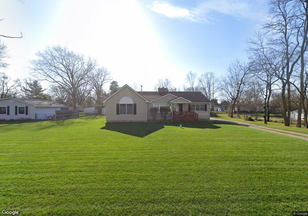
9757 Silverside South Lyon, MI 48178
Estimated Value: $378,000 - $466,000
3
Beds
2
Baths
1,806
Sq Ft
$224/Sq Ft
Est. Value
About This Home
This home is located at 9757 Silverside, South Lyon, MI 48178 and is currently estimated at $404,331, approximately $223 per square foot. 9757 Silverside is a home located in Livingston County with nearby schools including William A. Brummer Elementary School, Centennial Middle School, and South Lyon High School.
Ownership History
Date
Name
Owned For
Owner Type
Purchase Details
Closed on
Mar 17, 2005
Sold by
Bates James Robert and Bates Janice Helen
Bought by
Bates Jeffrey M and Bates Jennifer Lynn
Current Estimated Value
Home Financials for this Owner
Home Financials are based on the most recent Mortgage that was taken out on this home.
Original Mortgage
$210,000
Outstanding Balance
$108,363
Interest Rate
5.88%
Mortgage Type
Fannie Mae Freddie Mac
Estimated Equity
$295,968
Create a Home Valuation Report for This Property
The Home Valuation Report is an in-depth analysis detailing your home's value as well as a comparison with similar homes in the area
Home Values in the Area
Average Home Value in this Area
Purchase History
| Date | Buyer | Sale Price | Title Company |
|---|---|---|---|
| Bates Jeffrey M | $118,000 | -- |
Source: Public Records
Mortgage History
| Date | Status | Borrower | Loan Amount |
|---|---|---|---|
| Open | Bates Jeffrey M | $210,000 |
Source: Public Records
Tax History Compared to Growth
Tax History
| Year | Tax Paid | Tax Assessment Tax Assessment Total Assessment is a certain percentage of the fair market value that is determined by local assessors to be the total taxable value of land and additions on the property. | Land | Improvement |
|---|---|---|---|---|
| 2025 | $3,675 | $172,200 | $0 | $0 |
| 2024 | $2,476 | $164,300 | $0 | $0 |
| 2023 | $2,361 | $153,200 | $0 | $0 |
| 2022 | $3,001 | $123,200 | $0 | $0 |
| 2021 | $3,001 | $134,900 | $0 | $0 |
| 2020 | $2,986 | $139,000 | $0 | $0 |
| 2019 | $3,015 | $123,200 | $0 | $0 |
| 2018 | $2,974 | $113,400 | $0 | $0 |
| 2017 | $3,021 | $112,700 | $0 | $0 |
| 2016 | $3,065 | $109,600 | $0 | $0 |
| 2014 | $2,849 | $98,600 | $0 | $0 |
| 2012 | $2,849 | $89,400 | $0 | $0 |
Source: Public Records
Map
Nearby Homes
- 11390 Ridge Rd
- 11035 Silver View Ct
- 11047 Silver View Ct
- 11055 Silver View Ct
- 9044 Kemper Dr
- 0 Hillview Dr Unit 25052269
- 11108 Silver Lake Rd
- 10993 Stoney Point Dr
- 9112 Roger Scott Trail
- 9736 Cross Creek Dr
- 0000 Stoney Point Unit 5
- 11904 Moose Ridge Dr
- 11755 Shenandoah Dr Unit 159-4
- 10537 Oak Forest Dr
- 10512 Oak Forest Dr
- 11734 Shenandoah Dr Unit 3
- 11889 Shenandoah Dr Unit 3
- 10468 Oak Shore Dr
- 10536 Oak Shore Dr
- 10611 Lighthouse Point
- 9743 Silverside
- 11033 Tillson Dr
- 9777 Silverside
- 11041 Tillson Dr
- 9737 Silverside
- 9766 Silverside
- 9731 Silverside
- 11025 Tillson Dr
- 9780 Silverside
- 9762 Silverside
- 9758 Silverside
- 9791 Silverside
- 9746 Silverside
- 9742 Silverside
- 9734 Silverside
- 9786 Silverside
- 9738 Silverside
- 11017 Tillson Dr
- 11040 Tillson Dr
- 9743 Marshall Rd