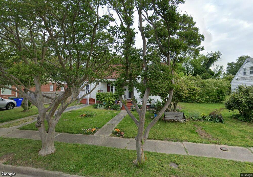
976 Albert Ave Norfolk, VA 23513
Coronado NeighborhoodEstimated Value: $214,000 - $255,345
3
Beds
2
Baths
1,128
Sq Ft
$206/Sq Ft
Est. Value
About This Home
This home is located at 976 Albert Ave, Norfolk, VA 23513 and is currently estimated at $232,336, approximately $205 per square foot. 976 Albert Ave is a home located in Norfolk City with nearby schools including Frances E. Willard Model Elementary School, Norview Middle School, and Norview High School.
Ownership History
Date
Name
Owned For
Owner Type
Purchase Details
Closed on
Mar 20, 2020
Sold by
Kesser Kay Z
Bought by
Johnson Mary B and Johnson Anna M
Current Estimated Value
Home Financials for this Owner
Home Financials are based on the most recent Mortgage that was taken out on this home.
Original Mortgage
$121,250
Outstanding Balance
$107,179
Interest Rate
3.4%
Mortgage Type
New Conventional
Estimated Equity
$125,157
Purchase Details
Closed on
Jun 20, 2008
Sold by
Frazier William H and Frazier Ellen G
Bought by
Kesser Kay Z
Create a Home Valuation Report for This Property
The Home Valuation Report is an in-depth analysis detailing your home's value as well as a comparison with similar homes in the area
Home Values in the Area
Average Home Value in this Area
Purchase History
| Date | Buyer | Sale Price | Title Company |
|---|---|---|---|
| Johnson Mary B | $125,000 | Sage Title Group Llc | |
| Kesser Kay Z | $118,000 | None Available |
Source: Public Records
Mortgage History
| Date | Status | Borrower | Loan Amount |
|---|---|---|---|
| Open | Johnson Mary B | $121,250 |
Source: Public Records
Tax History
| Year | Tax Paid | Tax Assessment Tax Assessment Total Assessment is a certain percentage of the fair market value that is determined by local assessors to be the total taxable value of land and additions on the property. | Land | Improvement |
|---|---|---|---|---|
| 2025 | $2,786 | $222,900 | $85,100 | $137,800 |
| 2024 | $2,581 | $209,800 | $85,100 | $124,700 |
| 2023 | $2,475 | $198,000 | $85,100 | $112,900 |
| 2022 | $2,198 | $175,800 | $62,900 | $112,900 |
| 2021 | $2,045 | $163,600 | $59,900 | $103,700 |
| 2020 | $1,866 | $149,300 | $49,500 | $99,800 |
| 2019 | $1,685 | $134,800 | $45,000 | $89,800 |
| 2018 | $1,645 | $131,600 | $45,000 | $86,600 |
| 2017 | $1,505 | $130,900 | $45,000 | $85,900 |
| 2016 | $1,505 | $140,900 | $45,000 | $95,900 |
| 2015 | $1,620 | $140,900 | $45,000 | $95,900 |
| 2014 | $1,620 | $140,900 | $45,000 | $95,900 |
Source: Public Records
Map
Nearby Homes
- 977 Wolcott Ave
- 968 Wolcott Ave
- 6804 Thaxton St
- 974 Philpotts Rd
- 1005 Marietta Ave
- 936 Widgeon Rd
- 6618 Palem Rd
- 920 Widgeon Rd
- 6459 Clare Rd
- 6456 Palem Rd
- 6429 Clare Rd
- 7012 Gregory Dr
- 964 Quail St
- 909 Workwood Rd
- 6384 Dove St
- 837 Tifton St
- 1077 Kittrell St
- 6383 Partridge St
- 852 Philpotts Rd
- 6361 Dove St
- 972 Albert Ave
- 980 Albert Ave
- 970 Albert Ave
- 975 Wolcott Ave
- 973 Wolcott Ave
- 984 Albert Ave
- 968 Albert Ave
- 975 Albert Ave
- 979 Wolcott Ave
- 979 Albert Ave
- 967 Wolcott Ave
- 971 Albert Ave
- 981 Wolcott Ave
- 983 Albert Ave
- 988 Albert Ave
- 6612 Thaxton St
- 962 Albert Ave
- 987 Albert Ave
- 961 Wolcott Ave
- 976 Marietta Ave
Your Personal Tour Guide
Ask me questions while you tour the home.