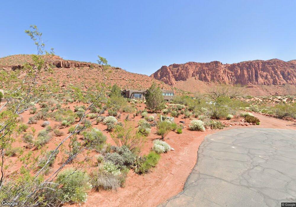
976 Crows Wing Way Ivins, UT 84738
Shonto Point NeighborhoodEstimated Value: $1,050,000 - $1,504,000
3
Beds
3
Baths
3,387
Sq Ft
$390/Sq Ft
Est. Value
About This Home
This home is located at 976 Crows Wing Way, Ivins, UT 84738 and is currently estimated at $1,321,419, approximately $390 per square foot. 976 Crows Wing Way is a home located in Washington County with nearby schools including Red Mountain School, Snow Canyon Middle School, and Lava Ridge Intermediate School.
Ownership History
Date
Name
Owned For
Owner Type
Purchase Details
Closed on
Jan 16, 2024
Sold by
Doughty Todd V
Bought by
Doughty Family Trust and Doughty
Current Estimated Value
Purchase Details
Closed on
Jun 6, 2017
Sold by
Doughty Todd V
Bought by
Shonto Point Homeowners A Ssociation
Home Financials for this Owner
Home Financials are based on the most recent Mortgage that was taken out on this home.
Interest Rate
3.94%
Create a Home Valuation Report for This Property
The Home Valuation Report is an in-depth analysis detailing your home's value as well as a comparison with similar homes in the area
Home Values in the Area
Average Home Value in this Area
Purchase History
| Date | Buyer | Sale Price | Title Company |
|---|---|---|---|
| Doughty Family Trust | -- | None Listed On Document | |
| Shonto Point Homeowners A Ssociation | -- | -- |
Source: Public Records
Mortgage History
| Date | Status | Borrower | Loan Amount |
|---|---|---|---|
| Previous Owner | Shonto Point Homeowners A Ssociation | -- |
Source: Public Records
Tax History Compared to Growth
Tax History
| Year | Tax Paid | Tax Assessment Tax Assessment Total Assessment is a certain percentage of the fair market value that is determined by local assessors to be the total taxable value of land and additions on the property. | Land | Improvement |
|---|---|---|---|---|
| 2025 | $4,435 | $718,300 | $269,720 | $448,580 |
| 2023 | $4,405 | $624,085 | $218,680 | $405,405 |
| 2022 | $5,572 | $606,650 | $191,180 | $415,470 |
| 2021 | $4,282 | $850,000 | $293,600 | $556,400 |
| 2020 | $4,267 | $800,100 | $268,600 | $531,500 |
| 2019 | $4,225 | $773,700 | $248,600 | $525,100 |
| 2018 | $3,280 | $320,170 | $0 | $0 |
| 2017 | $5,812 | $551,800 | $0 | $0 |
| 2016 | $6,153 | $539,600 | $0 | $0 |
| 2015 | $6,039 | $509,800 | $0 | $0 |
| 2014 | $6,022 | $510,900 | $0 | $0 |
Source: Public Records
Map
Nearby Homes
- 911 W Roadrunner Ct
- 1450 Tuweap Dr
- 1657 N Kayenta Dr
- 1151 Shawnee Ct
- 1121 Two Moons Way
- 973 W Sipala Trail
- 1183 Tuweap Dr
- 1060 Wintook Dr
- 1060 W Wintook Dr
- 1068 Shonto Ridge Dr
- 688 Shinava Dr
- 662 Shinava Dr
- 922 N Acequia Ct
- 854 Tawgoo Ct
- 0 Unit 25-266044
- 993 N Chusi Way
- 750 Shinava Dr
- 841 Shonto Ridge Dr
- 814 Wicasa Way
- 814 Wicasa Way Unit 272
- 976 W Crows Wing Way
- 1006 Crows Wing Way
- 973 W Crows Wing Way
- 1003 Crows Wing Way
- 911 Roadrunner Cir
- 1011 Kokopelli Way
- 911 Roadrunner Ct
- 1011 W Kokopelli Way
- 920 W Pahrus Ct
- 1036 W Crows Wing Way
- 918 Roadrunner Cir
- 1033 Crows Wing Way
- 921 Pahrus Ct
- 1051 Kokopelli Way
- 56 Shonto Point
- 1388 Big Soldier Ct
- 1022 Pahvant Ct
- 917 Taboots Ct
- Lot 451 Shonto Point
- 1060 W Crows Wing Way