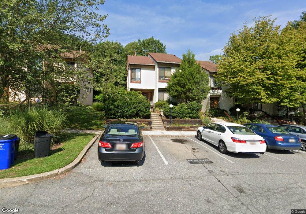
9762 Basket Ring Rd Columbia, MD 21045
Oakland Mills NeighborhoodEstimated Value: $383,000 - $389,896
Studio
4
Baths
1,560
Sq Ft
$248/Sq Ft
Est. Value
About This Home
This home is located at 9762 Basket Ring Rd, Columbia, MD 21045 and is currently estimated at $386,474, approximately $247 per square foot. 9762 Basket Ring Rd is a home located in Howard County with nearby schools including Talbott Springs Elementary School, Oakland Mills Middle School, and Oakland Mills High School.
Ownership History
Date
Name
Owned For
Owner Type
Purchase Details
Closed on
Jun 23, 1997
Sold by
Yevsey Bravy
Bought by
Hill Melissa J
Current Estimated Value
Purchase Details
Closed on
May 7, 1985
Sold by
Rodgers Theo C and Rodgers Wf
Bought by
Bravy Yevsey
Home Financials for this Owner
Home Financials are based on the most recent Mortgage that was taken out on this home.
Original Mortgage
$80,548
Interest Rate
13.07%
Create a Home Valuation Report for This Property
The Home Valuation Report is an in-depth analysis detailing your home's value as well as a comparison with similar homes in the area
Home Values in the Area
Average Home Value in this Area
Purchase History
| Date | Buyer | Sale Price | Title Company |
|---|---|---|---|
| Hill Melissa J | $119,000 | -- | |
| Bravy Yevsey | $80,500 | -- |
Source: Public Records
Mortgage History
| Date | Status | Borrower | Loan Amount |
|---|---|---|---|
| Previous Owner | Bravy Yevsey | $80,548 | |
| Closed | Hill Melissa J | -- |
Source: Public Records
Tax History
| Year | Tax Paid | Tax Assessment Tax Assessment Total Assessment is a certain percentage of the fair market value that is determined by local assessors to be the total taxable value of land and additions on the property. | Land | Improvement |
|---|---|---|---|---|
| 2025 | $4,149 | $291,800 | $0 | $0 |
| 2024 | $4,149 | $268,400 | $0 | $0 |
| 2023 | $3,900 | $245,000 | $90,000 | $155,000 |
| 2022 | $3,860 | $245,000 | $90,000 | $155,000 |
| 2021 | $3,952 | $245,000 | $90,000 | $155,000 |
| 2020 | $3,952 | $251,400 | $101,200 | $150,200 |
| 2019 | $3,941 | $250,633 | $0 | $0 |
| 2018 | $3,693 | $249,867 | $0 | $0 |
| 2017 | $3,585 | $249,100 | $0 | $0 |
| 2016 | $629 | $242,167 | $0 | $0 |
| 2015 | $629 | $235,233 | $0 | $0 |
| 2014 | $614 | $228,300 | $0 | $0 |
Source: Public Records
Map
Nearby Homes
- 9647 Whiteacre Rd Unit UTEA3
- 9641 White Acre Rd Unit A-1
- 9645 White Acre Rd Unit A-2
- 9653 Whiteacre Rd Unit C2
- 5870 Thunder Hill Rd Unit C3
- 5866 Thunder Hill Rd Unit A4
- 9585 Standon Place
- 5538 Vantage Point Rd
- 5510 Vantage Point Rd
- 5450 Bluecoat Ln
- 5421 Smooth Meadow Way
- 10001 Windstream Dr Unit 404
- 10001 Windstream Dr Unit 106
- 5390 Smooth Meadow Way Unit 2
- 10073 Windstream Dr Unit 5
- 9346 Enquiry Ct
- 5239 W Running Brook Rd Unit 30
- 5245 W Running Brook Rd
- 10211 Pembroke Green Place
- 10287 Wilde Lake Terrace
- 9760 Basket Ring Rd
- 9766 Basket Ring Rd
- 9758 Basket Ring Rd
- 9768 Basket Ring Rd
- 9756 Basket Ring Rd
- 9770 Basket Ring Rd
- 9726 Basket Ring Rd
- 9728 Basket Ring Rd
- 9722 Basket Ring Rd
- 9720 Basket Ring Rd
- 9730 Basket Ring Rd
- 9718 Basket Ring Rd
- 9732 Basket Ring Rd
- 9716 Basket Ring Rd
- 9734 Basket Ring Rd
- 9714 Basket Ring Rd
- 9736 Basket Ring Rd
- 9712 Basket Ring Rd
- 9708 Basket Ring Rd
- 9738 Basket Ring Rd
Your Personal Tour Guide
Ask me questions while you tour the home.