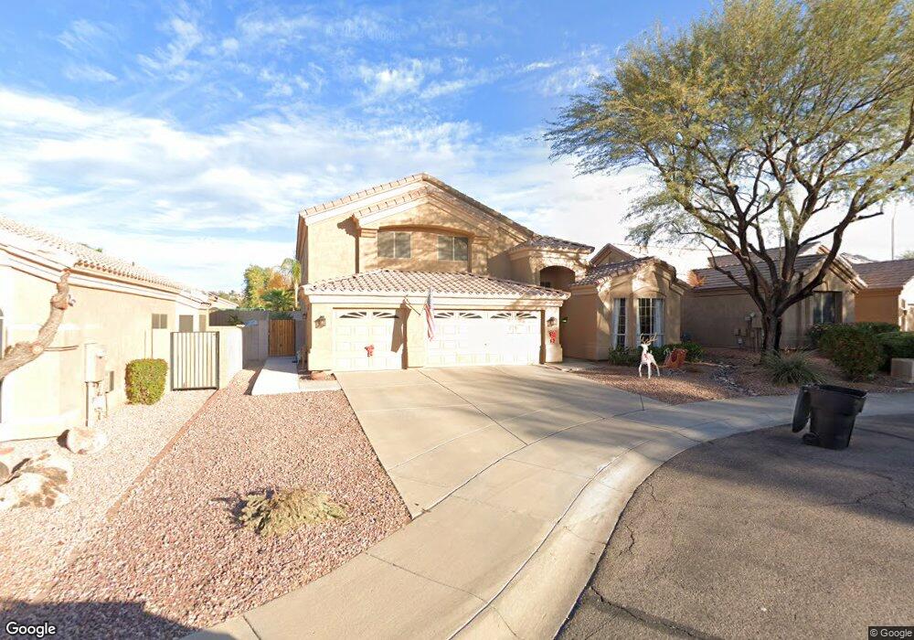
9762 E Palm Ridge Dr Scottsdale, AZ 85260
Horizons NeighborhoodEstimated Value: $808,354 - $1,067,000
--
Bed
4
Baths
2,955
Sq Ft
$309/Sq Ft
Est. Value
About This Home
This home is located at 9762 E Palm Ridge Dr, Scottsdale, AZ 85260 and is currently estimated at $912,839, approximately $308 per square foot. 9762 E Palm Ridge Dr is a home located in Maricopa County with nearby schools including Redfield Elementary School, Desert Canyon Middle School, and Desert Mountain High School.
Ownership History
Date
Name
Owned For
Owner Type
Purchase Details
Closed on
Nov 3, 2010
Sold by
Montgomery Anthony J and Montgomery Catherine R
Bought by
Montgomery Anthony James and Montgomery Catherine Rose
Current Estimated Value
Purchase Details
Closed on
Aug 4, 1997
Sold by
Peppers John B and Peppers Ruth E
Bought by
Montgomery Anthony J and Montgomery Catherine R
Home Financials for this Owner
Home Financials are based on the most recent Mortgage that was taken out on this home.
Original Mortgage
$232,000
Outstanding Balance
$29,418
Interest Rate
5.75%
Mortgage Type
New Conventional
Estimated Equity
$883,421
Purchase Details
Closed on
Jun 25, 1996
Sold by
Pulte Home Corp
Bought by
Peppers John B and Peppers Ruth E
Home Financials for this Owner
Home Financials are based on the most recent Mortgage that was taken out on this home.
Original Mortgage
$200,600
Interest Rate
8.09%
Mortgage Type
New Conventional
Create a Home Valuation Report for This Property
The Home Valuation Report is an in-depth analysis detailing your home's value as well as a comparison with similar homes in the area
Home Values in the Area
Average Home Value in this Area
Purchase History
| Date | Buyer | Sale Price | Title Company |
|---|---|---|---|
| Montgomery Anthony James | -- | None Available | |
| Montgomery Anthony J | $244,000 | Capital Title Agency | |
| Peppers John B | $250,797 | Security Title |
Source: Public Records
Mortgage History
| Date | Status | Borrower | Loan Amount |
|---|---|---|---|
| Open | Montgomery Anthony J | $232,000 | |
| Previous Owner | Peppers John B | $200,600 |
Source: Public Records
Tax History Compared to Growth
Tax History
| Year | Tax Paid | Tax Assessment Tax Assessment Total Assessment is a certain percentage of the fair market value that is determined by local assessors to be the total taxable value of land and additions on the property. | Land | Improvement |
|---|---|---|---|---|
| 2025 | $3,049 | $52,969 | -- | -- |
| 2024 | $2,975 | $50,447 | -- | -- |
| 2023 | $2,975 | $63,020 | $12,600 | $50,420 |
| 2022 | $2,837 | $49,670 | $9,930 | $39,740 |
| 2021 | $3,078 | $46,130 | $9,220 | $36,910 |
| 2020 | $3,051 | $43,670 | $8,730 | $34,940 |
| 2019 | $2,966 | $42,120 | $8,420 | $33,700 |
| 2018 | $2,896 | $40,260 | $8,050 | $32,210 |
| 2017 | $2,734 | $40,360 | $8,070 | $32,290 |
| 2016 | $2,664 | $38,950 | $7,790 | $31,160 |
| 2015 | $2,577 | $36,900 | $7,380 | $29,520 |
Source: Public Records
Map
Nearby Homes
- 9706 E Sheena Dr
- 9842 E Celtic Dr Unit 29
- 9858 E Celtic Dr Unit 30
- 9551 E Redfield Rd Unit 1068
- 14374 N 100th Place
- 10052 E Gelding Dr
- 9550 E Thunderbird Rd Unit 228
- 9555 E Raintree Dr Unit 2047
- 9555 E Raintree Dr Unit 1060
- 9555 E Raintree Dr Unit 1055
- 9555 E Raintree Dr Unit 2061
- 9555 E Raintree Dr Unit 1018
- 9869 E Davenport Dr Unit 70
- 14807 N 97th Place
- 9455 E Raintree Dr Unit 1025
- 15095 N Thompson Peak Pkwy Unit 1046
- 15095 N Thompson Peak Pkwy Unit 3044
- 15095 N Thompson Peak Pkwy Unit 2115
- 15095 N Thompson Peak Pkwy Unit 1049
- 14261 N 101st St
- 9754 E Palm Ridge Dr
- 9770 E Palm Ridge Dr
- 9757 E Winchcomb Dr
- 9746 E Palm Ridge Dr
- 9749 E Winchcomb Dr
- 9741 E Winchcomb Dr
- 9761 E Gelding Dr
- 9767 E Palm Ridge Dr
- 9738 E Palm Ridge Dr
- 9759 E Palm Ridge Dr
- 9775 E Palm Ridge Dr
- 9751 E Palm Ridge Dr
- 9733 E Winchcomb Dr
- 9730 E Palm Ridge Dr
- 9743 E Palm Ridge Dr
- 9768 E Sheena Dr
- 9746 E Winchcomb Dr
- 9754 E Winchcomb Dr
- 9725 E Winchcomb Dr
- 9776 E Sheena Dr