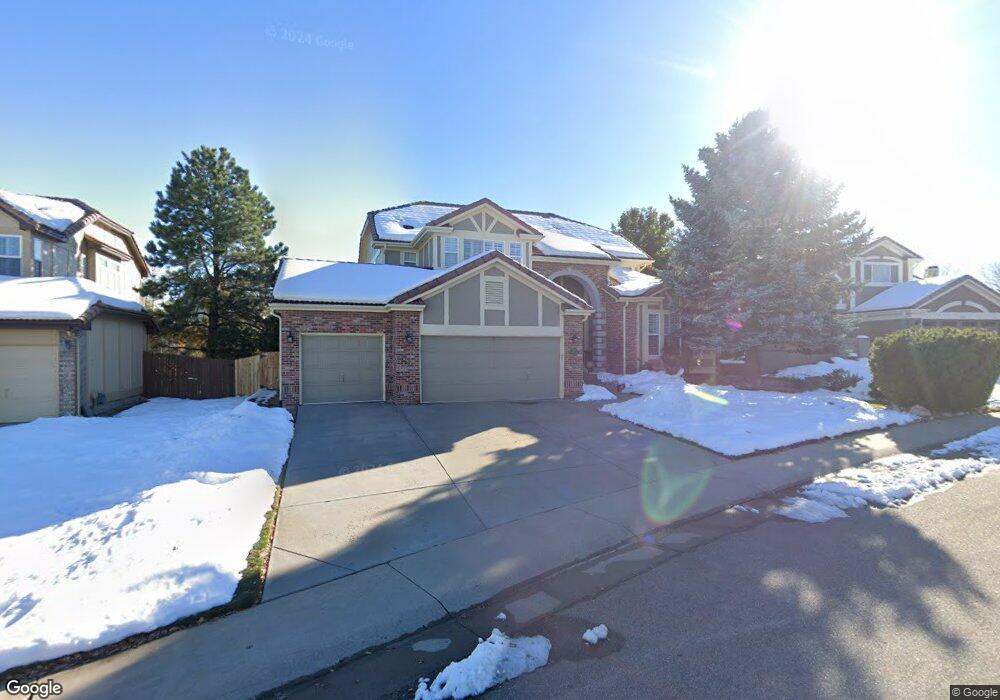
9768 Colinade Dr Lone Tree, CO 80124
Estimated Value: $1,051,000 - $1,213,000
5
Beds
4
Baths
5,033
Sq Ft
$221/Sq Ft
Est. Value
About This Home
This home is located at 9768 Colinade Dr, Lone Tree, CO 80124 and is currently estimated at $1,111,082, approximately $220 per square foot. 9768 Colinade Dr is a home located in Douglas County with nearby schools including Acres Green Elementary School, Cresthill Middle School, and Highlands Ranch High School.
Ownership History
Date
Name
Owned For
Owner Type
Purchase Details
Closed on
Jul 25, 2019
Sold by
Froelich Michael M and Mitchell Froehlich Teresa L
Bought by
Benson David J and Benson Deborah K
Current Estimated Value
Home Financials for this Owner
Home Financials are based on the most recent Mortgage that was taken out on this home.
Original Mortgage
$561,000
Outstanding Balance
$488,308
Interest Rate
3.82%
Mortgage Type
New Conventional
Estimated Equity
$622,774
Purchase Details
Closed on
Jun 17, 2010
Sold by
Primock Joseph and Friend David A
Bought by
Froehlich Michael M and Mitchell Froehlich Teresa L
Home Financials for this Owner
Home Financials are based on the most recent Mortgage that was taken out on this home.
Original Mortgage
$369,000
Interest Rate
4.93%
Mortgage Type
New Conventional
Purchase Details
Closed on
Mar 4, 2010
Sold by
Primock Joseph
Bought by
Primock Joseph and Fried David A
Purchase Details
Closed on
Mar 3, 2010
Sold by
Weiss Adam S and Weiss Michelle M
Bought by
Primock Joseph
Purchase Details
Closed on
Oct 1, 2008
Sold by
Weiss Michelle M and Weiss Adam S
Bought by
Weiss Michelle M
Purchase Details
Closed on
Aug 30, 2002
Sold by
Mckinstry James D and Mckinstry Brenna C
Bought by
Weiss Adam S and Weiss Michelle M
Home Financials for this Owner
Home Financials are based on the most recent Mortgage that was taken out on this home.
Original Mortgage
$190,000
Interest Rate
6.25%
Purchase Details
Closed on
Mar 4, 1999
Sold by
Pearce James E and Pearce Wendy S
Bought by
Mckinstry James D and Mckinstry Brenna C
Home Financials for this Owner
Home Financials are based on the most recent Mortgage that was taken out on this home.
Original Mortgage
$230,000
Interest Rate
6.73%
Purchase Details
Closed on
Sep 26, 1996
Sold by
Ryland Group Inc
Bought by
Pearce James E and Pearce Wendy S
Purchase Details
Closed on
Jun 23, 1995
Sold by
Ryland-Consolidated Lp
Bought by
Ryland Group Inc
Purchase Details
Closed on
Mar 1, 1994
Sold by
Troon Village Ltd
Bought by
Ryland Consolidated
Create a Home Valuation Report for This Property
The Home Valuation Report is an in-depth analysis detailing your home's value as well as a comparison with similar homes in the area
Home Values in the Area
Average Home Value in this Area
Purchase History
| Date | Buyer | Sale Price | Title Company |
|---|---|---|---|
| Benson David J | $750,000 | Guardian Title | |
| Froehlich Michael M | $525,000 | Land Title Guarantee Company | |
| Primock Joseph | -- | Security Title | |
| Primock Joseph | -- | None Available | |
| Weiss Michelle M | -- | None Available | |
| Weiss Adam S | $458,000 | -- | |
| Mckinstry James D | $352,000 | North American Title Co | |
| Pearce James E | $301,655 | Land Title | |
| Ryland Group Inc | $114,000 | -- | |
| Ryland Consolidated | $1,750,000 | -- |
Source: Public Records
Mortgage History
| Date | Status | Borrower | Loan Amount |
|---|---|---|---|
| Open | Benson David J | $561,000 | |
| Previous Owner | Froehlich Michael M | $369,000 | |
| Previous Owner | Weiss Adam S | $190,000 | |
| Previous Owner | Mckinstry James D | $230,000 |
Source: Public Records
Tax History
| Year | Tax Paid | Tax Assessment Tax Assessment Total Assessment is a certain percentage of the fair market value that is determined by local assessors to be the total taxable value of land and additions on the property. | Land | Improvement |
|---|---|---|---|---|
| 2025 | $6,519 | $63,550 | $11,410 | $52,140 |
| 2024 | $6,519 | $73,280 | $13,030 | $60,250 |
| 2023 | $6,585 | $73,280 | $13,030 | $60,250 |
| 2022 | $4,688 | $51,550 | $9,470 | $42,080 |
| 2021 | $5,192 | $51,550 | $9,470 | $42,080 |
| 2020 | $4,594 | $49,790 | $10,030 | $39,760 |
| 2019 | $4,610 | $49,790 | $10,030 | $39,760 |
| 2018 | $4,071 | $47,030 | $9,690 | $37,340 |
| 2017 | $4,136 | $47,030 | $9,690 | $37,340 |
| 2016 | $4,504 | $50,180 | $9,600 | $40,580 |
| 2015 | $4,604 | $50,180 | $9,600 | $40,580 |
| 2014 | $4,451 | $45,490 | $10,530 | $34,960 |
Source: Public Records
Map
Nearby Homes
- 9835 Firestone Cir
- 9873 Greensview Cir
- 9853 Greensview Cir
- 8356 Green Island Cir
- 8555 Green Island Cir
- 8561 Colonial Dr
- 9838 Cypress Point Cir
- 9570 Brook Hill Ln
- 9594 Brook Hill Ln
- 8666 Ainsdale Ct Unit 12B
- 10064 Bluffmont Ct
- 10091 Astoria Ct
- 9308 Miles Dr Unit 5
- 9565 Silent Hills Ln
- 8046 Lodgepole Trail
- 9535 Silent Hills Ln
- 7755 Barkway Ct
- 9198 Ridgegate Pkwy
- 10051 Belvedere Cir
- 8214 Lodgepole Trail
- 9758 Colinade Dr
- 9778 Colinade Dr
- 9812 Carmel Ct
- 9810 Carmel Ct
- 9808 Carmel Ct
- 9814 Carmel Ct
- 9806 Carmel Ct
- 9788 Colinade Dr
- 9748 Colinade Dr
- 9816 Carmel Ct
- 9757 Colinade Dr
- 9804 Carmel Ct
- 9818 Carmel Ct
- 9738 Colinade Dr
- 9798 Colinade Dr
- 9777 Colinade Dr
- 9801 Firestone Cir
- 9802 Carmel Ct
- 9820 Carmel Ct
- 9737 Colinade Dr
Your Personal Tour Guide
Ask me questions while you tour the home.