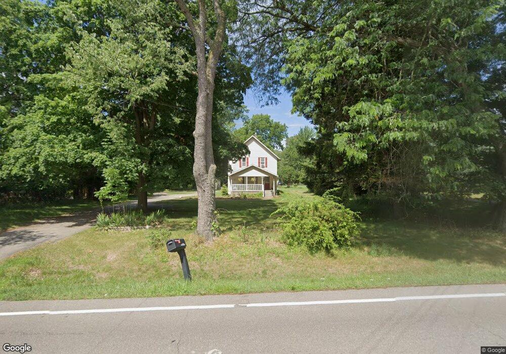
977 Collindale Ave NW Grand Rapids, MI 49504
Westside Connection NeighborhoodEstimated Value: $331,000 - $406,000
--
Bed
1
Bath
2,136
Sq Ft
$170/Sq Ft
Est. Value
About This Home
This home is located at 977 Collindale Ave NW, Grand Rapids, MI 49504 and is currently estimated at $362,611, approximately $169 per square foot. 977 Collindale Ave NW is a home located in Kent County with nearby schools including Shawmut Hills School, CA Frost Environmental Science Middle High School, and Westwood Middle School.
Ownership History
Date
Name
Owned For
Owner Type
Purchase Details
Closed on
Jul 10, 2015
Sold by
Prusinski Anthony G and Prusinski Margaret J
Bought by
Prusinski John R
Current Estimated Value
Home Financials for this Owner
Home Financials are based on the most recent Mortgage that was taken out on this home.
Original Mortgage
$92,800
Interest Rate
4.01%
Mortgage Type
New Conventional
Create a Home Valuation Report for This Property
The Home Valuation Report is an in-depth analysis detailing your home's value as well as a comparison with similar homes in the area
Home Values in the Area
Average Home Value in this Area
Purchase History
| Date | Buyer | Sale Price | Title Company |
|---|---|---|---|
| Prusinski John R | $116,000 | None Available |
Source: Public Records
Mortgage History
| Date | Status | Borrower | Loan Amount |
|---|---|---|---|
| Closed | Prusinski John R | $92,800 |
Source: Public Records
Tax History Compared to Growth
Tax History
| Year | Tax Paid | Tax Assessment Tax Assessment Total Assessment is a certain percentage of the fair market value that is determined by local assessors to be the total taxable value of land and additions on the property. | Land | Improvement |
|---|---|---|---|---|
| 2025 | $3,121 | $159,700 | $0 | $0 |
| 2024 | $3,121 | $143,400 | $0 | $0 |
| 2023 | $3,167 | $136,100 | $0 | $0 |
| 2022 | $3,007 | $120,900 | $0 | $0 |
| 2021 | $2,943 | $111,900 | $0 | $0 |
| 2020 | $2,810 | $105,200 | $0 | $0 |
| 2019 | $2,943 | $98,700 | $0 | $0 |
| 2018 | $2,845 | $90,000 | $0 | $0 |
| 2017 | $2,769 | $79,300 | $0 | $0 |
| 2016 | $2,801 | $73,000 | $0 | $0 |
| 2015 | $3,062 | $73,000 | $0 | $0 |
| 2013 | -- | $62,200 | $0 | $0 |
Source: Public Records
Map
Nearby Homes
- 768 Westview Ave NW
- 960 Brownwood Ave NW
- 919 Fairfield Ave NW
- 1270 Hillburn Ave NW Unit 35
- 433 Carpenter Ave NW
- 658 Clover Ridge Ave NW
- 958 Maynard Ave NW
- 1217 El Camino Dr NW
- 2883 Burritt St NW
- 1289 Lancaster Ave NW
- 2957 Burritt St NW
- 1300 Lancaster Ave NW
- 2407 7th St NW
- 3020 Burritt St NW
- 528 Charlotte Ave NW
- 709 Cashew Ct NW
- 415 Charlotte Ave NW
- 1421 Benning Ave NW
- 1460 Benning Ave NW
- 701 Kommer Ct NW
- 959 Collindale Ave NW
- 1009 Collindale Ave NW
- 945 Collindale Ave NW
- 1021 Collindale Ave NW
- 974 Collindale Ave NW
- 987 Collindale Ave NW
- 992 Collindale Ave NW
- 931 Collindale Ave NW
- 962 Collindale Ave NW
- 1001 Collindale Ave NW
- 1008 Collindale Ave NW
- 917 Collindale Ave NW
- 1041 Collindale Ave NW
- 932 Collindale Ave NW
- 1026 Collindale Ave NW
- 905 Collindale Ave NW
- 918 Collindale Ave NW
- 1063 Collindale Ave NW
- 1050 Collindale Ave NW
- 875 Collindale Ave NW