Estimated Value: $652,000 - $693,000
3
Beds
1
Bath
1,844
Sq Ft
$365/Sq Ft
Est. Value
About This Home
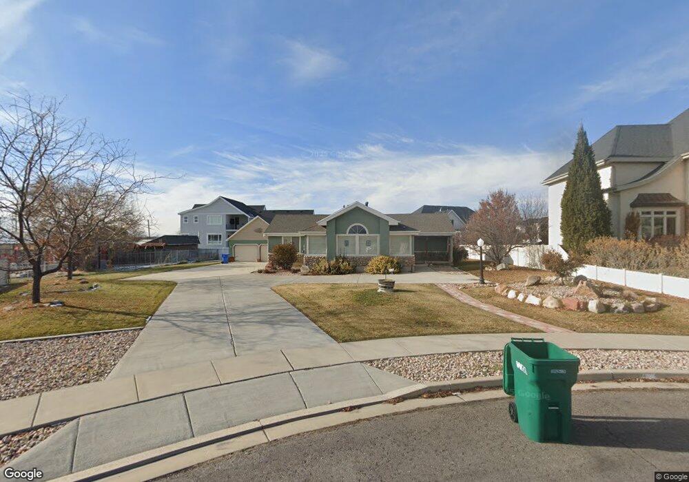
This home is located at 977 N 1540 E, Lehi, UT 84043 and is currently estimated at $673,313, approximately $365 per square foot. 977 N 1540 E is a home located in Utah County with nearby schools including Freedom Elementary School, Lehi Junior High School, and Skyridge High School.
Ownership History
Date
Name
Owned For
Owner Type
Purchase Details
Closed on
Nov 3, 2021
Sold by
Peck Elizabeth A
Bought by
Peck Elizabeth A and Peck Michael L
Current Estimated Value
Home Financials for this Owner
Home Financials are based on the most recent Mortgage that was taken out on this home.
Original Mortgage
$780,000
Outstanding Balance
$416,184
Interest Rate
9.9%
Mortgage Type
Reverse Mortgage Home Equity Conversion Mortgage
Estimated Equity
$257,129
Purchase Details
Closed on
Mar 25, 2014
Sold by
Peck Lynn W and Peck Arlene S
Bought by
Peck Elizabeth A
Purchase Details
Closed on
Apr 1, 2013
Sold by
Peck Lynn W and Peck Arlene S
Bought by
Peck Elizabeth A
Create a Home Valuation Report for This Property
The Home Valuation Report is an in-depth analysis detailing your home's value as well as a comparison with similar homes in the area
Home Values in the Area
Average Home Value in this Area
Purchase History
| Date | Buyer | Sale Price | Title Company |
|---|---|---|---|
| Peck Elizabeth A | -- | Boston National Title | |
| Peck Elizabeth A | -- | None Available | |
| Peck Elizabeth A | -- | Affiliated First Title Co |
Source: Public Records
Mortgage History
| Date | Status | Borrower | Loan Amount |
|---|---|---|---|
| Open | Peck Elizabeth A | $780,000 | |
| Closed | Peck Elizabeth A | $780,000 |
Source: Public Records
Tax History
| Year | Tax Paid | Tax Assessment Tax Assessment Total Assessment is a certain percentage of the fair market value that is determined by local assessors to be the total taxable value of land and additions on the property. | Land | Improvement |
|---|---|---|---|---|
| 2025 | $2,842 | $354,915 | -- | -- |
| 2024 | $2,842 | $332,640 | $0 | $0 |
| 2023 | $2,656 | $337,480 | $0 | $0 |
| 2022 | $2,617 | $322,355 | $0 | $0 |
| 2021 | $24 | $405,900 | $236,100 | $169,800 |
| 2020 | $9 | $377,300 | $218,600 | $158,700 |
| 2019 | $1,972 | $377,300 | $218,600 | $158,700 |
| 2018 | $34 | $362,100 | $206,600 | $155,500 |
| 2017 | $1,661 | $159,720 | $0 | $0 |
| 2016 | $0 | $155,485 | $0 | $0 |
| 2015 | -- | $155,485 | $0 | $0 |
| 2014 | $1,569 | $132,165 | $0 | $0 |
Source: Public Records
Map
Nearby Homes
- 893 N 1580 E
- 1175 E 900 N
- 3935 W 1000 N Unit 438
- 3983 W 1000 N Unit 442
- 4007 W 1000 N
- 3947 W 1000 N Unit 439
- 3971 W 1000 N Unit 441
- 3959 W 1000 N
- 3995 W 1000 N
- 9435 N Aspen Hollow Cir
- 1117 N Cedar Hollow Blvd
- 414 N 1322 E
- 764 W 880 North St Unit 308
- 822 N 860 W Unit 317
- 1370 N Cedar Hollow Blvd
- 822 W 800 St N Unit LOT319
- 890 N Whipple Dr
- 832 N Somerset Aly
- 807 N Somerset Aly
- 742 N 700 West Cir
- 1003 N 1540 E
- 1542 E 975 N
- 972 N 1490 E Unit 509
- 972 N 1490 E
- 998 N 1490 E Unit 508
- 1515 E 900 N
- 1027 N 1540 E
- 1516 E 900 N
- 1002 N 1540 E Unit 37
- 1026 N 1490 E Unit 507
- 957 N 1590 E
- 1405 E 900 N
- 1026 N 1540 E
- 1053 N 1540 E
- 1582 E 900 N
- 969 N 1490 E Unit 502
- 933 N 1590 E
- 1001 N 1490 E Unit 503
- 1587 E 975 N
- 1052 N 1540 E Unit 35