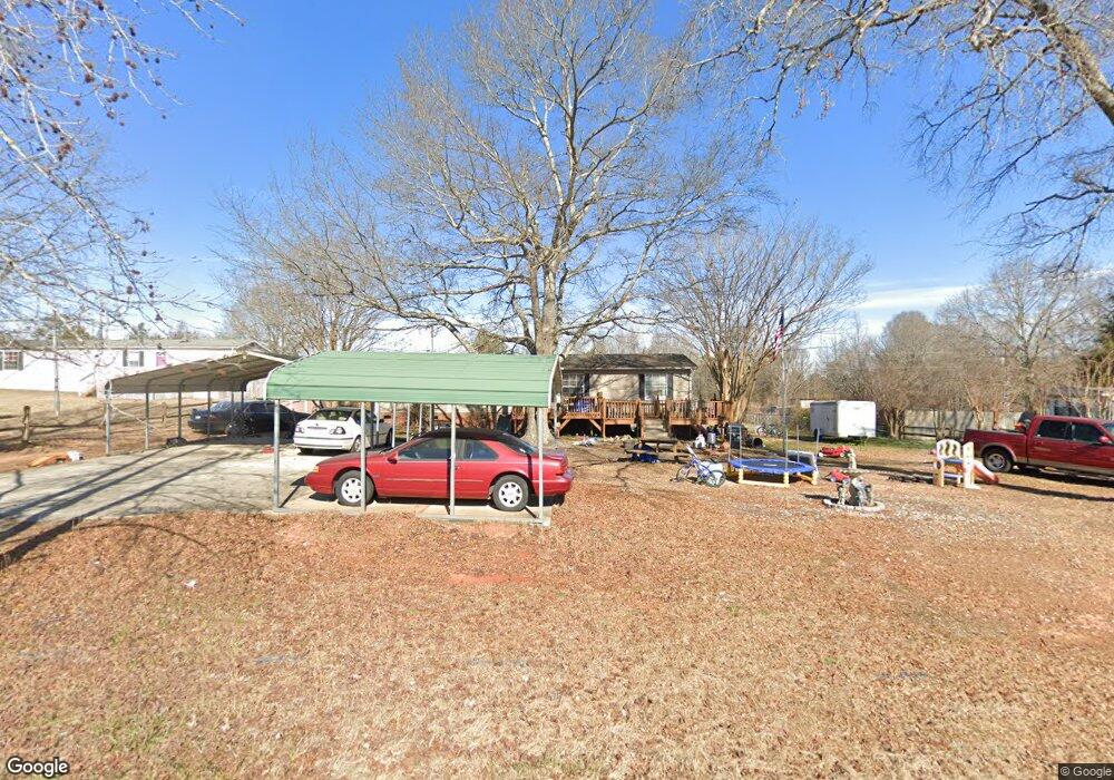
977 Neely Store Rd Rock Hill, SC 29730
Estimated Value: $161,000 - $374,000
--
Bed
--
Bath
1,680
Sq Ft
$149/Sq Ft
Est. Value
About This Home
This home is located at 977 Neely Store Rd, Rock Hill, SC 29730 and is currently estimated at $249,544, approximately $148 per square foot. 977 Neely Store Rd is a home located in York County with nearby schools including Lesslie Elementary School, Castle Heights Middle School, and Rock Hill High School.
Ownership History
Date
Name
Owned For
Owner Type
Purchase Details
Closed on
Mar 12, 2024
Sold by
Harrington Patrick T
Bought by
Ellis Cody
Current Estimated Value
Home Financials for this Owner
Home Financials are based on the most recent Mortgage that was taken out on this home.
Original Mortgage
$150,590
Outstanding Balance
$148,113
Interest Rate
6.69%
Mortgage Type
FHA
Estimated Equity
$101,431
Purchase Details
Closed on
Feb 19, 2015
Sold by
Estate Of Lisa Glenn Harrington
Bought by
Harrington Patrick T and Inzerillo Mary Madison
Create a Home Valuation Report for This Property
The Home Valuation Report is an in-depth analysis detailing your home's value as well as a comparison with similar homes in the area
Home Values in the Area
Average Home Value in this Area
Purchase History
| Date | Buyer | Sale Price | Title Company |
|---|---|---|---|
| Ellis Cody | $180,000 | None Listed On Document | |
| Ellis Cody | $180,000 | None Listed On Document | |
| Harrington Patrick T | -- | -- |
Source: Public Records
Mortgage History
| Date | Status | Borrower | Loan Amount |
|---|---|---|---|
| Open | Ellis Cody | $150,590 | |
| Closed | Ellis Cody | $150,590 |
Source: Public Records
Tax History Compared to Growth
Tax History
| Year | Tax Paid | Tax Assessment Tax Assessment Total Assessment is a certain percentage of the fair market value that is determined by local assessors to be the total taxable value of land and additions on the property. | Land | Improvement |
|---|---|---|---|---|
| 2024 | $317 | $2,256 | $1,120 | $1,136 |
| 2023 | $325 | $2,256 | $1,120 | $1,136 |
| 2022 | $326 | $2,256 | $1,120 | $1,136 |
| 2021 | -- | $2,256 | $1,120 | $1,136 |
| 2020 | $325 | $2,256 | $0 | $0 |
| 2019 | $371 | $2,460 | $0 | $0 |
| 2018 | $369 | $2,460 | $0 | $0 |
| 2017 | $1,198 | $3,690 | $0 | $0 |
| 2016 | $1,160 | $3,690 | $0 | $0 |
| 2014 | $326 | $2,460 | $1,200 | $1,260 |
| 2013 | $326 | $2,600 | $1,200 | $1,400 |
Source: Public Records
Map
Nearby Homes
- 1034 Neely Store Rd
- 1104 Neely Store Rd
- 2999 Starnes Dr
- 1540 Neely Store Rd
- 2715 Shandon Rd
- 709 Pierce Ct
- 1715 Hopewell Rd
- 1580 Anderson Rd S
- 3943 Walker Rd Unit LOT ONLY
- 3943 Walker Rd
- 3943 Walker Road (Land Only)
- 508 Bridgestone Ln
- 172 Neely Store Rd
- 00 Southwinds Ct Unit 24
- 1177 Ellis Pond Dr
- 2021 Eddie Massey Ln
- 2217 Smoltz Dr
- 00 Hopewell Rd
- 1780 Stuart Carter Ave
- 953 Church Rd
- 965 Neely Store Rd
- 989 Neely Store Rd
- 953 Neely Store Rd
- 1001 Neely Store Rd
- 964 Neely Store Rd
- 933 Neely Store Rd
- 933 Neely Store Rd
- 988 Neely Store Rd
- 945 Neely Store Rd
- 921 Durham Ln
- 1013 Neely Store Rd
- 828 Broome Place
- 925 Neely Store Rd
- 933 Durham Ln
- 1022 Neely Store Rd
- 945 Durham Ln
- 840 Broome Place
- 926 Durham Ln
- 913 Neely Store Rd
- 957 Durham Ln