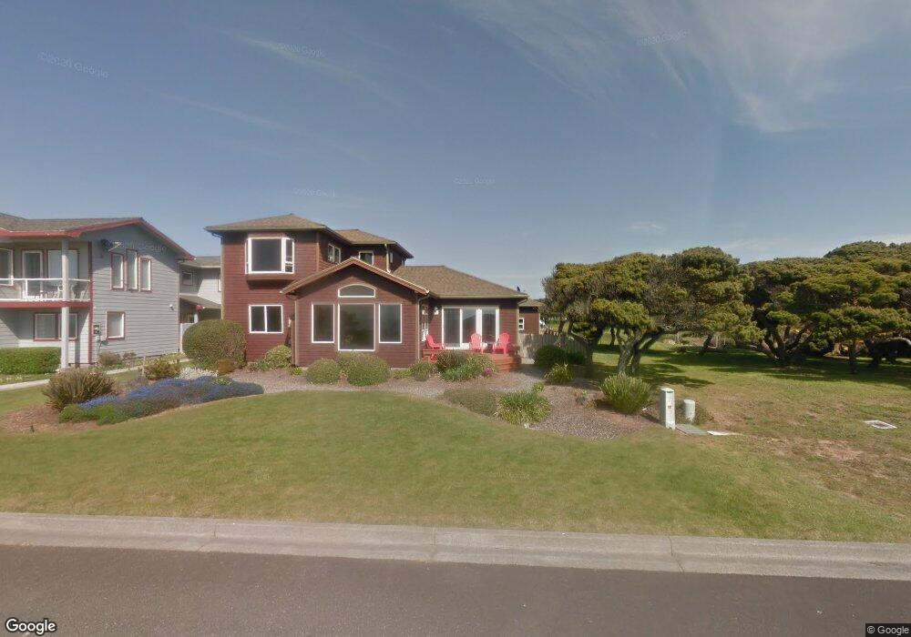
977 Portland Ave SW Bandon, OR 97411
Estimated Value: $734,000 - $911,097
3
Beds
2
Baths
2,044
Sq Ft
$402/Sq Ft
Est. Value
About This Home
This home is located at 977 Portland Ave SW, Bandon, OR 97411 and is currently estimated at $822,549, approximately $402 per square foot. 977 Portland Ave SW is a home located in Coos County with nearby schools including Ocean Crest Elementary School, Harbor Lights Middle School, and Bandon Senior High School.
Ownership History
Date
Name
Owned For
Owner Type
Purchase Details
Closed on
Aug 17, 2006
Sold by
Grieve William G and Greive Denise D
Bought by
Swenson Harold and Herman Jill
Current Estimated Value
Home Financials for this Owner
Home Financials are based on the most recent Mortgage that was taken out on this home.
Original Mortgage
$500,000
Outstanding Balance
$298,637
Interest Rate
6.76%
Mortgage Type
Purchase Money Mortgage
Estimated Equity
$523,912
Purchase Details
Closed on
Sep 27, 2004
Sold by
Crunkilton Robert E and Crunkilton Terry J
Bought by
Grieve William G and Grieve Denise D
Home Financials for this Owner
Home Financials are based on the most recent Mortgage that was taken out on this home.
Original Mortgage
$410,000
Interest Rate
5.37%
Mortgage Type
Purchase Money Mortgage
Create a Home Valuation Report for This Property
The Home Valuation Report is an in-depth analysis detailing your home's value as well as a comparison with similar homes in the area
Home Values in the Area
Average Home Value in this Area
Purchase History
| Date | Buyer | Sale Price | Title Company |
|---|---|---|---|
| Swenson Harold | $855,000 | Fidelity National Title Co | |
| Grieve William G | $735,000 | Fidelity National Title Co |
Source: Public Records
Mortgage History
| Date | Status | Borrower | Loan Amount |
|---|---|---|---|
| Open | Swenson Harold | $500,000 | |
| Previous Owner | Grieve William G | $410,000 | |
| Closed | Grieve William G | $141,250 |
Source: Public Records
Tax History Compared to Growth
Tax History
| Year | Tax Paid | Tax Assessment Tax Assessment Total Assessment is a certain percentage of the fair market value that is determined by local assessors to be the total taxable value of land and additions on the property. | Land | Improvement |
|---|---|---|---|---|
| 2025 | $5,682 | $515,710 | -- | -- |
| 2024 | $5,621 | $500,690 | -- | -- |
| 2023 | $5,474 | $486,110 | $0 | $0 |
| 2022 | $5,495 | $471,960 | $0 | $0 |
| 2021 | $5,280 | $458,220 | $0 | $0 |
| 2020 | $4,793 | $458,220 | $0 | $0 |
| 2019 | $4,778 | $431,930 | $0 | $0 |
| 2018 | $4,493 | $419,350 | $0 | $0 |
| 2017 | $4,389 | $407,140 | $0 | $0 |
| 2016 | $4,254 | $395,290 | $0 | $0 |
| 2015 | $4,015 | $383,780 | $0 | $0 |
| 2014 | $4,015 | $372,610 | $0 | $0 |
Source: Public Records
Map
Nearby Homes
- 1575 Beach Loop Dr SW
- 875 12th St SW
- 1257 7th St SW
- 1280 Ocean Dr SW
- 1950 Beach Loop Dr SW
- 835 SW 11th
- 1312 Village Loop
- 1313 Village Loop
- 1323 Village Loop
- 2131 Beach Loop Dr SW
- 737 11th St SW
- 0 Eighth St SW Unit 797186006
- 0 SW Eighth at Harrison Ave
- 00 Harrison Ave Lot B
- 875 Ocean Dr SW
- 0 Beach Loop Dr SW Unit 201837812
- 0 Franklin Ave SW Unit 23128327
- 0 Jetty Rd SW Unit 269553922
- 0 Jetty Rd SW Unit 267448665
- 000 Jetty Rd Unit 100
- 1241 Beach Loop Dr SW
- 1235 Beach Loop Dr SW
- 1241 Beach Loop Rd
- 1257 Beach Loop Dr SW
- 1240 Newport Ave SW
- 1263 Beach Loop Dr SW
- 0 Beach Loop 4601 Dr SW Unit 4601
- 1219 Beach Loop Dr SW
- 1240 Beach Loop Dr SW
- 1260 Beach Loop Rd
- 1220 Newport Ave SW
- 1230 Newport Ave SW
- 1275 Beach Loop Dr SW
- 1335 Beach Loop Dr SW
- 1183 Beach Loop Dr SW
- 1256 Newport Ave SW
- 1190 Beach Loop Dr SW
- 1280 Beach Loop Dr SW
- 1175 Beach Loop Dr SW
- 1160 Newport Ave SW