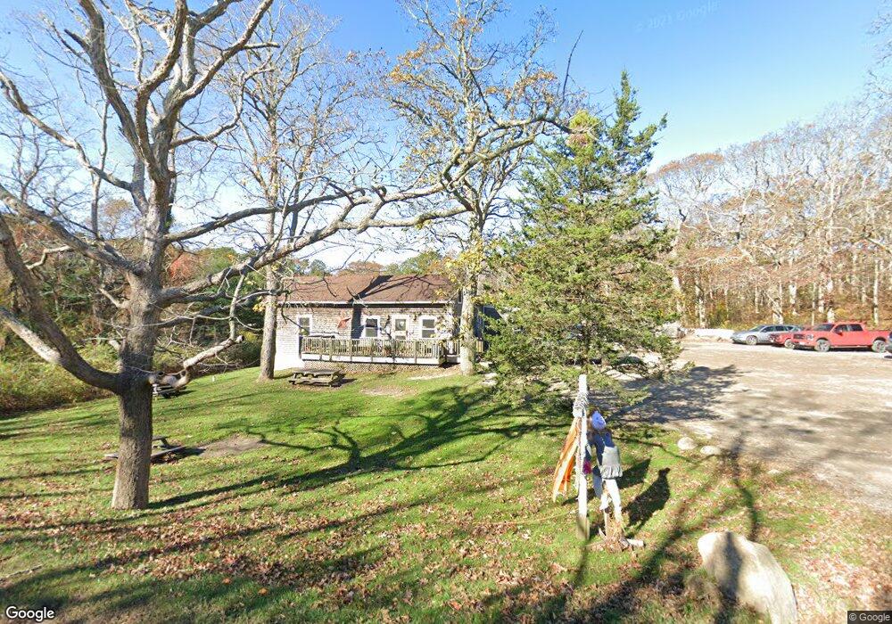
977 State Rd Vineyard Haven, MA 02568
Vineyard Haven NeighborhoodEstimated Value: $1,801,677
3
Beds
3
Baths
2,788
Sq Ft
$646/Sq Ft
Est. Value
About This Home
This home is located at 977 State Rd, Vineyard Haven, MA 02568 and is currently estimated at $1,801,677, approximately $646 per square foot. 977 State Rd is a home located in Dukes County with nearby schools including Tisbury Elementary School, Martha's Vineyard Regional High School, and Martha's Vineyard Charter School.
Ownership History
Date
Name
Owned For
Owner Type
Purchase Details
Closed on
Jun 1, 2012
Sold by
Tapestry Holdings Llc
Bought by
Willowtree & Pig Llc
Current Estimated Value
Home Financials for this Owner
Home Financials are based on the most recent Mortgage that was taken out on this home.
Original Mortgage
$407,500
Outstanding Balance
$283,337
Interest Rate
3.9%
Mortgage Type
Commercial
Estimated Equity
$1,518,340
Purchase Details
Closed on
Nov 6, 2002
Sold by
Isabella M White T and Zexter Alan
Bought by
Tapestry Hldgs Llc
Create a Home Valuation Report for This Property
The Home Valuation Report is an in-depth analysis detailing your home's value as well as a comparison with similar homes in the area
Home Values in the Area
Average Home Value in this Area
Purchase History
| Date | Buyer | Sale Price | Title Company |
|---|---|---|---|
| Willowtree & Pig Llc | $775,000 | -- | |
| Tapestry Hldgs Llc | $440,000 | -- |
Source: Public Records
Mortgage History
| Date | Status | Borrower | Loan Amount |
|---|---|---|---|
| Open | Tapestry Hldgs Llc | $407,500 | |
| Closed | Tapestry Hldgs Llc | $326,000 | |
| Closed | Tapestry Hldgs Llc | $338,000 |
Source: Public Records
Tax History Compared to Growth
Tax History
| Year | Tax Paid | Tax Assessment Tax Assessment Total Assessment is a certain percentage of the fair market value that is determined by local assessors to be the total taxable value of land and additions on the property. | Land | Improvement |
|---|---|---|---|---|
| 2025 | $6,970 | $873,400 | $357,000 | $516,400 |
| 2024 | $6,970 | $873,400 | $357,000 | $516,400 |
| 2023 | $0 | $873,400 | $357,000 | $516,400 |
| 2022 | $0 | $702,100 | $204,000 | $498,100 |
| 2021 | $0 | $702,100 | $204,000 | $498,100 |
| 2020 | $6,254 | $702,100 | $204,000 | $498,100 |
| 2019 | $0 | $702,100 | $204,000 | $498,100 |
| 2018 | $0 | $702,100 | $204,000 | $498,100 |
| 2017 | $0 | $653,800 | $192,400 | $461,400 |
| 2016 | -- | $654,600 | $192,400 | $462,200 |
| 2015 | $2,762 | $654,600 | $192,400 | $462,200 |
Source: Public Records
Map
Nearby Homes
- 16 Red Coat Hill Rd
- 53 Stoney Hill Rd
- 4 Rock Pond Rd
- 56 Holmes Hole Rd Unit 10
- 56 Holmes Hole Rd
- 105 Stoney Hill Rd
- 157 Ben Chase Rd
- 34 Pine Ln
- 169 Clover Hill Dr
- 51 Lantern Ln
- 71 Stoney Hill Rd
- 12 Wheelhouse Way
- 136 W Spring St
- 20 Brook Hollow Rd
- 97 Longview Rd
- 22 Oklahoma Ave
- 55 Old House Way
- 5A2.12 State Rd
- 159 Lake St
- 344 Greenwood Ave
- 1001 State Rd
- 1056 State Rd
- 969 State Rd
- 45 Codding Ln
- 73 Codding Ln
- 1037 State Rd
- 66 Codding Ln
- 46 Codding Ln
- 1000 State Rd
- 1000 State Rd
- 21 Deer Hill Rd
- 24 Peacegate Way
- 1128 State Rd
- 74 Codding Ln
- 1026 State Rd
- 00 State Rd
- 0 State Rd
- 0 State Rd Unit FldGallery 20417
- 3 State Rd
- 200 Red Coat Hill Rd