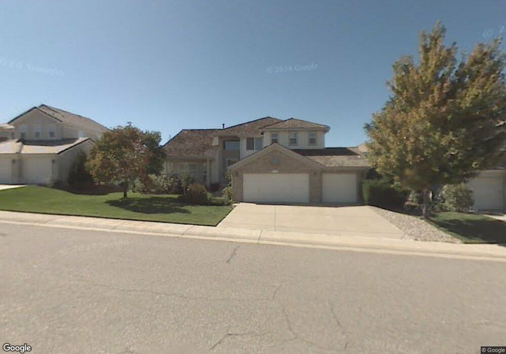
9771 Tall Grass Cir Lone Tree, CO 80124
Estimated Value: $903,683 - $974,000
4
Beds
3
Baths
2,687
Sq Ft
$353/Sq Ft
Est. Value
About This Home
This home is located at 9771 Tall Grass Cir, Lone Tree, CO 80124 and is currently estimated at $948,421, approximately $352 per square foot. 9771 Tall Grass Cir is a home located in Douglas County with nearby schools including Acres Green Elementary School, Cresthill Middle School, and Highlands Ranch High School.
Ownership History
Date
Name
Owned For
Owner Type
Purchase Details
Closed on
Dec 15, 2006
Sold by
Ingham Delaney F and Doyle Edward A
Bought by
Miller Stanley T
Current Estimated Value
Home Financials for this Owner
Home Financials are based on the most recent Mortgage that was taken out on this home.
Original Mortgage
$372,000
Outstanding Balance
$222,411
Interest Rate
6.31%
Mortgage Type
Purchase Money Mortgage
Estimated Equity
$726,010
Purchase Details
Closed on
May 31, 2001
Sold by
Helm Blake A and Helm Patricia E
Bought by
Ingham Delaney F and Doyle Edward A
Home Financials for this Owner
Home Financials are based on the most recent Mortgage that was taken out on this home.
Original Mortgage
$193,300
Interest Rate
7.07%
Mortgage Type
Balloon
Purchase Details
Closed on
Mar 16, 1999
Sold by
Helm Blake A and Elsner Patricia A
Bought by
Helm Blake A and Helm Patricia E
Home Financials for this Owner
Home Financials are based on the most recent Mortgage that was taken out on this home.
Original Mortgage
$300,000
Interest Rate
7%
Purchase Details
Closed on
Feb 20, 1998
Sold by
Bauer Dennis M and Bauer Michele D
Bought by
Helm Blake A and Elsner Patricia A
Home Financials for this Owner
Home Financials are based on the most recent Mortgage that was taken out on this home.
Original Mortgage
$208,000
Interest Rate
6.92%
Purchase Details
Closed on
Feb 16, 1996
Sold by
The Ryland Group Inc
Bought by
Bauer Dennis M and Bauer Michele D
Home Financials for this Owner
Home Financials are based on the most recent Mortgage that was taken out on this home.
Original Mortgage
$191,250
Interest Rate
7.09%
Mortgage Type
Balloon
Purchase Details
Closed on
Aug 18, 1994
Sold by
Ryland Consolidated
Bought by
Ryland Group Inc
Purchase Details
Closed on
Mar 1, 1994
Sold by
Troon Village Ltd
Bought by
Ryland Consolidated
Create a Home Valuation Report for This Property
The Home Valuation Report is an in-depth analysis detailing your home's value as well as a comparison with similar homes in the area
Home Values in the Area
Average Home Value in this Area
Purchase History
| Date | Buyer | Sale Price | Title Company |
|---|---|---|---|
| Miller Stanley T | $465,000 | Land Title | |
| Ingham Delaney F | $390,000 | Land Title | |
| Helm Blake A | -- | -- | |
| Helm Blake A | $299,000 | Land Title | |
| Bauer Dennis M | $255,000 | Land Title | |
| Ryland Group Inc | $111,100 | -- | |
| Ryland Consolidated | $1,750,000 | -- |
Source: Public Records
Mortgage History
| Date | Status | Borrower | Loan Amount |
|---|---|---|---|
| Open | Miller Stanley T | $372,000 | |
| Previous Owner | Ingham Delaney F | $193,300 | |
| Previous Owner | Helm Blake A | $300,000 | |
| Previous Owner | Helm Blake A | $208,000 | |
| Previous Owner | Bauer Dennis M | $191,250 | |
| Closed | Helm Blake A | $91,000 |
Source: Public Records
Tax History Compared to Growth
Tax History
| Year | Tax Paid | Tax Assessment Tax Assessment Total Assessment is a certain percentage of the fair market value that is determined by local assessors to be the total taxable value of land and additions on the property. | Land | Improvement |
|---|---|---|---|---|
| 2024 | $6,110 | $68,910 | $11,530 | $57,380 |
| 2023 | $6,171 | $68,910 | $11,530 | $57,380 |
| 2022 | $4,403 | $48,420 | $7,820 | $40,600 |
| 2021 | $4,578 | $48,420 | $7,820 | $40,600 |
| 2020 | $4,292 | $46,510 | $8,380 | $38,130 |
| 2019 | $4,306 | $46,510 | $8,380 | $38,130 |
| 2018 | $3,695 | $42,690 | $7,290 | $35,400 |
| 2017 | $3,754 | $42,690 | $7,290 | $35,400 |
| 2016 | $4,070 | $45,340 | $7,420 | $37,920 |
| 2015 | $4,160 | $45,340 | $7,420 | $37,920 |
| 2014 | $3,974 | $40,610 | $7,510 | $33,100 |
Source: Public Records
Map
Nearby Homes
- 10884 Lyric St
- 9873 Greensview Cir
- 9851 Greensview Cir
- 9493 Southern Hills Cir Unit A25
- 10102 Prestwick Trail
- 9838 Cypress Point Cir
- 8176 Lone Oak Ct
- 9565 Silent Hills Ln
- 9308 Miles Dr Unit 5
- 9535 Silent Hills Ln
- 10031 Town Ridge Ln
- 10205 Bluffmont Dr
- 10066 Belvedere Cir
- 9165 Kornbrust Dr
- 7855 Arundel Ln
- 8260 Lodgepole Trail
- 9430 S Silent Hills Dr
- 9410 S Silent Hills Dr
- 10164 Ridgegate Cir
- 7438 Indian Wells Ln
- 9775 Tall Grass Cir
- 9763 Tall Grass Cir
- 8706 Tall Grass Place
- 9748 Colinade Dr
- 9783 Tall Grass Cir
- 9753 Tall Grass Cir
- 9738 Colinade Dr
- 8705 Tall Grass Place
- 9728 Colinade Dr
- 8716 Tall Grass Place
- 9794 Tall Grass Cir
- 9758 Colinade Dr
- 9818 Carmel Ct
- 9795 Tall Grass Cir
- 9820 Carmel Ct
- 9816 Carmel Ct
- 9747 Tall Grass Cir
- 8715 Tall Grass Place
- 9814 Carmel Ct
- 9718 Colinade Dr