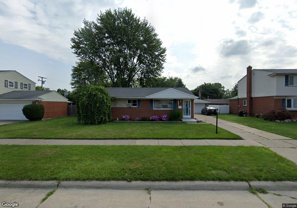
9777 Mckinley St Taylor, MI 48180
Estimated Value: $227,893 - $241,000
--
Bed
--
Bath
1,270
Sq Ft
$184/Sq Ft
Est. Value
About This Home
This home is located at 9777 Mckinley St, Taylor, MI 48180 and is currently estimated at $233,223, approximately $183 per square foot. 9777 Mckinley St is a home located in Wayne County with nearby schools including Kinyon Elementary School, Robert J. West Middle School, and Taylor Preparatory High School.
Ownership History
Date
Name
Owned For
Owner Type
Purchase Details
Closed on
Feb 13, 2007
Sold by
Sulak William and Sulak Shawn
Bought by
Moore Linda
Current Estimated Value
Purchase Details
Closed on
Jul 6, 2005
Sold by
Langston Tyree
Bought by
Wells Fargo Bank Na and First Franklin Mortgage Loan Trust 2003-
Purchase Details
Closed on
Sep 5, 2003
Sold by
Swingle Shelly A
Bought by
Langston Tyree
Purchase Details
Closed on
Aug 1, 2002
Sold by
Swingle Gerald D
Bought by
Swingle Shelly A
Create a Home Valuation Report for This Property
The Home Valuation Report is an in-depth analysis detailing your home's value as well as a comparison with similar homes in the area
Home Values in the Area
Average Home Value in this Area
Purchase History
| Date | Buyer | Sale Price | Title Company |
|---|---|---|---|
| Moore Linda | $145,000 | Multiple | |
| Wells Fargo Bank Na | $135,000 | -- | |
| Langston Tyree | $149,900 | Capital Title Ins Agency | |
| Swingle Shelly A | -- | -- |
Source: Public Records
Tax History Compared to Growth
Tax History
| Year | Tax Paid | Tax Assessment Tax Assessment Total Assessment is a certain percentage of the fair market value that is determined by local assessors to be the total taxable value of land and additions on the property. | Land | Improvement |
|---|---|---|---|---|
| 2025 | $2,288 | $111,100 | $0 | $0 |
| 2024 | $2,288 | $103,500 | $0 | $0 |
| 2023 | $3,374 | $90,000 | $0 | $0 |
| 2022 | $2,126 | $81,300 | $0 | $0 |
| 2021 | $3,185 | $74,400 | $0 | $0 |
| 2020 | $2,990 | $67,100 | $0 | $0 |
| 2019 | $304,169 | $56,300 | $0 | $0 |
| 2018 | $1,826 | $46,600 | $0 | $0 |
| 2017 | $2,739 | $43,800 | $0 | $0 |
| 2016 | $3,024 | $42,500 | $0 | $0 |
| 2015 | $4,125 | $42,100 | $0 | $0 |
| 2013 | $4,100 | $42,600 | $0 | $0 |
| 2012 | $1,797 | $41,400 | $12,500 | $28,900 |
Source: Public Records
Map
Nearby Homes
- 9883 Roosevelt St
- 22150 Haig St
- 9942 Lincoln St
- 22333 Kinyon St
- 22129 Kinyon St Unit 52
- 22455 Meadow Woods Cir
- 9560 Sylvester St
- 9381 Pardee Rd
- 22311 Wick Rd
- 22327 Wick Rd
- 22134 Wick Rd
- 9125 Dudley St
- 23364 Baker St
- 9167 Groschner St
- 23414 Baker St Unit 332
- 10880 Pardee Rd Unit 45
- 22382 Mary St
- 23395 Pinewood Dr Unit 121
- 22662 Goddard Rd Unit 7
- 21059 Wick Rd
- 9793 Mckinley St
- 9763 Mckinley St
- 9774 Roosevelt St
- 9760 Roosevelt St
- 9790 Roosevelt St
- 9809 Mckinley St
- 9749 Mckinley St
- 9778 Mckinley St
- 9794 Mckinley St
- 9812 Roosevelt St
- 9746 Roosevelt St
- 9764 Mckinley St
- 9810 Mckinley St
- 9823 Mckinley St
- 9735 Mckinley St
- 9750 Mckinley St
- 9732 Roosevelt St
- 9826 Roosevelt St
- 9775 Roosevelt St
- 9801 Lincoln St