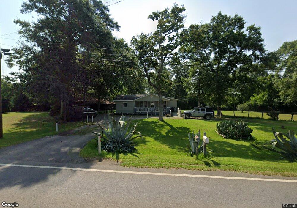
978 Bronwood Hwy Dawson, GA 39842
Estimated Value: $59,986 - $240,000
3
Beds
1
Bath
1,372
Sq Ft
$85/Sq Ft
Est. Value
About This Home
This home is located at 978 Bronwood Hwy, Dawson, GA 39842 and is currently estimated at $115,997, approximately $84 per square foot. 978 Bronwood Hwy is a home located in Terrell County with nearby schools including Cooper-Carver Elementary School, Terrell Middle School, and Terrell High School.
Ownership History
Date
Name
Owned For
Owner Type
Purchase Details
Closed on
Jul 4, 2020
Sold by
Mcconnell Janice W
Bought by
Schmitt Jesse N and Schmitt Regina L
Current Estimated Value
Purchase Details
Closed on
Jun 2, 2020
Sold by
Parnacott Owen W
Bought by
Mcconnell Janice W
Purchase Details
Closed on
Oct 7, 2008
Sold by
Terrell County Sheriffs Of
Bought by
Parnacott Owen
Purchase Details
Closed on
Jul 14, 1998
Sold by
Wills Wiley Milford
Bought by
Wills Terry Milford
Purchase Details
Closed on
Dec 9, 1997
Sold by
Wills Terry Milford
Bought by
Wills Wiley Milford
Create a Home Valuation Report for This Property
The Home Valuation Report is an in-depth analysis detailing your home's value as well as a comparison with similar homes in the area
Home Values in the Area
Average Home Value in this Area
Purchase History
| Date | Buyer | Sale Price | Title Company |
|---|---|---|---|
| Schmitt Jesse N | $41,700 | -- | |
| Mcconnell Janice W | $35,000 | -- | |
| Parnacott Owen | -- | -- | |
| Wills Terry Milford | -- | -- | |
| Wills Wiley Milford | -- | -- |
Source: Public Records
Tax History Compared to Growth
Tax History
| Year | Tax Paid | Tax Assessment Tax Assessment Total Assessment is a certain percentage of the fair market value that is determined by local assessors to be the total taxable value of land and additions on the property. | Land | Improvement |
|---|---|---|---|---|
| 2024 | $659 | $14,700 | $3,440 | $11,260 |
| 2023 | $455 | $14,700 | $3,440 | $11,260 |
| 2022 | $455 | $14,700 | $3,440 | $11,260 |
| 2021 | $455 | $14,700 | $3,440 | $11,260 |
| 2020 | $458 | $14,768 | $3,440 | $11,328 |
| 2019 | $443 | $14,768 | $3,440 | $11,328 |
| 2018 | $443 | $15,146 | $3,440 | $11,706 |
| 2017 | $454 | $15,146 | $3,440 | $11,706 |
| 2016 | $454 | $15,146 | $3,440 | $11,706 |
| 2015 | -- | $15,146 | $3,440 | $11,706 |
| 2014 | -- | $15,146 | $3,440 | $11,706 |
| 2013 | -- | $15,146 | $3,440 | $11,706 |
Source: Public Records
Map
Nearby Homes
- 0 Cooper Dr NE Unit 7597500
- 0 Cooper Dr NE Unit 10543060
- 828 Cooper Dr NE
- 1264 Ball Park Ave NE
- 1256 Ball Park Ave NE
- 1239 Askew Dr NE
- 904 Ash St NE
- 1240 Askew Dr NE
- 1258 Askew Dr NE
- 434 Foster Ave
- 513 College St NE
- 527 Orange St NE
- 448 Henry Mitchell Dr NE
- 707 Johnson St SE
- 411 E Lee St
- 362 Cinderella Ln SE
- 978 Lovers Ln
- 0 Cox Rd
- 361/552 NW Tenth Ave
- 229 7th Ave NW
- 1010 Bronwood Hwy
- 979 Bronwood Hwy
- 961 Bronwood Hwy
- 919 Crawford St NE
- 927 Crawford St NE
- 896 Crawford St NE
- 890 Crawford St NE
- 887 Crawford St NE
- 634 15th Ave NE
- 870 Cooper Dr NE
- 880 Crawford St NE
- 642 Geise Ave NE
- 622 15th Ave NE
- 1070 Bronwood Hwy
- 640-648 Geise Ave
- 877 Crawford St NE
- 862 Cooper Dr NE
- 1111 Bronwood Hwy Unit 1115
- 640 Geise Ave NE Unit 648
- 654 Geise Ave NE