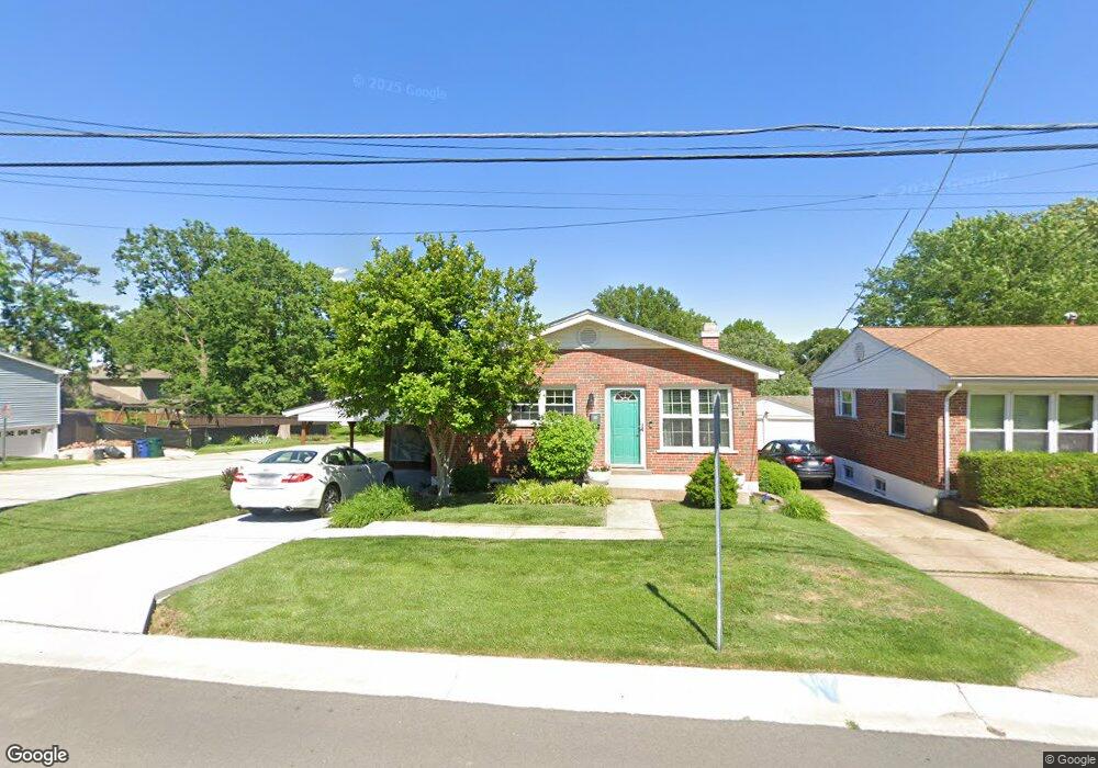
978 Lindemann Rd Saint Louis, MO 63131
Estimated Value: $308,000 - $388,181
2
Beds
3
Baths
936
Sq Ft
$363/Sq Ft
Est. Value
About This Home
This home is located at 978 Lindemann Rd, Saint Louis, MO 63131 and is currently estimated at $339,545, approximately $362 per square foot. 978 Lindemann Rd is a home located in St. Louis County with nearby schools including Westchester Elementary School, North Kirkwood Middle School, and Kirkwood Senior High School.
Ownership History
Date
Name
Owned For
Owner Type
Purchase Details
Closed on
Aug 29, 2003
Sold by
Edwards Walter
Bought by
Schuerman Mary
Current Estimated Value
Home Financials for this Owner
Home Financials are based on the most recent Mortgage that was taken out on this home.
Original Mortgage
$114,300
Outstanding Balance
$52,014
Interest Rate
6.08%
Mortgage Type
Unknown
Estimated Equity
$287,531
Purchase Details
Closed on
Jun 16, 2003
Sold by
Piotrowski Ruthanne and Straight Ruth Ann
Bought by
Edwards Walter
Create a Home Valuation Report for This Property
The Home Valuation Report is an in-depth analysis detailing your home's value as well as a comparison with similar homes in the area
Home Values in the Area
Average Home Value in this Area
Purchase History
| Date | Buyer | Sale Price | Title Company |
|---|---|---|---|
| Schuerman Mary | $142,900 | -- | |
| Edwards Walter | $112,000 | -- |
Source: Public Records
Mortgage History
| Date | Status | Borrower | Loan Amount |
|---|---|---|---|
| Open | Schuerman Mary | $114,300 |
Source: Public Records
Tax History
| Year | Tax Paid | Tax Assessment Tax Assessment Total Assessment is a certain percentage of the fair market value that is determined by local assessors to be the total taxable value of land and additions on the property. | Land | Improvement |
|---|---|---|---|---|
| 2025 | $3,156 | $64,540 | $43,340 | $21,200 |
| 2024 | $3,156 | $54,320 | $32,510 | $21,810 |
| 2023 | $3,107 | $54,320 | $32,510 | $21,810 |
| 2022 | $2,686 | $43,700 | $32,510 | $11,190 |
| 2021 | $2,657 | $43,700 | $32,510 | $11,190 |
| 2020 | $2,571 | $40,640 | $32,510 | $8,130 |
| 2019 | $2,574 | $40,640 | $32,510 | $8,130 |
| 2018 | $2,483 | $35,160 | $20,240 | $14,920 |
| 2016 | $2,457 | $35,150 | $14,440 | $20,710 |
Source: Public Records
Map
Nearby Homes
- 11909 Lillian Ave
- 1126 Bopp Rd
- 12224 TBB Roger Ln
- 1056 Cedargate Dr
- 1319 Kendon Dr
- 1940 Meadowtree Ln Unit 1
- 1940 Meadowtree Ln Unit 2
- 1312 W Essex Ave
- 2000 Meadowtree Ln Unit 7
- 2005 Woodland Knoll
- 2025 Woodland Knoll
- 927 Lanyard Ln
- 1612 Dougherty Ferry Rd
- 2033 Woodland Knoll
- 452 Iris Ln
- 1534 Woodgate Dr
- 419 Gabriel Dr
- 525 Ballas Park Dr
- 966 N Geyer Rd
- 513 Scottsdale Rd
- 976 Lindemann Rd
- 1000 Lindemann Rd
- 974 Lindemann Rd
- 975 Windemere Ave
- 1004 Lindemann Rd
- 1025 Windemere Ave
- 1003 Lindemann Rd
- 11949 Grant Place
- 1005 Lindemann Rd
- 1024 Lindemann Rd
- 1007 Lindemann Rd
- 855 Windemere Ave
- 1009 Lindemann Rd
- 1031 Windemere Ave
- 1021 Lindemann Rd
- 973 Lindemann Rd
- 1026 Lindemann Rd
- 11948 Amherst Dr
- 1035 Windemere Ave
- 1023 Lindemann Rd
Your Personal Tour Guide
Ask me questions while you tour the home.