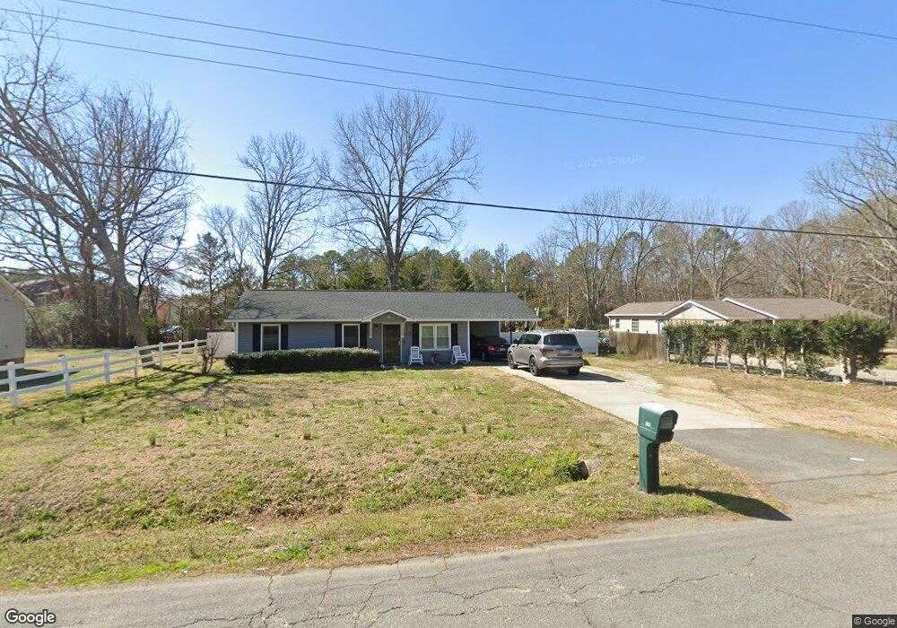
978 Pearson Dr Rock Hill, SC 29730
Estimated Value: $180,000 - $277,000
3
Beds
2
Baths
1,259
Sq Ft
$179/Sq Ft
Est. Value
About This Home
This home is located at 978 Pearson Dr, Rock Hill, SC 29730 and is currently estimated at $224,837, approximately $178 per square foot. 978 Pearson Dr is a home located in York County with nearby schools including Mount Holly Elementary School, Saluda Trail Middle School, and Rock Hill High School.
Ownership History
Date
Name
Owned For
Owner Type
Purchase Details
Closed on
Nov 15, 2016
Sold by
Jackson Everette T
Bought by
Smith Dale D
Current Estimated Value
Home Financials for this Owner
Home Financials are based on the most recent Mortgage that was taken out on this home.
Original Mortgage
$118,243
Outstanding Balance
$94,418
Interest Rate
3.42%
Mortgage Type
New Conventional
Estimated Equity
$130,419
Purchase Details
Closed on
Sep 10, 2015
Sold by
Mitchener Joseph P
Bought by
Jackson Everette Tyrone
Purchase Details
Closed on
Apr 6, 2004
Sold by
The Bank Of New York
Bought by
Jackson Everette T
Purchase Details
Closed on
Dec 1, 2003
Sold by
Mcgriff Charles A and Mcgriff Sandra J
Bought by
The Bank Of New York and Eqcc Trust 2001-1F
Create a Home Valuation Report for This Property
The Home Valuation Report is an in-depth analysis detailing your home's value as well as a comparison with similar homes in the area
Home Values in the Area
Average Home Value in this Area
Purchase History
| Date | Buyer | Sale Price | Title Company |
|---|---|---|---|
| Smith Dale D | $121,900 | Blackhawk Title Llc | |
| Jackson Everette Tyrone | $35,000 | -- | |
| Jackson Everette T | $70,000 | -- | |
| The Bank Of New York | $60,000 | -- |
Source: Public Records
Mortgage History
| Date | Status | Borrower | Loan Amount |
|---|---|---|---|
| Open | Smith Dale D | $118,243 |
Source: Public Records
Tax History
| Year | Tax Paid | Tax Assessment Tax Assessment Total Assessment is a certain percentage of the fair market value that is determined by local assessors to be the total taxable value of land and additions on the property. | Land | Improvement |
|---|---|---|---|---|
| 2025 | $1,029 | $4,787 | $1,189 | $3,598 |
| 2024 | $913 | $4,163 | $1,400 | $2,763 |
| 2023 | $916 | $4,163 | $1,400 | $2,763 |
| 2022 | $922 | $4,163 | $1,400 | $2,763 |
| 2021 | -- | $4,163 | $1,400 | $2,763 |
| 2020 | $924 | $4,163 | $0 | $0 |
| 2019 | $1,026 | $4,480 | $0 | $0 |
| 2018 | $1,025 | $4,480 | $0 | $0 |
| 2017 | $987 | $4,480 | $0 | $0 |
| 2016 | $655 | $3,000 | $0 | $0 |
| 2014 | $678 | $3,000 | $800 | $2,200 |
| 2013 | $678 | $3,260 | $800 | $2,460 |
Source: Public Records
Map
Nearby Homes
- 1104 Parkmont Ln
- 1152 Mt Holly Rd
- 831 Yale St Unit 30
- 330 Pinewood Ln
- 805 Brunswick Dr
- 1280 Shenandoah Cir
- 753 Schuyler Dr
- 1361 Mount Holly Rd
- 536 Braintree Terrace
- 835 Rockdale St
- 830 von Buren Blvd
- 834 von Buren Blvd
- 1514 Van Ness Rd
- 1438 America St
- 775 Mallory Dr
- 975 Bunker Trace
- 1035 S Stone Ave
- 1035 Stonewall Ave S
- 1054 S Jones Avenue Extension
- 879 von Buren Blvd
- 970 Pearson Dr
- 1012 Pearson Dr
- 1020 Pearson Dr
- 964 Pearson Dr
- 969 Pearson Dr
- 1009 Pearson Dr
- 1028 Pearson Dr
- 958 Pearson Dr
- 957 Pearson Dr
- 949 Pearson Dr
- 1036 Pearson Dr
- 942 Pearson Dr
- 941 Pearson Dr
- 1073 Pearson Dr
- 1054 Robbie Ln
- 936 Pearson Dr
- 1062 Robbie Ln
- 935 Pearson Dr
- 934 Pearson Dr
- 905 Southland Dr
Your Personal Tour Guide
Ask me questions while you tour the home.