Estimated Value: $140,000 - $188,000
3
Beds
2
Baths
888
Sq Ft
$194/Sq Ft
Est. Value
About This Home
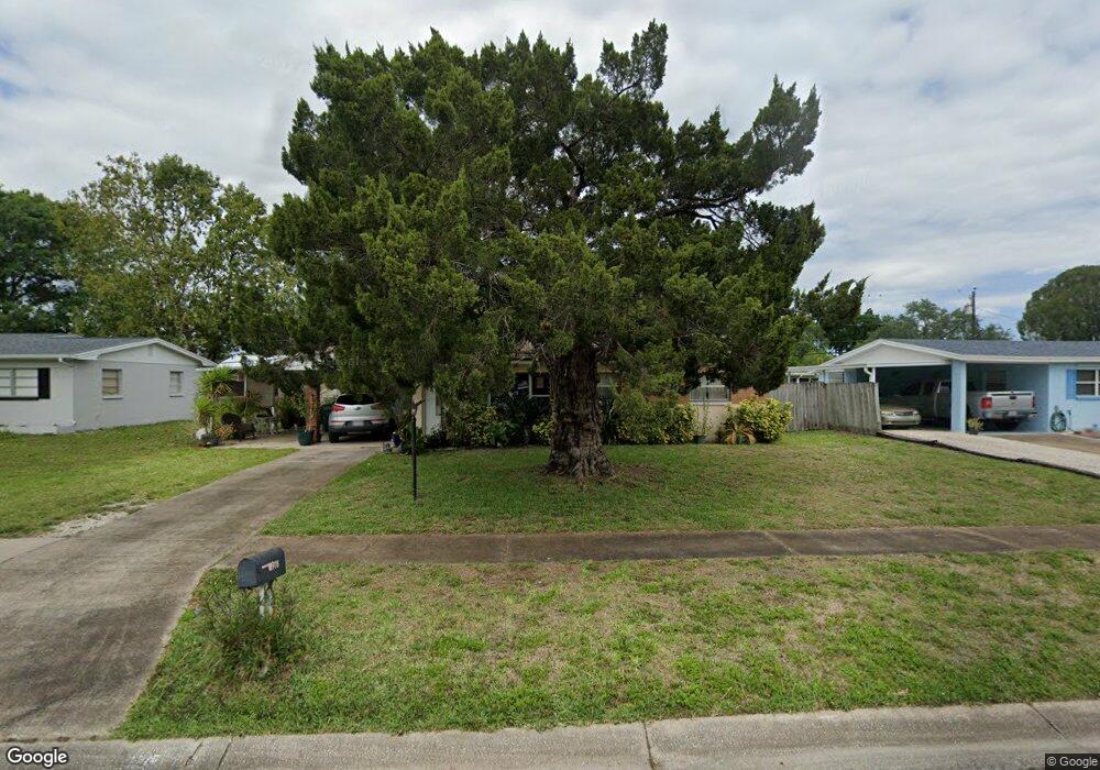
This home is located at 978 Poinsetta St, Cocoa, FL 32927 and is currently estimated at $172,320, approximately $194 per square foot. 978 Poinsetta St is a home located in Brevard County with nearby schools including Atlantis Elementary School, Space Coast Junior/Senior High School, and East Atlantic Prep of Brevard County.
Ownership History
Date
Name
Owned For
Owner Type
Purchase Details
Closed on
Nov 30, 2016
Sold by
Merola Robert W and Merola Catherine A
Bought by
978 Poinsetta Dr Land Trust
Current Estimated Value
Purchase Details
Closed on
Aug 9, 2016
Sold by
Stewart Patricia A
Bought by
Merola Robert W and Merola Catherine A
Purchase Details
Closed on
Jun 13, 2002
Sold by
Trosset George H and Trosset Nihla
Bought by
Stewart Robert E and Stewart Patricia A
Home Financials for this Owner
Home Financials are based on the most recent Mortgage that was taken out on this home.
Original Mortgage
$56,050
Interest Rate
6.77%
Create a Home Valuation Report for This Property
The Home Valuation Report is an in-depth analysis detailing your home's value as well as a comparison with similar homes in the area
Home Values in the Area
Average Home Value in this Area
Purchase History
| Date | Buyer | Sale Price | Title Company |
|---|---|---|---|
| 978 Poinsetta Dr Land Trust | $65,500 | First International Title In | |
| Merola Robert W | $45,000 | None Available | |
| Stewart Robert E | $59,000 | -- |
Source: Public Records
Mortgage History
| Date | Status | Borrower | Loan Amount |
|---|---|---|---|
| Previous Owner | Stewart Robert E | $56,050 |
Source: Public Records
Tax History
| Year | Tax Paid | Tax Assessment Tax Assessment Total Assessment is a certain percentage of the fair market value that is determined by local assessors to be the total taxable value of land and additions on the property. | Land | Improvement |
|---|---|---|---|---|
| 2025 | $2,115 | $129,370 | -- | -- |
| 2024 | $2,150 | $131,960 | -- | -- |
| 2023 | $2,150 | $144,680 | $0 | $0 |
| 2022 | $1,944 | $135,960 | $0 | $0 |
| 2021 | $1,722 | $93,800 | $42,000 | $51,800 |
| 2020 | $1,626 | $87,830 | $40,000 | $47,830 |
| 2019 | $1,527 | $84,730 | $35,000 | $49,730 |
| 2018 | $1,439 | $75,310 | $27,000 | $48,310 |
| 2017 | $1,357 | $65,200 | $24,000 | $41,200 |
| 2016 | $1,115 | $50,940 | $18,000 | $32,940 |
| 2015 | $1,058 | $41,110 | $15,000 | $26,110 |
| 2014 | $975 | $37,380 | $11,000 | $26,380 |
Source: Public Records
Map
Nearby Homes
- 977 Poinsetta St
- 973 Poinsetta St
- 1014 Illinois Rd
- 414 Oakridge Ave
- 1029 Illinois Rd
- 361 Payne Ave
- 000 Arabella Ln
- 961 Kaufman St
- 1040 Jersey St
- 925 MacCo Rd
- 520 Arabella Ln
- 1050 Barclay Dr
- 985 Tope St
- 7060 N Highway 1 Unit AA206
- 7060 N Highway 1 Unit 205
- 7060 N Highway 1 Unit AA102
- 7240 N Highway 1 Unit 106
- 7170 N Highway 1 Unit 103
- 7160 N Highway 1 Unit 204
- 7030 N Highway 1 Unit 101
- 974 Poinsetta St
- 982 Poinsetta St
- 977 MacCo Rd
- 973 MacCo Rd
- 981 MacCo Rd
- 981 N MacCo
- 970 Poinsetta St
- 986 Poinsetta St
- 969 MacCo Rd
- 981 Poinsetta St
- 985 MacCo Rd
- 401 Oakridge Ave
- 966 Poinsetta St
- 985 Poinsetta St
- 413 Oakridge Ave
- 965 MacCo Rd
- 990 Poinsetta St
- 1002 Illinois Rd
- 978 MacCo Rd
- 989 MacCo Rd Unit 2
Your Personal Tour Guide
Ask me questions while you tour the home.