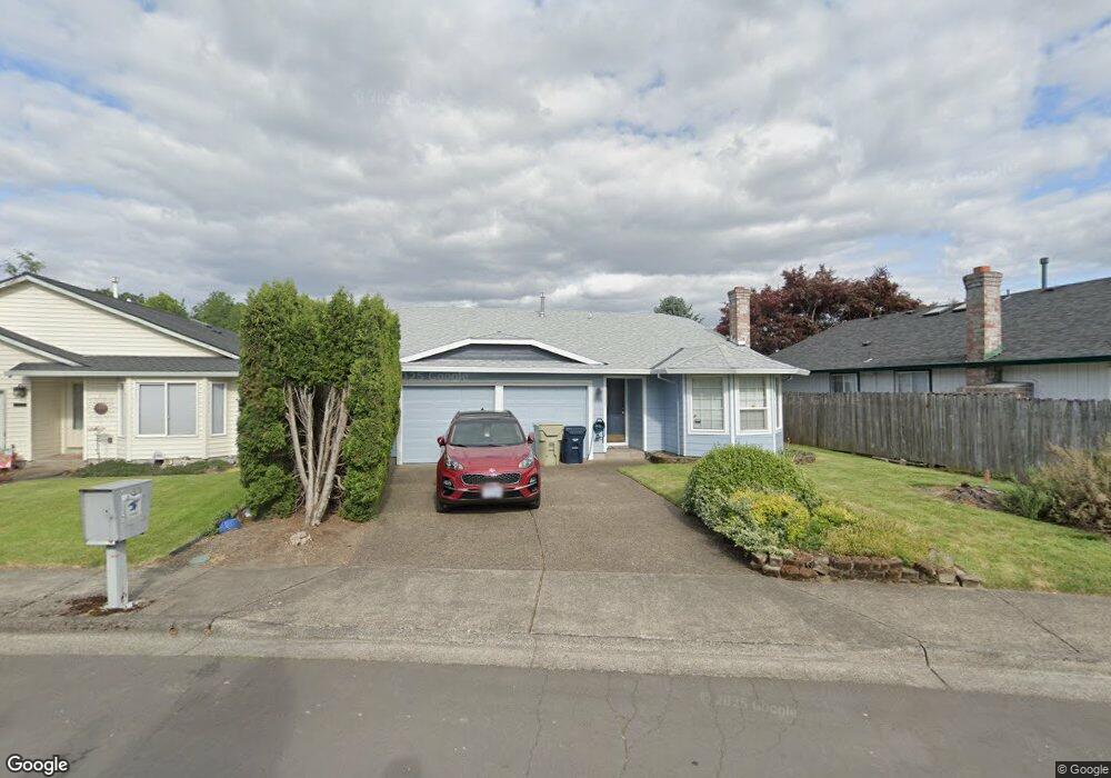
978 SW 217th Ave Beaverton, OR 97006
Estimated Value: $483,093 - $486,000
3
Beds
2
Baths
1,376
Sq Ft
$352/Sq Ft
Est. Value
About This Home
This home is located at 978 SW 217th Ave, Beaverton, OR 97006 and is currently estimated at $484,523, approximately $352 per square foot. 978 SW 217th Ave is a home located in Washington County with nearby schools including Indian Hills Elementary School, R.A. Brown Middle School, and Century High School.
Ownership History
Date
Name
Owned For
Owner Type
Purchase Details
Closed on
Aug 10, 2016
Sold by
Patrick Jack D and Patrick Cynthia M
Bought by
Patrick Jack D and Patrick Cynthia M
Current Estimated Value
Purchase Details
Closed on
Apr 4, 1997
Sold by
Brunswick Debra K Hart and Hart Debra K
Bought by
Patrick Jack D and Patrick Cynthia M
Home Financials for this Owner
Home Financials are based on the most recent Mortgage that was taken out on this home.
Original Mortgage
$94,000
Outstanding Balance
$11,909
Interest Rate
7.66%
Estimated Equity
$472,614
Create a Home Valuation Report for This Property
The Home Valuation Report is an in-depth analysis detailing your home's value as well as a comparison with similar homes in the area
Home Values in the Area
Average Home Value in this Area
Purchase History
| Date | Buyer | Sale Price | Title Company |
|---|---|---|---|
| Patrick Jack D | -- | None Available | |
| Patrick Jack D | $137,500 | Stewart Title Company |
Source: Public Records
Mortgage History
| Date | Status | Borrower | Loan Amount |
|---|---|---|---|
| Open | Patrick Jack D | $94,000 |
Source: Public Records
Tax History Compared to Growth
Tax History
| Year | Tax Paid | Tax Assessment Tax Assessment Total Assessment is a certain percentage of the fair market value that is determined by local assessors to be the total taxable value of land and additions on the property. | Land | Improvement |
|---|---|---|---|---|
| 2025 | $3,624 | $240,850 | -- | -- |
| 2024 | $3,517 | $233,840 | -- | -- |
| 2023 | $3,517 | $227,030 | $0 | $0 |
| 2022 | $3,388 | $227,030 | $0 | $0 |
| 2021 | $3,326 | $214,000 | $0 | $0 |
| 2020 | $3,255 | $207,770 | $0 | $0 |
| 2019 | $3,156 | $201,720 | $0 | $0 |
| 2018 | $3,019 | $195,850 | $0 | $0 |
| 2017 | $2,906 | $190,150 | $0 | $0 |
| 2016 | $2,831 | $184,620 | $0 | $0 |
| 2015 | $2,732 | $179,250 | $0 | $0 |
| 2014 | $2,681 | $174,030 | $0 | $0 |
Source: Public Records
Map
Nearby Homes
- 21612 SW Kristin Ct
- 21525 SW Frammy Way
- 1200 SW 215th Ave
- 1372 SW 217th Ave
- 21238 SW Dana Ct
- 7259 SE Harnish St
- 569 NE Natalie St
- 7996 NE Heiser St
- 7397 SE Langwood St
- 7967 NE Heiser St
- 7200 SE Harnish St
- 21524 SW Parkin Ln
- 279 NE Natalie St
- 172 NE 79th Ave
- 183 NE 80th Ave
- 188 NE 79th Ave
- 20937 SW Edgemont St
- 7355 SE Frances St
- 7983 NE Caitlin St
- 7082 SE Lois St
- 1010 SW 217th Ave
- 21685 SW Lois St
- 21645 SW Lois St
- 21605 SW Lois St
- 21714 SW Hudgik Ct
- 989 SW 217th Ave
- 956 SW 217th Ave
- 1025 SW 217th Ave
- 21570 SW Rankin Ct
- 1055 SW 217th Ave
- 21736 SW Hudgik Ct
- 21585 SW Lois St
- 944 SW 217th Ave
- 21588 SW Rankin Ct
- 21758 SW Hudgik Ct
- 21565 SW Lois St
- 21680 SW Lois St
- 21735 SW Lois St
- 21640 SW Lois St
- 21579 SW Rankin Ct