Estimated Value: $296,997 - $385,000
4
Beds
2
Baths
2,466
Sq Ft
$134/Sq Ft
Est. Value
About This Home
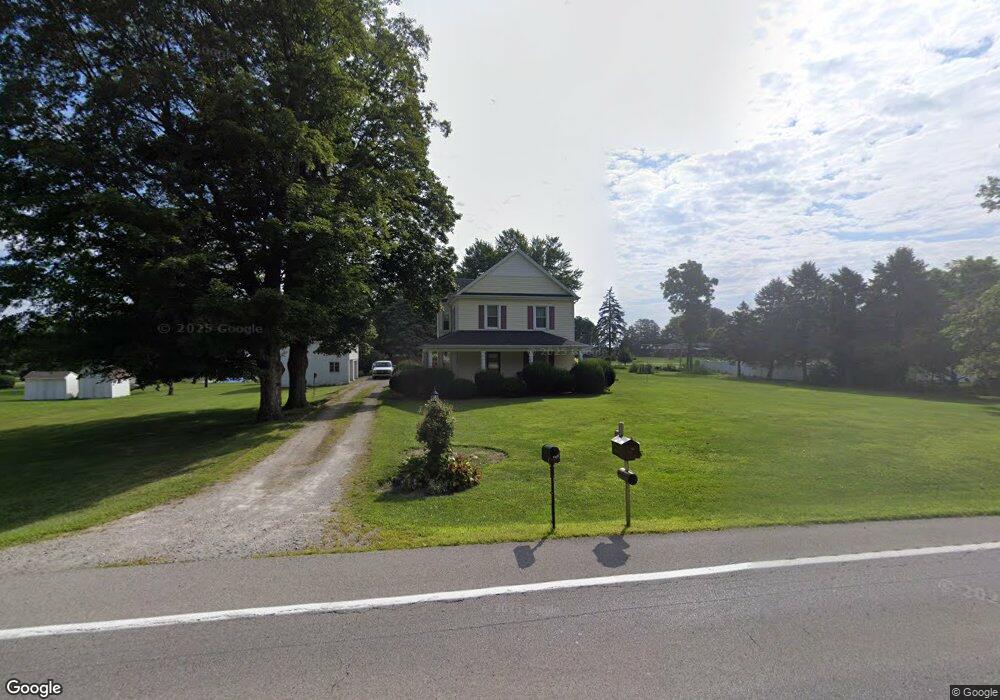
This home is located at 978 Us Route 68 S, Xenia, OH 45385 and is currently estimated at $331,249, approximately $134 per square foot. 978 Us Route 68 S is a home located in Greene County with nearby schools including Xenia High School, Summit Academy Community School for Alternative Learners - Xenia, and Legacy Christian Academy.
Ownership History
Date
Name
Owned For
Owner Type
Purchase Details
Closed on
Oct 31, 2013
Sold by
Brumbaugh Jeffrey S
Bought by
Hawker Douglas M
Current Estimated Value
Purchase Details
Closed on
Mar 25, 2009
Sold by
Hawker Michael E and Hawker Dorothy J
Bought by
Brumbaugh Jeffrey S
Purchase Details
Closed on
Mar 6, 2009
Sold by
Hawker Michael E and Hawker Dorothy J
Bought by
Hawker Michael E and Hawker Dorothy J
Create a Home Valuation Report for This Property
The Home Valuation Report is an in-depth analysis detailing your home's value as well as a comparison with similar homes in the area
Home Values in the Area
Average Home Value in this Area
Purchase History
| Date | Buyer | Sale Price | Title Company |
|---|---|---|---|
| Hawker Douglas M | $15,000 | None Available | |
| Brumbaugh Jeffrey S | -- | Attorney | |
| Hawker Michael E | -- | Attorney |
Source: Public Records
Tax History Compared to Growth
Tax History
| Year | Tax Paid | Tax Assessment Tax Assessment Total Assessment is a certain percentage of the fair market value that is determined by local assessors to be the total taxable value of land and additions on the property. | Land | Improvement |
|---|---|---|---|---|
| 2024 | $3,588 | $85,450 | $16,240 | $69,210 |
| 2023 | $3,588 | $85,450 | $16,240 | $69,210 |
| 2022 | $3,155 | $69,100 | $15,320 | $53,780 |
| 2021 | $3,195 | $69,100 | $15,320 | $53,780 |
| 2020 | $3,067 | $69,100 | $15,320 | $53,780 |
| 2019 | $2,792 | $60,320 | $10,720 | $49,600 |
| 2018 | $2,802 | $60,320 | $10,720 | $49,600 |
| 2017 | $2,725 | $60,320 | $10,720 | $49,600 |
| 2016 | $2,532 | $54,590 | $10,720 | $43,870 |
| 2015 | $2,538 | $54,590 | $10,720 | $43,870 |
| 2014 | $1,218 | $54,590 | $10,720 | $43,870 |
Source: Public Records
Map
Nearby Homes
- 966 Us Route 68 S
- 983 Livingston Dr
- 994 Us Route 68 S
- 808 Robin Rd
- 967 Livingston Dr
- 788 Maple Dr
- 960 Livingston Dr
- 970 Livingston Dr
- 945 Livingston Dr
- 805 Robin Rd
- 980 Livingston Dr
- 940 Us Route 68 S
- 821 Robin Rd
- 946 Livingston Dr
- 935 Livingston Dr
- 1 Robin Rd
- 841 Maple Dr
- 973 Valley Dale Dr
- 1000 Livingston Dr
- 936 Livingston Dr