Estimated Value: $285,079 - $310,000
4
Beds
3
Baths
2,022
Sq Ft
$148/Sq Ft
Est. Value
About This Home
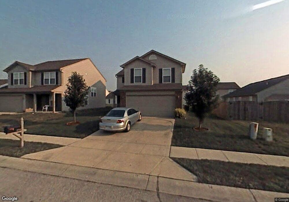
This home is located at 9782 Trail Dr, Avon, IN 46123 and is currently estimated at $299,520, approximately $148 per square foot. 9782 Trail Dr is a home located in Hendricks County with nearby schools including Maple Elementary School, White Oak Elementary School, and Avon Middle School North.
Ownership History
Date
Name
Owned For
Owner Type
Purchase Details
Closed on
Feb 19, 2009
Sold by
Secretary Of Housing & Urban Development
Bought by
Arthur Gregory Rebecca
Current Estimated Value
Home Financials for this Owner
Home Financials are based on the most recent Mortgage that was taken out on this home.
Original Mortgage
$89,947
Outstanding Balance
$55,583
Interest Rate
5.09%
Mortgage Type
FHA
Estimated Equity
$243,937
Purchase Details
Closed on
Sep 29, 2008
Sold by
Colonial National Ortgage Assn
Bought by
Secretary Of Hud
Purchase Details
Closed on
Aug 21, 2008
Sold by
Sims Ron D and Beneficial Indiana Inc
Bought by
Colonial National Mortgage
Create a Home Valuation Report for This Property
The Home Valuation Report is an in-depth analysis detailing your home's value as well as a comparison with similar homes in the area
Home Values in the Area
Average Home Value in this Area
Purchase History
| Date | Buyer | Sale Price | Title Company |
|---|---|---|---|
| Arthur Gregory Rebecca | -- | None Available | |
| Secretary Of Hud | -- | None Available | |
| Colonial National Mortgage | $146,328 | None Available |
Source: Public Records
Mortgage History
| Date | Status | Borrower | Loan Amount |
|---|---|---|---|
| Open | Arthur Gregory Rebecca | $89,947 |
Source: Public Records
Tax History
| Year | Tax Paid | Tax Assessment Tax Assessment Total Assessment is a certain percentage of the fair market value that is determined by local assessors to be the total taxable value of land and additions on the property. | Land | Improvement |
|---|---|---|---|---|
| 2025 | $2,799 | $259,400 | $42,800 | $216,600 |
| 2024 | $2,799 | $251,900 | $42,800 | $209,100 |
| 2023 | $2,532 | $223,700 | $37,200 | $186,500 |
| 2022 | $2,539 | $217,100 | $35,400 | $181,700 |
| 2021 | $2,011 | $170,700 | $33,700 | $137,000 |
| 2020 | $1,799 | $159,800 | $33,700 | $126,100 |
| 2019 | $1,689 | $152,300 | $31,800 | $120,500 |
| 2018 | $1,807 | $147,900 | $31,800 | $116,100 |
| 2017 | $1,415 | $141,500 | $30,300 | $111,200 |
| 2016 | $1,382 | $138,200 | $30,300 | $107,900 |
| 2014 | $1,252 | $125,200 | $27,800 | $97,400 |
Source: Public Records
Map
Nearby Homes
- 9459 Jackson Way
- 9991 Ellsworth Ln
- 781 Hollowood Ln
- 542 Dalton Way
- 9663 Stonewall Ln
- 883 Hollowood Ln
- 10194 Buell Dr
- 9478 Enclave Dr Unit B1 U51
- 571 Corbin Way
- 575 Corbin Way
- 257 Strand Ln Unit C
- 9440 Enclave Dr Unit A
- 10238 Stillwell Dr
- 439 Dylan Dr
- 450 Angelina Way
- 555 Dylan Dr
- 528 Dylan Dr
- 388 Angelina Way
- 446 N County Road 1050 E
- 9847 Kenwood St
Your Personal Tour Guide
Ask me questions while you tour the home.