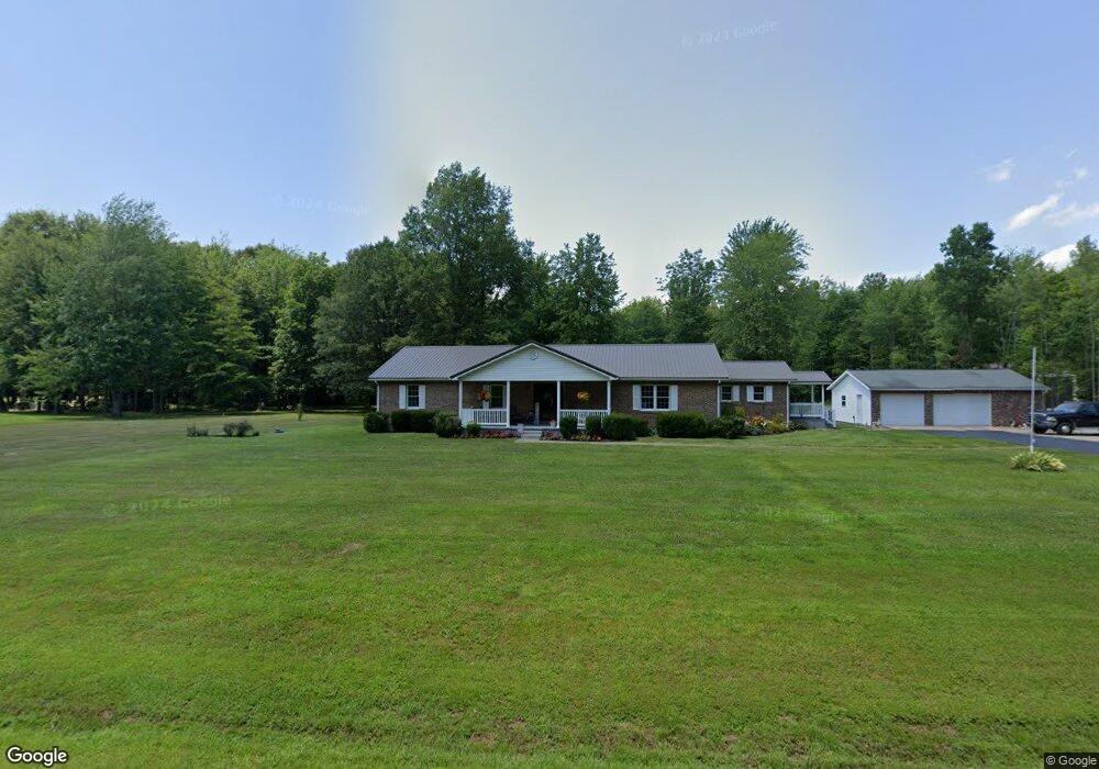
9789 W Fork Rd Georgetown, OH 45121
Estimated Value: $340,000 - $401,000
3
Beds
2
Baths
2,368
Sq Ft
$157/Sq Ft
Est. Value
About This Home
This home is located at 9789 W Fork Rd, Georgetown, OH 45121 and is currently estimated at $370,759, approximately $156 per square foot. 9789 W Fork Rd is a home with nearby schools including Georgetown Elementary School and Georgetown Jr/Sr High School.
Ownership History
Date
Name
Owned For
Owner Type
Purchase Details
Closed on
Aug 3, 2004
Sold by
Roe Tom and Roe Lois
Bought by
Hardyman Lovell D and Hardyman Ramona R
Current Estimated Value
Purchase Details
Closed on
Jan 2, 2002
Sold by
Vest Arville
Bought by
Roe Tom and Roe Lois
Home Financials for this Owner
Home Financials are based on the most recent Mortgage that was taken out on this home.
Original Mortgage
$148,300
Interest Rate
8.5%
Mortgage Type
New Conventional
Purchase Details
Closed on
Jan 14, 1998
Sold by
Shaker Investments
Bought by
Vest Arville and Vest Evelyn
Create a Home Valuation Report for This Property
The Home Valuation Report is an in-depth analysis detailing your home's value as well as a comparison with similar homes in the area
Home Values in the Area
Average Home Value in this Area
Purchase History
| Date | Buyer | Sale Price | Title Company |
|---|---|---|---|
| Hardyman Lovell D | $159,000 | -- | |
| Roe Tom | $148,300 | -- | |
| Vest Arville | $17,900 | -- |
Source: Public Records
Mortgage History
| Date | Status | Borrower | Loan Amount |
|---|---|---|---|
| Previous Owner | Roe Tom | $148,300 |
Source: Public Records
Tax History Compared to Growth
Tax History
| Year | Tax Paid | Tax Assessment Tax Assessment Total Assessment is a certain percentage of the fair market value that is determined by local assessors to be the total taxable value of land and additions on the property. | Land | Improvement |
|---|---|---|---|---|
| 2024 | $2,614 | $77,900 | $14,740 | $63,160 |
| 2023 | $2,614 | $63,850 | $12,110 | $51,740 |
| 2022 | $2,229 | $63,850 | $12,110 | $51,740 |
| 2021 | $1,863 | $63,850 | $12,110 | $51,740 |
| 2020 | $1,638 | $55,520 | $10,530 | $44,990 |
| 2019 | $1,625 | $55,520 | $10,530 | $44,990 |
| 2018 | $1,611 | $55,520 | $10,530 | $44,990 |
| 2017 | $1,535 | $55,200 | $13,900 | $41,300 |
| 2016 | $1,535 | $55,200 | $13,900 | $41,300 |
| 2015 | $1,555 | $55,200 | $13,900 | $41,300 |
| 2014 | $1,339 | $47,170 | $5,870 | $41,300 |
| 2013 | $1,335 | $47,170 | $5,870 | $41,300 |
Source: Public Records
Map
Nearby Homes
- 9705 W Fork Rd
- 5400 Wahlsburg East Rd
- 5781 Camp Run Rd
- 4641 Wahlsburg East Rd
- 143 Hamer Rd
- 10898 Parker Lane Rd
- 6983 Yockey Rd
- 2 N Kenwood Ave
- 1 N Kenwood Ave
- 427 Kenwood Ave
- 874 Mount Orab Pike
- 331 Spring Grove Dr
- 4279 Sunshine Rd
- 60 New St
- 403 Elmwood Ct
- 399 Elmwood Ct
- 401 Elmwood Ct
- 508 Mount Orab Pike
- 406 E North St
- 708 E State St
- 9767 W Fork Rd
- 9803 W Fork Rd
- 9800 W Fork Rd
- 9764 W Fork Rd
- 9750 W Fork Rd
- 9738 W Fork Rd
- 9839 W Fork Rd
- 9842 W Fork Rd
- 9939 W Fork Rd
- 9645 W Fork Rd
- 9936 W Fork Rd
- 9659 W Fork Rd
- 9627 W Fork Rd
- 9974 W Fork Rd
- 9619 W Fork Rd
- 9607 W Fork Rd
- 5610 Wahlsburg East Rd
- 5582 Wahlsburg East Rd
- 5612 Wahlsburg East Rd
- 9818 Baker Hanselman Rd