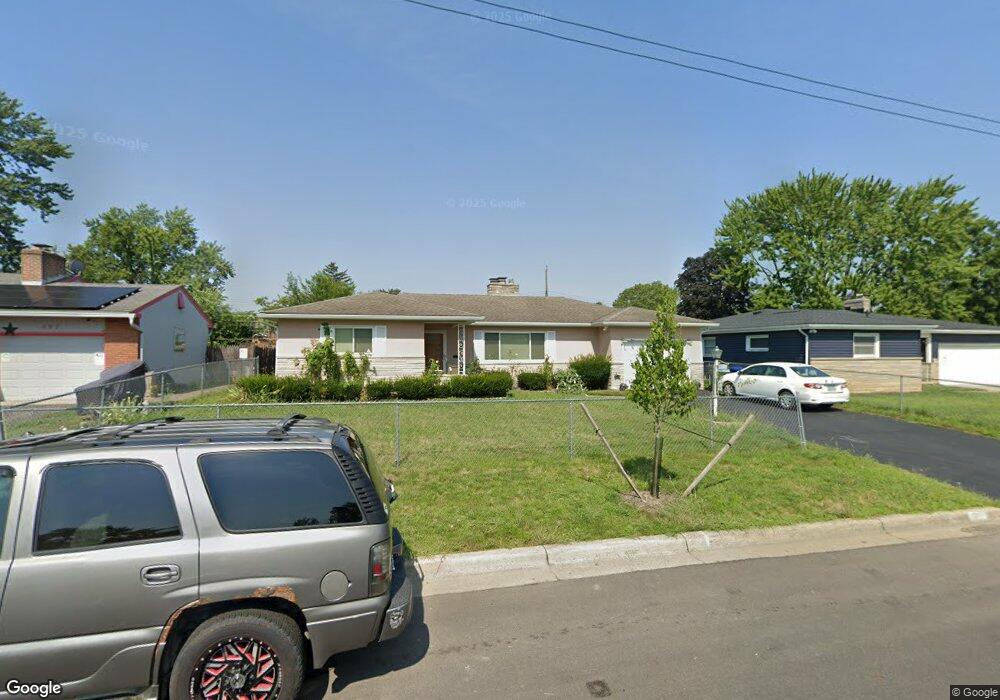
979 Anthony Dr Columbus, OH 43204
Southwest Hilltop NeighborhoodEstimated Value: $218,000 - $234,000
3
Beds
1
Bath
1,370
Sq Ft
$165/Sq Ft
Est. Value
About This Home
This home is located at 979 Anthony Dr, Columbus, OH 43204 and is currently estimated at $226,494, approximately $165 per square foot. 979 Anthony Dr is a home located in Franklin County with nearby schools including Binns Elementary School, Wedgewood Middle School, and Briggs High School.
Ownership History
Date
Name
Owned For
Owner Type
Purchase Details
Closed on
May 30, 2014
Sold by
Moore Tennessee
Bought by
Moore Tennessee and Gubbins Donna S
Current Estimated Value
Purchase Details
Closed on
Nov 18, 2002
Sold by
Moore Tennessee
Bought by
Moore Tennessee
Purchase Details
Closed on
Aug 9, 1989
Bought by
Moore Tennessee
Purchase Details
Closed on
May 1, 1985
Purchase Details
Closed on
Dec 1, 1983
Create a Home Valuation Report for This Property
The Home Valuation Report is an in-depth analysis detailing your home's value as well as a comparison with similar homes in the area
Home Values in the Area
Average Home Value in this Area
Purchase History
| Date | Buyer | Sale Price | Title Company |
|---|---|---|---|
| Moore Tennessee | -- | None Available | |
| Moore Tennessee | -- | -- | |
| Moore Tennessee | -- | -- | |
| -- | $55,500 | -- | |
| -- | -- | -- |
Source: Public Records
Tax History
| Year | Tax Paid | Tax Assessment Tax Assessment Total Assessment is a certain percentage of the fair market value that is determined by local assessors to be the total taxable value of land and additions on the property. | Land | Improvement |
|---|---|---|---|---|
| 2025 | $2,527 | $67,520 | $14,770 | $52,750 |
| 2024 | $2,527 | $67,520 | $14,770 | $52,750 |
| 2023 | $2,489 | $67,515 | $14,770 | $52,745 |
| 2022 | $1,721 | $42,880 | $7,980 | $34,900 |
| 2021 | $1,725 | $42,880 | $7,980 | $34,900 |
| 2020 | $1,728 | $42,880 | $7,980 | $34,900 |
| 2019 | $1,622 | $35,490 | $6,650 | $28,840 |
| 2018 | $809 | $35,490 | $6,650 | $28,840 |
| 2017 | $1,621 | $35,490 | $6,650 | $28,840 |
| 2016 | $1,345 | $29,060 | $5,570 | $23,490 |
| 2015 | $611 | $29,060 | $5,570 | $23,490 |
| 2014 | $1,224 | $29,060 | $5,570 | $23,490 |
| 2013 | $756 | $34,160 | $6,545 | $27,615 |
Source: Public Records
Map
Nearby Homes
- 3318 Miriam Dr S
- 3340 Miriam Dr S
- 988 S Roys Ave
- 894 Binns Blvd
- 3029 Rosedale Ave
- 840 Mark Place
- 814 Miriam Dr W
- 793 Binns Blvd
- 811 Chestershire Rd
- 814 Chestershire Rd
- 884 S Hague Ave
- 903 S Harris Ave
- 2856 Vanderberg Ave Unit 858
- 3551 Glorious Rd
- 1309 Treehaven Ln
- 695 Demorest Rd
- 620 Salisbury Rd
- 570 S Westgate Ave
- 1147 Parma Ave
- 733 S Hague Ave
- 987 Anthony Dr
- 969 Anthony Dr
- 970 Miriam Dr E
- 995 Anthony Dr
- 959 Anthony Dr
- 962 Miriam Dr E
- 982 Anthony Dr
- 992 Anthony Dr
- 952 Miriam Dr E
- 972 Anthony Dr
- 1005 Anthony Dr
- 986 Miriam Dr E
- 951 Anthony Dr
- 1000 Anthony Dr
- 964 Anthony Dr
- 944 Miriam Dr E
- 1015 Anthony Dr
- 1010 Anthony Dr
- 954 Anthony Dr
- 943 Anthony Dr
Your Personal Tour Guide
Ask me questions while you tour the home.