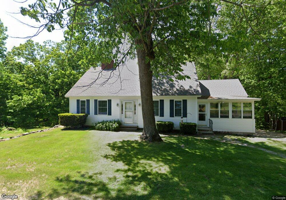
979 River Rd Livermore, ME 04253
Estimated Value: $265,372 - $358,000
Studio
--
Bath
1,040
Sq Ft
$291/Sq Ft
Est. Value
About This Home
This home is located at 979 River Rd, Livermore, ME 04253 and is currently estimated at $302,843, approximately $291 per square foot. 979 River Rd is a home with nearby schools including Spruce Mountain Primary School, Spruce Mountain Middle School, and Spruce Mountain High School.
Ownership History
Date
Name
Owned For
Owner Type
Purchase Details
Closed on
Dec 23, 2005
Sold by
Phaneuf Ft
Bought by
Phaneuf Dana C
Current Estimated Value
Home Financials for this Owner
Home Financials are based on the most recent Mortgage that was taken out on this home.
Original Mortgage
$86,000
Interest Rate
6.36%
Mortgage Type
Purchase Money Mortgage
Create a Home Valuation Report for This Property
The Home Valuation Report is an in-depth analysis detailing your home's value as well as a comparison with similar homes in the area
Home Values in the Area
Average Home Value in this Area
Purchase History
| Date | Buyer | Sale Price | Title Company |
|---|---|---|---|
| Phaneuf Dana C | -- | -- |
Source: Public Records
Mortgage History
| Date | Status | Borrower | Loan Amount |
|---|---|---|---|
| Closed | Phaneuf Dana C | $86,000 |
Source: Public Records
Tax History
| Year | Tax Paid | Tax Assessment Tax Assessment Total Assessment is a certain percentage of the fair market value that is determined by local assessors to be the total taxable value of land and additions on the property. | Land | Improvement |
|---|---|---|---|---|
| 2025 | $3,139 | $166,107 | $35,000 | $131,107 |
| 2024 | $2,840 | $166,107 | $35,000 | $131,107 |
| 2023 | $2,699 | $166,107 | $35,000 | $131,107 |
| 2022 | $2,658 | $166,107 | $35,000 | $131,107 |
| 2021 | $2,658 | $166,107 | $35,000 | $131,107 |
| 2020 | $2,533 | $166,107 | $35,000 | $131,107 |
| 2019 | $2,328 | $143,281 | $31,000 | $112,281 |
| 2018 | $2,292 | $143,281 | $31,000 | $112,281 |
| 2017 | $2,350 | $143,281 | $31,000 | $112,281 |
| 2016 | $2,292 | $143,281 | $31,000 | $112,281 |
| 2015 | $2,292 | $143,281 | $31,000 | $112,281 |
| 2014 | $2,035 | $143,281 | $31,000 | $112,281 |
Source: Public Records
Map
Nearby Homes
- 881 River Rd
- 735 River Rd
- 5 Corbyn Way
- 21 Stonewall Dr
- Lot 0 Strickland Ferry Rd
- 309 Strickland Ferry Rd
- 1081 Federal Rd
- 132 Hunton Loop
- 62 Norton Rd
- 614 Federal Rd
- 506 Park St
- 21 Hathaway Hill Rd
- 232 Campground Rd
- 146 Karn Rd
- 171 Park St
- 1671 Federal Rd
- 49 Pomeroy Hill Rd
- 40 Deer Run
- 11 Oak St
- 1785 Federal Rd
Your Personal Tour Guide
Ask me questions while you tour the home.