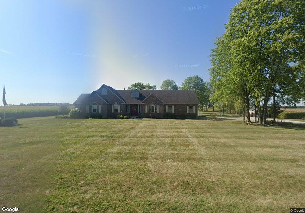
9791 Smoky Row Rd Greens Fork, IN 47345
Estimated Value: $359,937 - $500,000
3
Beds
3
Baths
2,740
Sq Ft
$154/Sq Ft
Est. Value
About This Home
This home is located at 9791 Smoky Row Rd, Greens Fork, IN 47345 and is currently estimated at $420,734, approximately $153 per square foot. 9791 Smoky Row Rd is a home located in Wayne County with nearby schools including Hagerstown Elementary School, Hagerstown Junior/Senior High School, and Sugar Grove School.
Ownership History
Date
Name
Owned For
Owner Type
Purchase Details
Closed on
Jun 24, 2013
Sold by
Doerstler Mark A and Doerstler Madelle Dreu
Bought by
Doerstler Michael J and Doerstler Nancy K
Current Estimated Value
Home Financials for this Owner
Home Financials are based on the most recent Mortgage that was taken out on this home.
Original Mortgage
$187,200
Interest Rate
3.83%
Mortgage Type
New Conventional
Create a Home Valuation Report for This Property
The Home Valuation Report is an in-depth analysis detailing your home's value as well as a comparison with similar homes in the area
Home Values in the Area
Average Home Value in this Area
Purchase History
| Date | Buyer | Sale Price | Title Company |
|---|---|---|---|
| Doerstler Michael J | -- | None Available |
Source: Public Records
Mortgage History
| Date | Status | Borrower | Loan Amount |
|---|---|---|---|
| Closed | Doerstler Michael J | $187,200 |
Source: Public Records
Tax History Compared to Growth
Tax History
| Year | Tax Paid | Tax Assessment Tax Assessment Total Assessment is a certain percentage of the fair market value that is determined by local assessors to be the total taxable value of land and additions on the property. | Land | Improvement |
|---|---|---|---|---|
| 2024 | $2,730 | $271,400 | $17,600 | $253,800 |
| 2023 | $2,571 | $251,400 | $16,100 | $235,300 |
| 2022 | $2,627 | $256,900 | $16,100 | $240,800 |
| 2021 | $2,463 | $239,700 | $16,100 | $223,600 |
| 2020 | $2,379 | $233,300 | $15,900 | $217,400 |
| 2019 | $2,374 | $233,100 | $15,900 | $217,200 |
| 2018 | $2,389 | $234,700 | $15,900 | $218,800 |
| 2017 | $2,387 | $234,900 | $15,900 | $219,000 |
| 2016 | $2,300 | $228,600 | $15,400 | $213,200 |
| 2014 | $2,007 | $211,600 | $15,400 | $196,200 |
| 2013 | $2,007 | $204,800 | $15,400 | $189,400 |
Source: Public Records
Map
Nearby Homes
- 314 S Main St
- 6855 N Centerville Rd
- 8292 Main St
- 0 Walnut St
- 274 4th St
- 5159 State Road 38
- 425 N Elm St
- 200 N Elm St
- 8171 George Early Rd
- 50 Grandview Ct
- 475 N Washington St
- 7310 Lacy Rd
- 129 W South Market St
- 6357 Dalton Rd
- 6049 U S 35
- 207 College Corner Rd
- 9683 U S 40
- 0 Ellen Ct
- Lot 29 Ellen Ct
- LOT 25 Ellen Ct
- 9600 Smoky Row Rd
- 10001 Smoky Row Rd
- 0 Smokey Row Unit 10013327
- 0 Smokey Row Unit 10013451
- 0 Smokey Row Unit 10018459
- 10090 Smoky Row Rd
- 9450 Smoky Row Rd
- 10114 Smoky Row Rd
- 5737 Dingle Rd
- 10274 Smoky Row Rd
- 5783 Sugar Grove Rd
- 9539 Smoky Row Rd
- 9539 Smoky Row Rd
- 5539 Sugar Grove Rd
- 9219 Smoky Row Rd
- 5869 Dingle Rd
- 5969 Sugar Grove Rd
- 9784 Fox Rd
- 5730 Sugar Grove Rd
- 5626 Sugar Grove Rd