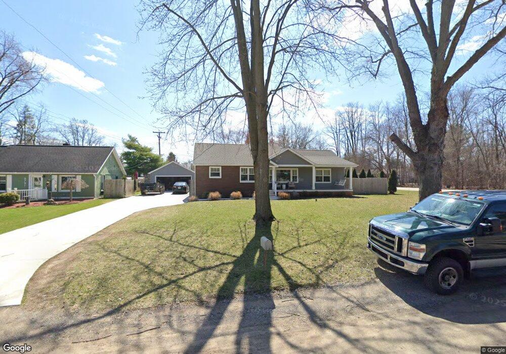
9795 Silverside Unit Bldg-Unit South Lyon, MI 48178
Estimated Value: $387,000 - $584,000
4
Beds
2
Baths
1,513
Sq Ft
$300/Sq Ft
Est. Value
About This Home
This home is located at 9795 Silverside Unit Bldg-Unit, South Lyon, MI 48178 and is currently estimated at $453,616, approximately $299 per square foot. 9795 Silverside Unit Bldg-Unit is a home located in Livingston County with nearby schools including William A. Brummer Elementary School, Centennial Middle School, and South Lyon High School.
Ownership History
Date
Name
Owned For
Owner Type
Purchase Details
Closed on
Jul 16, 2021
Sold by
Canner Richard W
Bought by
Santoro Mielentz Michael and Pisano Adrianna
Current Estimated Value
Purchase Details
Closed on
Apr 18, 2018
Sold by
Moe Jo Llc
Bought by
Canner Richard W
Purchase Details
Closed on
Jun 27, 2017
Sold by
Bank Of America
Bought by
Moe Jo Llc
Home Financials for this Owner
Home Financials are based on the most recent Mortgage that was taken out on this home.
Interest Rate
3.9%
Create a Home Valuation Report for This Property
The Home Valuation Report is an in-depth analysis detailing your home's value as well as a comparison with similar homes in the area
Home Values in the Area
Average Home Value in this Area
Purchase History
| Date | Buyer | Sale Price | Title Company |
|---|---|---|---|
| Santoro Mielentz Michael | $365,000 | None Available | |
| Canner Richard W | $280,000 | -- | |
| Moe Jo Llc | -- | -- |
Source: Public Records
Mortgage History
| Date | Status | Borrower | Loan Amount |
|---|---|---|---|
| Previous Owner | Moe Jo Llc | -- |
Source: Public Records
Tax History Compared to Growth
Tax History
| Year | Tax Paid | Tax Assessment Tax Assessment Total Assessment is a certain percentage of the fair market value that is determined by local assessors to be the total taxable value of land and additions on the property. | Land | Improvement |
|---|---|---|---|---|
| 2025 | $5,313 | $183,500 | $0 | $0 |
| 2024 | $3,579 | $174,600 | $0 | $0 |
| 2023 | $3,414 | $162,000 | $0 | $0 |
| 2022 | $3,832 | $128,300 | $0 | $0 |
| 2021 | $3,832 | $140,100 | $0 | $0 |
| 2020 | $3,832 | $143,700 | $0 | $0 |
| 2019 | $3,869 | $128,300 | $0 | $0 |
| 2018 | $3,664 | $120,300 | $0 | $0 |
| 2017 | $4,531 | $110,600 | $0 | $0 |
| 2016 | $2,917 | $108,800 | $0 | $0 |
| 2014 | $2,692 | $93,300 | $0 | $0 |
| 2012 | $2,692 | $85,100 | $0 | $0 |
Source: Public Records
Map
Nearby Homes
- 11390 Ridge Rd
- 11035 Silver View Ct
- 11047 Silver View Ct
- 11055 Silver View Ct
- 9044 Kemper Dr
- 0 Hillview Dr Unit 25052269
- 11108 Silver Lake Rd
- 9736 Cross Creek Dr
- 9112 Roger Scott Trail
- 10993 Stoney Point Dr
- 0000 Stoney Point Unit 5
- 10537 Oak Forest Dr
- 10512 Oak Forest Dr
- 11904 Moose Ridge Dr
- 10468 Oak Shore Dr
- 10536 Oak Shore Dr
- 10456 Oak Shore Dr
- 10611 Lighthouse Point
- 11755 Shenandoah Dr Unit 159-4
- 10817 Cliffview Dr
- 9795 Silverside
- 9791 Silverside
- 11017 Tillson Dr
- 9800 Marshall Rd
- 9777 Silverside
- 9786 Silverside
- 11025 Tillson Dr
- 9794 Silverside
- 0 Marshall Unit 213032809
- 0 Marshall Unit R213032676
- 9834 Marshall Rd
- 9780 Silverside
- 11033 Tillson Dr
- 9842 Marshall Rd
- 11008 Tillson Dr
- 9757 Silverside
- 9760 Marshall Rd
- 9766 Silverside
- 11041 Tillson Dr
- 11024 Tillson Dr