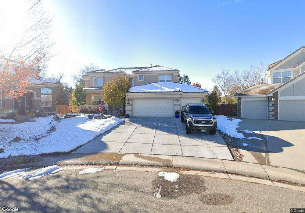
9798 Colinade Dr Lone Tree, CO 80124
Estimated Value: $976,041 - $1,112,000
4
Beds
4
Baths
3,175
Sq Ft
$326/Sq Ft
Est. Value
About This Home
This home is located at 9798 Colinade Dr, Lone Tree, CO 80124 and is currently estimated at $1,033,510, approximately $325 per square foot. 9798 Colinade Dr is a home located in Douglas County with nearby schools including Acres Green Elementary School, Cresthill Middle School, and Highlands Ranch High School.
Ownership History
Date
Name
Owned For
Owner Type
Purchase Details
Closed on
Sep 27, 2000
Sold by
Maurer David E and Maurer Margaret P
Bought by
Brooks Geoffrey A and Brooks Joanie I
Current Estimated Value
Home Financials for this Owner
Home Financials are based on the most recent Mortgage that was taken out on this home.
Original Mortgage
$320,000
Outstanding Balance
$115,281
Interest Rate
7.75%
Estimated Equity
$918,229
Purchase Details
Closed on
Oct 30, 1995
Sold by
The Ryland Group Inc
Bought by
Maurer David E and Maurer Margaret P
Home Financials for this Owner
Home Financials are based on the most recent Mortgage that was taken out on this home.
Original Mortgage
$275,500
Interest Rate
7.58%
Purchase Details
Closed on
May 19, 1995
Sold by
Ryland Consolidated
Bought by
Ryland Group Inc
Purchase Details
Closed on
Mar 1, 1994
Sold by
Troon Village Ltd
Bought by
Ryland Consolidated
Create a Home Valuation Report for This Property
The Home Valuation Report is an in-depth analysis detailing your home's value as well as a comparison with similar homes in the area
Home Values in the Area
Average Home Value in this Area
Purchase History
| Date | Buyer | Sale Price | Title Company |
|---|---|---|---|
| Brooks Geoffrey A | $404,000 | Land Title | |
| Maurer David E | $306,168 | Land Title | |
| Ryland Group Inc | $114,000 | -- | |
| Ryland Consolidated | $1,750,000 | -- |
Source: Public Records
Mortgage History
| Date | Status | Borrower | Loan Amount |
|---|---|---|---|
| Open | Brooks Geoffrey A | $320,000 | |
| Previous Owner | Maurer David E | $275,500 |
Source: Public Records
Tax History Compared to Growth
Tax History
| Year | Tax Paid | Tax Assessment Tax Assessment Total Assessment is a certain percentage of the fair market value that is determined by local assessors to be the total taxable value of land and additions on the property. | Land | Improvement |
|---|---|---|---|---|
| 2024 | $6,330 | $71,260 | $14,120 | $57,140 |
| 2023 | $6,393 | $71,260 | $14,120 | $57,140 |
| 2022 | $4,623 | $50,840 | $10,220 | $40,620 |
| 2021 | $4,806 | $50,840 | $10,220 | $40,620 |
| 2020 | $4,410 | $47,790 | $9,580 | $38,210 |
| 2019 | $4,424 | $47,790 | $9,580 | $38,210 |
| 2018 | $3,866 | $44,660 | $9,460 | $35,200 |
| 2017 | $3,928 | $44,660 | $9,460 | $35,200 |
| 2016 | $4,162 | $46,370 | $9,690 | $36,680 |
| 2015 | $4,255 | $46,370 | $9,690 | $36,680 |
| 2014 | $4,025 | $41,140 | $9,150 | $31,990 |
Source: Public Records
Map
Nearby Homes
- 9873 Greensview Cir
- 9851 Greensview Cir
- 10884 Lyric St
- 9493 Southern Hills Cir Unit A25
- 9838 Cypress Point Cir
- 10102 Prestwick Trail
- 8176 Lone Oak Ct
- 9308 Miles Dr Unit 5
- 9565 Silent Hills Ln
- 7438 Indian Wells Ln
- 8260 Lodgepole Trail
- 9535 Silent Hills Ln
- 7855 Arundel Ln
- 7469 La Quinta Place
- 9412 La Quinta Way
- 8159 Lodgepole Trail
- 10205 Bluffmont Dr
- 10031 Town Ridge Ln
- 10225 Dunsford Dr
- 10066 Belvedere Cir
- 9788 Colinade Dr
- 9787 Colinade Dr
- 9778 Colinade Dr
- 9777 Colinade Dr
- 8452 Fairview Ct
- 9792 Bay Hill Dr
- 9757 Colinade Dr
- 9735 Bay Hill Way
- 9768 Colinade Dr
- 9801 Firestone Cir
- 8432 Fairview Ct
- 9736 Bay Hill Way
- 9803 Firestone Cir
- 9806 Carmel Ct
- 9808 Carmel Ct
- 9737 Colinade Dr
- 9786 Bay Hill Dr
- 9804 Carmel Ct
- 9805 Firestone Cir
- 9725 Bay Hill Way