Estimated Value: $483,831 - $561,000
2
Beds
2
Baths
959
Sq Ft
$540/Sq Ft
Est. Value
About This Home
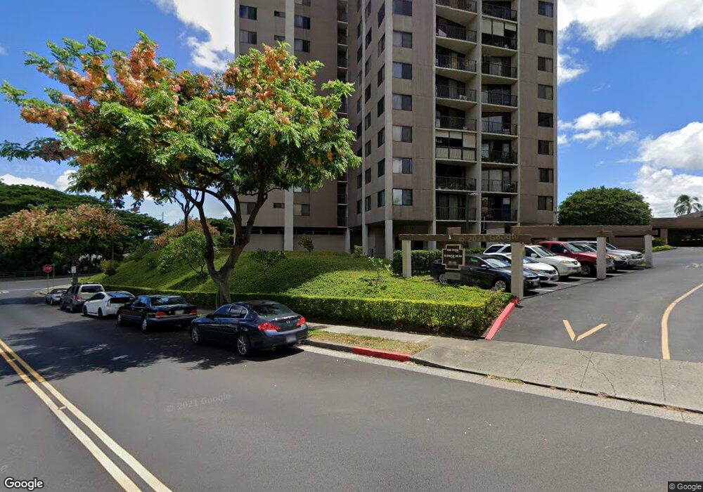
This home is located at 98-501 Koauka Loop Unit A302, Aiea, HI 96701 and is currently estimated at $517,458, approximately $539 per square foot. 98-501 Koauka Loop Unit A302 is a home located in Honolulu County with nearby schools including Alvah A Scott Elementary School, Aiea Intermediate School, and Aiea High School.
Ownership History
Date
Name
Owned For
Owner Type
Purchase Details
Closed on
May 25, 2006
Sold by
Sakai Jay Tetsuo
Bought by
Tasaki Guy Kanetaro and Tasaki Karrie Ann Mei Jun
Current Estimated Value
Home Financials for this Owner
Home Financials are based on the most recent Mortgage that was taken out on this home.
Original Mortgage
$322,050
Outstanding Balance
$187,795
Interest Rate
6.52%
Mortgage Type
Fannie Mae Freddie Mac
Estimated Equity
$329,663
Purchase Details
Closed on
Oct 8, 2003
Sold by
Okinaka Yukie
Bought by
Sakai Jay Tetsuo
Home Financials for this Owner
Home Financials are based on the most recent Mortgage that was taken out on this home.
Original Mortgage
$175,000
Interest Rate
4.37%
Mortgage Type
Unknown
Create a Home Valuation Report for This Property
The Home Valuation Report is an in-depth analysis detailing your home's value as well as a comparison with similar homes in the area
Home Values in the Area
Average Home Value in this Area
Purchase History
| Date | Buyer | Sale Price | Title Company |
|---|---|---|---|
| Tasaki Guy Kanetaro | $339,000 | Fntic | |
| Sakai Jay Tetsuo | $219,000 | -- |
Source: Public Records
Mortgage History
| Date | Status | Borrower | Loan Amount |
|---|---|---|---|
| Open | Tasaki Guy Kanetaro | $322,050 | |
| Previous Owner | Sakai Jay Tetsuo | $175,000 | |
| Closed | Sakai Jay Tetsuo | $21,900 |
Source: Public Records
Tax History Compared to Growth
Tax History
| Year | Tax Paid | Tax Assessment Tax Assessment Total Assessment is a certain percentage of the fair market value that is determined by local assessors to be the total taxable value of land and additions on the property. | Land | Improvement |
|---|---|---|---|---|
| 2025 | $1,316 | $480,700 | $90,200 | $390,500 |
| 2024 | $1,316 | $496,100 | $85,500 | $410,600 |
| 2023 | $1,013 | $489,300 | $85,500 | $403,800 |
| 2022 | $1,201 | $443,000 | $78,400 | $364,600 |
| 2021 | $1,126 | $421,600 | $76,000 | $345,600 |
| 2020 | $1,166 | $433,100 | $76,000 | $357,100 |
| 2019 | $1,229 | $431,000 | $87,600 | $343,400 |
| 2018 | $1,295 | $450,100 | $75,100 | $375,000 |
| 2017 | $1,151 | $408,800 | $61,300 | $347,500 |
| 2016 | $1,140 | $405,600 | $56,300 | $349,300 |
| 2015 | $1,114 | $398,300 | $55,100 | $343,200 |
| 2014 | $813 | $327,400 | $52,600 | $274,800 |
Source: Public Records
Map
Nearby Homes
- 98-501 Koauka Loop Unit A1008
- 98-501 Koauka Loop Unit A603
- 98-351 Koauka Loop Unit C1706
- 98-351 Koauka Loop Unit C1903
- 98-351 Koauka Loop Unit C1506
- 98-487 Koauka Loop Unit B1603
- 98-360 Koauka Loop Unit 243
- 98-360 Koauka Loop Unit 206
- 98-450 Koauka Loop Unit 401
- 98-450 Koauka Loop Unit 312
- 98-450 Koauka Loop Unit 1011
- 98-450 Koauka Loop Unit 1108
- 98-500 Koauka Loop Unit 8N
- 98-500 Koauka Loop Unit 7N
- 98-500 Koauka Loop Unit 6E
- 98-500 Koauka Loop Unit 2H
- 98-500 Koauka Loop Unit 10C
- 98-500 Koauka Loop Unit 17A
- 98-500 Koauka Loop Unit 18A
- 98-500 Koauka Loop Unit 16C
- 98-501 Koauka Loop Unit A1502
- 98-501 Koauka Loop Unit A307
- 98-501 Koauka Loop Unit A306
- 98-501 Koauka Loop Unit A1504
- 98-501 Koauka Loop Unit A1606
- 98-501 Koauka Loop Unit A308
- 98-501 Koauka Loop Unit A606
- 98-501 Koauka Loop Unit A1805
- 98-501 Koauka Loop Unit A405
- 98-501 Koauka Loop Unit A1701
- 98-501 Koauka Loop Unit A903
- 98-501 Koauka Loop Unit A408
- 98-501 Koauka Loop Unit A1306
- 98-501 Koauka Loop Unit A1704
- 98-501 Koauka Loop Unit A1505
- 98-501 Koauka Loop Unit A1707
- 98-501 Koauka Loop Unit A608
- 98-501 Koauka Loop Unit A1405
- 98-501 Koauka Loop Unit A1307
- 98-501 Koauka Loop Unit A1103