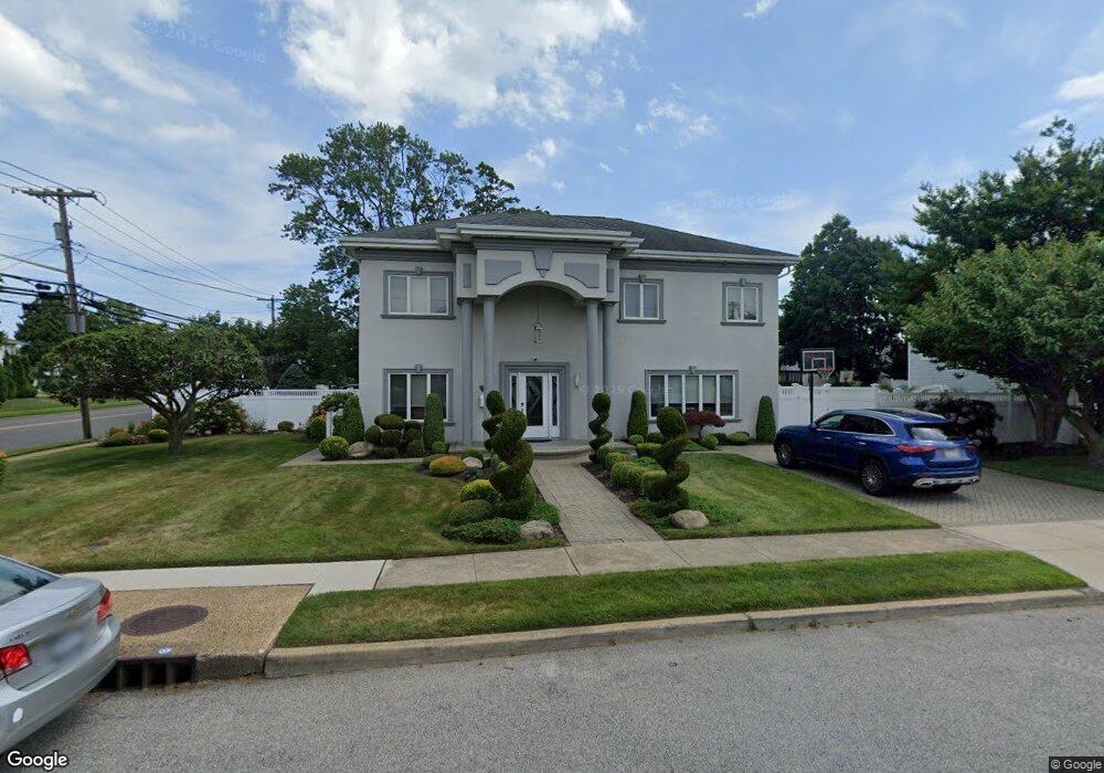
98 Beverly Way Merrick, NY 11566
Estimated Value: $1,218,000 - $1,410,521
4
Beds
4
Baths
3,096
Sq Ft
$425/Sq Ft
Est. Value
About This Home
This home is located at 98 Beverly Way, Merrick, NY 11566 and is currently estimated at $1,314,261, approximately $424 per square foot. 98 Beverly Way is a home located in Nassau County with nearby schools including Merrick Avenue Middle School, John F. Kennedy High School, and St. Elizabeth Ann Seton Regional School.
Ownership History
Date
Name
Owned For
Owner Type
Purchase Details
Closed on
Sep 6, 2018
Sold by
Ostroff Warren
Bought by
Green Brian and Green Gvansta
Current Estimated Value
Home Financials for this Owner
Home Financials are based on the most recent Mortgage that was taken out on this home.
Original Mortgage
$594,000
Outstanding Balance
$512,627
Interest Rate
4.5%
Mortgage Type
New Conventional
Estimated Equity
$801,634
Purchase Details
Closed on
Nov 10, 2014
Sold by
Sullivan Rita
Bought by
Ostroff Warren
Purchase Details
Closed on
May 17, 2006
Sold by
Sullivan James
Create a Home Valuation Report for This Property
The Home Valuation Report is an in-depth analysis detailing your home's value as well as a comparison with similar homes in the area
Home Values in the Area
Average Home Value in this Area
Purchase History
| Date | Buyer | Sale Price | Title Company |
|---|---|---|---|
| Green Brian | $849,000 | None Available | |
| Green Brian | $849,000 | None Available | |
| Green Brian | $849,000 | None Available | |
| Ostroff Warren | -- | None Available | |
| Ostroff Warren | -- | None Available | |
| Ostroff Warren | -- | None Available | |
| -- | $216,000 | -- | |
| -- | $216,000 | -- |
Source: Public Records
Mortgage History
| Date | Status | Borrower | Loan Amount |
|---|---|---|---|
| Open | Green Brian | $594,000 | |
| Closed | Green Brian | $594,000 |
Source: Public Records
Tax History
| Year | Tax Paid | Tax Assessment Tax Assessment Total Assessment is a certain percentage of the fair market value that is determined by local assessors to be the total taxable value of land and additions on the property. | Land | Improvement |
|---|---|---|---|---|
| 2025 | $23,040 | $773 | $282 | $491 |
| 2024 | $5,431 | $798 | $291 | $507 |
| 2023 | $22,426 | $826 | $301 | $525 |
| 2022 | $22,426 | $826 | $301 | $525 |
| 2021 | $30,244 | $813 | $350 | $463 |
| 2020 | $22,765 | $1,117 | $564 | $553 |
| 2019 | $5,244 | $1,197 | $534 | $663 |
| 2018 | $13,938 | $1,355 | $0 | $0 |
| 2017 | $8,366 | $881 | $604 | $277 |
| 2016 | $11,911 | $881 | $393 | $488 |
| 2015 | $3,274 | $881 | $393 | $488 |
| 2014 | $3,274 | $881 | $393 | $488 |
| 2013 | $3,100 | $881 | $392 | $489 |
Source: Public Records
Map
Nearby Homes
- 2072 Brighton Way
- 2070 Beverly Way
- 2845 Whaleneck Dr
- 2066 Holland Way
- 110 Hampton Way
- 109 Elliot St
- 2884 Bay Dr
- 2829 Frankel Blvd
- 2863 Harbor Rd
- 2077 Byron Rd
- 2729 Shore Dr
- 2074 Ellen Dr
- 217 Bayview Ave
- 1993 Lowell Ln
- 1903 George Ct
- 23 Bay St
- 2858 Shore Rd
- 2043 Ripley Ln
- 2876 Shore Rd
- 163 Wynsum Ave
- 2071 Oliver Way
- 2854 Hewlett Ave
- 2064 Beverly Way
- 2077 Beverly Way
- 2065 Oliver Way
- 2071 Beverly Way
- 2847 Hewlett Ave
- 2084 Beverly Way
- 2065 Beverly Way
- 2058 Beverly Way
- 2059 Oliver Way
- 2083 Beverly Way
- 2059 Beverly Way
- 2810 Hewlett Ave
- 2072 Oliver Way
- 2082 Oliver Way
- 2052 Beverly Way
- 2100 Beverly Way
- 2053 Oliver Way
- 2064 Oliver Way
Your Personal Tour Guide
Ask me questions while you tour the home.