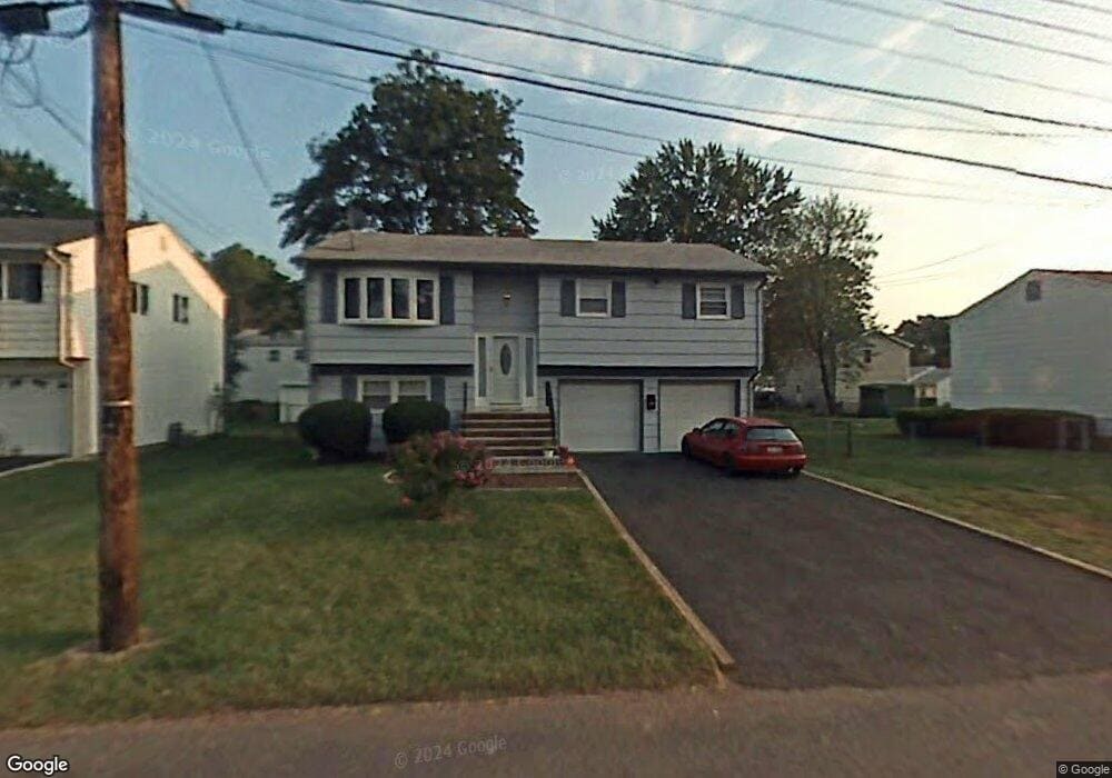
98 Cedar St Colonia, NJ 07067
Estimated Value: $425,617 - $674,000
3
Beds
2
Baths
1,080
Sq Ft
$507/Sq Ft
Est. Value
About This Home
This home is located at 98 Cedar St, Colonia, NJ 07067 and is currently estimated at $547,404, approximately $506 per square foot. 98 Cedar St is a home located in Middlesex County with nearby schools including Oak Ridge Heights Elementary School, Colonia Middle School, and Colonia High School.
Ownership History
Date
Name
Owned For
Owner Type
Purchase Details
Closed on
Aug 25, 2016
Sold by
Fannie Mae
Bought by
Hernandez Josue V and Hernandez Hillary S
Current Estimated Value
Home Financials for this Owner
Home Financials are based on the most recent Mortgage that was taken out on this home.
Original Mortgage
$329,422
Interest Rate
4.13%
Mortgage Type
FHA
Purchase Details
Closed on
May 12, 2015
Sold by
Manning Cynthia
Bought by
Federal National Mortgage Association
Purchase Details
Closed on
Aug 25, 2006
Sold by
Foreman Lorene
Bought by
Alfair Norris and Manning Cynthia
Home Financials for this Owner
Home Financials are based on the most recent Mortgage that was taken out on this home.
Original Mortgage
$299,000
Interest Rate
6.71%
Mortgage Type
New Conventional
Create a Home Valuation Report for This Property
The Home Valuation Report is an in-depth analysis detailing your home's value as well as a comparison with similar homes in the area
Home Values in the Area
Average Home Value in this Area
Purchase History
| Date | Buyer | Sale Price | Title Company |
|---|---|---|---|
| Hernandez Josue V | $286,900 | Reo America Abstract Inc | |
| Federal National Mortgage Association | -- | Attorney | |
| Alfair Norris | $399,900 | -- |
Source: Public Records
Mortgage History
| Date | Status | Borrower | Loan Amount |
|---|---|---|---|
| Previous Owner | Hernandez Josue V | $329,422 | |
| Previous Owner | Alfair Norris | $299,000 |
Source: Public Records
Tax History Compared to Growth
Tax History
| Year | Tax Paid | Tax Assessment Tax Assessment Total Assessment is a certain percentage of the fair market value that is determined by local assessors to be the total taxable value of land and additions on the property. | Land | Improvement |
|---|---|---|---|---|
| 2025 | $9,390 | $77,600 | $22,000 | $55,600 |
| 2024 | $9,186 | $77,600 | $22,000 | $55,600 |
| 2023 | $9,186 | $77,600 | $22,000 | $55,600 |
| 2022 | $8,958 | $77,600 | $22,000 | $55,600 |
| 2021 | $8,685 | $77,600 | $22,000 | $55,600 |
| 2020 | $8,617 | $77,600 | $22,000 | $55,600 |
| 2019 | $8,413 | $77,600 | $22,000 | $55,600 |
| 2018 | $8,253 | $77,600 | $22,000 | $55,600 |
| 2017 | $8,108 | $77,600 | $22,000 | $55,600 |
| 2016 | $8,014 | $77,300 | $22,000 | $55,300 |
| 2015 | $7,873 | $77,300 | $22,000 | $55,300 |
| 2014 | $7,704 | $77,300 | $22,000 | $55,300 |
Source: Public Records
Map
Nearby Homes
- 3 Mckinley Ave
- 25 N Lincoln Ave
- 49 Cleveland Ave
- 99 Cameo Place
- 116 Arthur Ave
- 80 Mckinley Ave
- 150 Carolyn Ave
- 70 Lancaster Rd
- 24 Frederick Ave
- 115 Mckinley Ave
- 19 State St
- 78 Patricia Ave
- 131 Morningside Rd
- 5 Elizabeth Ct
- 17 Rolling Hill Way
- 27 Stemmer Dr
- 836 W Inman Ave
- 80 Gaywood Ave
- 39 Mildred Terrace
- 442 Stalevicz Ln