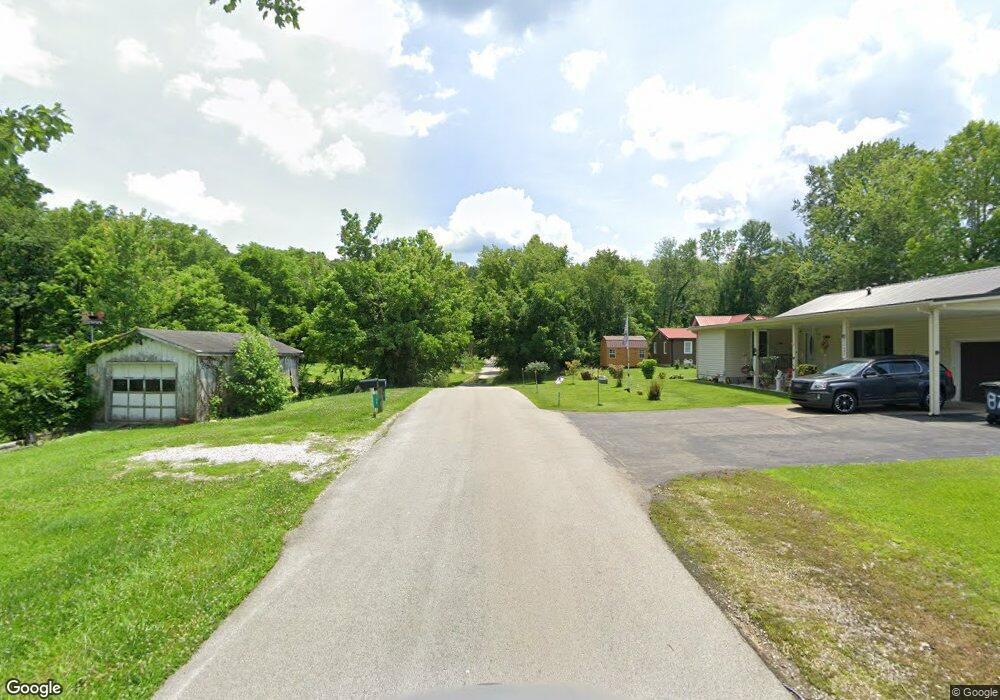
98 Church Rd Salt Lick, KY 40371
Estimated Value: $77,000 - $113,329
2
Beds
1
Bath
768
Sq Ft
$129/Sq Ft
Est. Value
About This Home
This home is located at 98 Church Rd, Salt Lick, KY 40371 and is currently estimated at $98,832, approximately $128 per square foot. 98 Church Rd is a home with nearby schools including Crossroads Elementary School, Bath County Middle School, and Bath County High School.
Ownership History
Date
Name
Owned For
Owner Type
Purchase Details
Closed on
Mar 2, 2023
Sold by
Greene Travis C
Bought by
Davis Karley
Current Estimated Value
Home Financials for this Owner
Home Financials are based on the most recent Mortgage that was taken out on this home.
Original Mortgage
$67,500
Outstanding Balance
$65,388
Interest Rate
6.15%
Mortgage Type
New Conventional
Estimated Equity
$33,444
Purchase Details
Closed on
Sep 10, 2019
Sold by
Earls Wanda M and Earls Wanda
Bought by
Greene Travis C
Purchase Details
Closed on
May 16, 2005
Sold by
Perry Billy
Bought by
Earls Wanda
Create a Home Valuation Report for This Property
The Home Valuation Report is an in-depth analysis detailing your home's value as well as a comparison with similar homes in the area
Home Values in the Area
Average Home Value in this Area
Purchase History
| Date | Buyer | Sale Price | Title Company |
|---|---|---|---|
| Davis Karley | $75,000 | -- | |
| Davis Karley | $75,000 | None Listed On Document | |
| Greene Travis C | -- | None Available | |
| Earls Wanda | $50,000 | None Available |
Source: Public Records
Mortgage History
| Date | Status | Borrower | Loan Amount |
|---|---|---|---|
| Open | Davis Karley | $67,500 | |
| Closed | Davis Karley | $67,500 |
Source: Public Records
Tax History Compared to Growth
Tax History
| Year | Tax Paid | Tax Assessment Tax Assessment Total Assessment is a certain percentage of the fair market value that is determined by local assessors to be the total taxable value of land and additions on the property. | Land | Improvement |
|---|---|---|---|---|
| 2024 | $935 | $75,000 | $0 | $0 |
| 2023 | $154 | $58,800 | $0 | $0 |
| 2022 | $213 | $58,800 | $0 | $0 |
| 2021 | $211 | $58,800 | $0 | $0 |
| 2020 | $671 | $58,800 | $0 | $0 |
| 2019 | $69 | $45,000 | $0 | $0 |
| 2018 | $91 | $45,000 | $0 | $0 |
| 2017 | -- | $45,000 | $0 | $0 |
| 2015 | -- | $44,500 | $0 | $0 |
| 2013 | -- | $45,000 | $10,000 | $35,000 |
Source: Public Records
Map
Nearby Homes
- 262 Main St
- 181 Helton Rd
- 2114 S Highway 211
- 1051 McClain Cemetery Rd
- 56 Christina Dr
- 118 Old River Rd
- 354 Old River Rd
- 2850 Lower Licking Rd
- 34 Mckenzie Rd
- 185 Poplar Rd
- 155 Poplar Rd
- 0 Farm House Trail Unit 59593
- 0 Farmhouse Trail Unit 91.2 Acres Land
- 2995 Moores Ferry Rd
- 24 Outlook Dr
- 143 Outlook Dr
- 250 Outlook Dr
- 84 Brent Ln
- 135 Arrowhead Dr
- 3696 McCarty Branch Rd
- 126 Church St
- 69 Center St
- 153 Church St
- 179 Turkey Ridge
- 85 Fanning Ln
- 1 Church St
- 123 Main St
- 158 Church St
- 211 Kentucky 211
- 173 Church St
- 175 Main St
- 35 Maple St
- 298 Main St
- 9431 E Highway 60
- 9413 E Highway 60
- 9413 U S 60
- 0 Maple St Unit Lot 15 & 1/2 of 14
- 49 Maple St
- 201 Main St
- 3080 Kentucky 211
