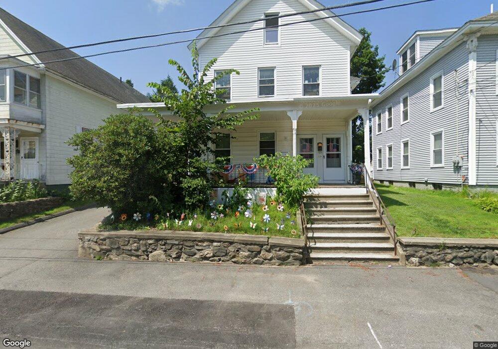
98 Clark St Unit 100 Clinton, MA 01510
Estimated Value: $432,252 - $672,000
6
Beds
2
Baths
3,206
Sq Ft
$174/Sq Ft
Est. Value
About This Home
This home is located at 98 Clark St Unit 100, Clinton, MA 01510 and is currently estimated at $557,563, approximately $173 per square foot. 98 Clark St Unit 100 is a home located in Worcester County with nearby schools including Clinton Elementary School, Clinton Senior High School, and Clinton Middle School.
Ownership History
Date
Name
Owned For
Owner Type
Purchase Details
Closed on
Sep 18, 2015
Sold by
Morrison Stephen K
Bought by
Rugid Enterprises Llc
Current Estimated Value
Purchase Details
Closed on
Jun 29, 2011
Sold by
Grady Margaret E
Bought by
Morrison Stephen K
Home Financials for this Owner
Home Financials are based on the most recent Mortgage that was taken out on this home.
Original Mortgage
$118,978
Interest Rate
4.87%
Mortgage Type
FHA
Create a Home Valuation Report for This Property
The Home Valuation Report is an in-depth analysis detailing your home's value as well as a comparison with similar homes in the area
Home Values in the Area
Average Home Value in this Area
Purchase History
| Date | Buyer | Sale Price | Title Company |
|---|---|---|---|
| Rugid Enterprises Llc | -- | -- | |
| Morrison Stephen K | $124,000 | -- |
Source: Public Records
Mortgage History
| Date | Status | Borrower | Loan Amount |
|---|---|---|---|
| Previous Owner | Morrison Stephen K | $118,978 |
Source: Public Records
Tax History Compared to Growth
Tax History
| Year | Tax Paid | Tax Assessment Tax Assessment Total Assessment is a certain percentage of the fair market value that is determined by local assessors to be the total taxable value of land and additions on the property. | Land | Improvement |
|---|---|---|---|---|
| 2025 | $4,991 | $375,300 | $100,000 | $275,300 |
| 2024 | $4,691 | $357,000 | $100,000 | $257,000 |
| 2023 | $4,411 | $329,900 | $90,900 | $239,000 |
| 2022 | $4,394 | $294,700 | $82,600 | $212,100 |
| 2021 | $4,148 | $260,200 | $78,700 | $181,500 |
| 2020 | $3,945 | $254,700 | $78,700 | $176,000 |
| 2019 | $3,705 | $232,600 | $76,400 | $156,200 |
| 2018 | $3,493 | $205,700 | $76,400 | $129,300 |
| 2017 | $3,295 | $186,500 | $76,400 | $110,100 |
| 2016 | $3,221 | $186,500 | $76,400 | $110,100 |
| 2015 | $2,814 | $168,900 | $74,200 | $94,700 |
| 2014 | $2,728 | $168,900 | $74,200 | $94,700 |
Source: Public Records
Map
Nearby Homes
- 57 Clark St
- 1 Grady St
- 459 High St
- 22 Forest Ave
- 55 Sterling St Unit 306
- 55 Sterling St Unit 314
- 55 Sterling St Unit 212
- 201-203 Stone St
- 201 Stone St Unit 203
- 216 Walnut St
- 23 Ash St
- 89 1/2 Walnut St
- 51 Rigby St
- 155 Cedar St
- 30 John F. Kennedy Ave
- 0 Parker Rd
- 19 Magnolia Ave
- 13 Simon Ct
- 125 Grove St
- 405 Ridgefield Cir Unit C
- 104 Clark St Unit 106
- 96 Clark St
- 761 Main St
- 753 Main St
- 737 Main St Unit 1
- 737 Main St
- 767 Main St
- 88 Clark St
- 88 Clark St Unit 2
- 101 Clark St
- 747 Main St Unit 749
- 93 Clark St
- 107 Clark St
- 747-749 Main St Unit 2
- 773 Main St
- 773 Main St Unit 2
- 773 Main St Unit 1
- 84 Clark St
- 109 Clark St
- 118 Clark St