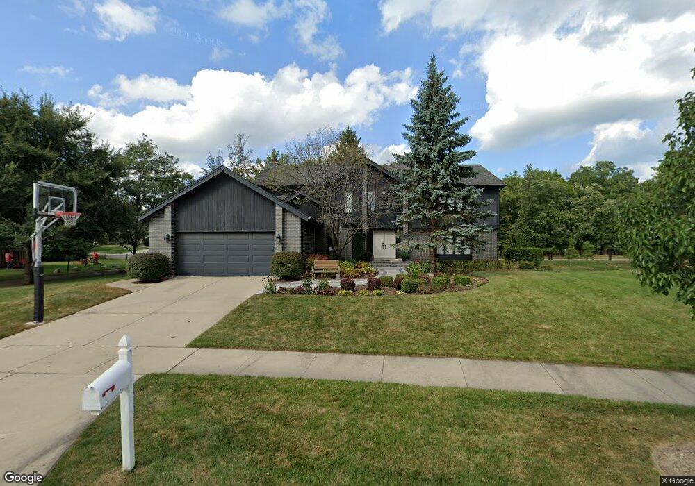
98 E Saint Andrews Ln Deerfield, IL 60015
Briarwood NeighborhoodEstimated Value: $1,006,576 - $1,335,000
4
Beds
3
Baths
3,382
Sq Ft
$339/Sq Ft
Est. Value
About This Home
This home is located at 98 E Saint Andrews Ln, Deerfield, IL 60015 and is currently estimated at $1,144,894, approximately $338 per square foot. 98 E Saint Andrews Ln is a home located in Lake County with nearby schools including Kipling Elementary School, Alan B Shepard Middle School, and Deerfield High School.
Ownership History
Date
Name
Owned For
Owner Type
Purchase Details
Closed on
Jul 22, 2025
Sold by
Weinstein Gail
Bought by
Gail E Beck Trust and Weinstein
Current Estimated Value
Purchase Details
Closed on
Jan 13, 2005
Sold by
Tick Steven H and Tick Andrea M
Bought by
Weinstein Noah and Weinstein Gail
Home Financials for this Owner
Home Financials are based on the most recent Mortgage that was taken out on this home.
Original Mortgage
$546,000
Interest Rate
5.83%
Mortgage Type
Purchase Money Mortgage
Create a Home Valuation Report for This Property
The Home Valuation Report is an in-depth analysis detailing your home's value as well as a comparison with similar homes in the area
Home Values in the Area
Average Home Value in this Area
Purchase History
We collect this data history from publicly available records. To have your information removed, we recommend requesting removal directly through your county’s website.
| Date | Buyer | Sale Price | Title Company |
|---|---|---|---|
| Gail E Beck Trust | -- | None Listed On Document | |
| Weinstein Noah | $780,000 | St |
Source: Public Records
Mortgage History
We collect this data history from publicly available records. To have your information removed, we recommend requesting removal directly through your county’s website.
| Date | Status | Borrower | Loan Amount |
|---|---|---|---|
| Previous Owner | Weinstein Noah | $546,000 |
Source: Public Records
Tax History
| Year | Tax Paid | Tax Assessment Tax Assessment Total Assessment is a certain percentage of the fair market value that is determined by local assessors to be the total taxable value of land and additions on the property. | Land | Improvement |
|---|---|---|---|---|
| 2025 | $24,120 | $284,676 | $56,211 | $228,465 |
| 2024 | $22,050 | $268,385 | $52,994 | $215,391 |
| 2023 | $20,141 | $241,919 | $47,768 | $194,151 |
| 2022 | $20,141 | $218,185 | $52,476 | $165,709 |
| 2021 | $19,062 | $210,909 | $50,726 | $160,183 |
| 2020 | $18,296 | $210,909 | $50,726 | $160,183 |
| 2019 | $17,824 | $209,923 | $50,489 | $159,434 |
| 2018 | $18,742 | $229,683 | $55,851 | $173,832 |
| 2017 | $18,566 | $228,359 | $55,529 | $172,830 |
| 2016 | $17,868 | $217,402 | $52,865 | $164,537 |
| 2015 | $17,315 | $201,990 | $49,117 | $152,873 |
| 2014 | $18,389 | $208,022 | $49,738 | $158,284 |
| 2012 | $17,890 | $209,235 | $50,028 | $159,207 |
Source: Public Records
Map
Nearby Homes
- 2130 Magnolia Ln
- 75 Eastwood Dr
- 31 Mulberry East Rd
- 122 Mulberry Rd
- 109 Mulberry Rd
- 2015 Maplewood Rd
- 1921 Beechnut Rd
- 707 Brierhill Rd
- 2009 Skyelar Ct
- 126 Millstone Rd
- 705 Ridge Rd
- 1744 Walnut Cir
- 860 Heather Rd
- 2055 Walnut Cir
- 985 Coventry Ln
- 778 Barberry Rd
- 970 Windsor Rd
- 421 Milford Rd
- 1931 Oakwood Rd
- 757 Kipling Place
- 116 E Saint Andrews Ln
- 80 E Saint Andrews Ln
- 136 E Saint Andrews Ln
- 99 E Saint Andrews Ln
- 345 Carlisle Ave
- 85 E Saint Andrews Ln
- 68 E Saint Andrews Ln
- 150 E Saint Andrews Ln
- 340 Carlisle Ave
- 172 E Saint Andrews Ln
- 71 E Saint Andrews Ln
- 365 Carlisle Ave
- 165 E Saint Andrews Ln
- 46 E Saint Andrews Ln
- 15 Shenandoah Rd
- 57 E Saint Andrews Ln
- 179 E Saint Andrews Ln
- 86 Tamarisk Ln
- 186 E Saint Andrews Ln
- 24 E Saint Andrews Ln
Your Personal Tour Guide
Ask me questions while you tour the home.