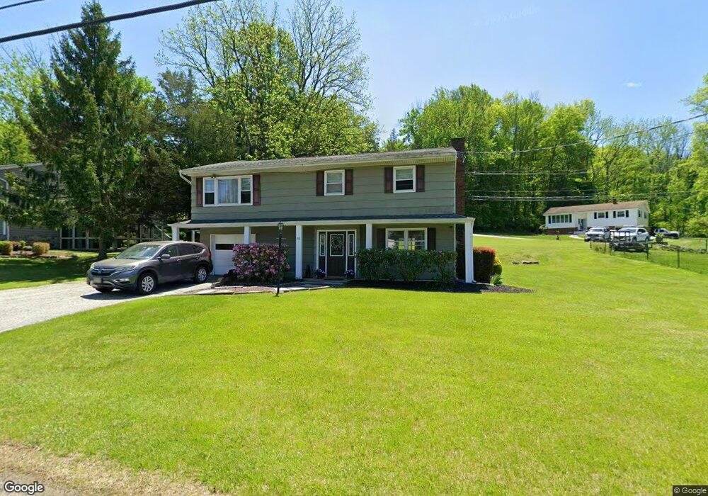
98 Forest Rd Andover, NJ 07821
Estimated Value: $381,696 - $520,000
Studio
--
Bath
1,718
Sq Ft
$264/Sq Ft
Est. Value
About This Home
This home is located at 98 Forest Rd, Andover, NJ 07821 and is currently estimated at $453,174, approximately $263 per square foot. 98 Forest Rd is a home located in Sussex County with nearby schools including Green Hills School and Tranquility Adventist School.
Ownership History
Date
Name
Owned For
Owner Type
Purchase Details
Closed on
Sep 6, 2001
Sold by
Scudilla Patrick and Scudilla Donna
Bought by
Cole Thomas and Cole Rebecca
Current Estimated Value
Home Financials for this Owner
Home Financials are based on the most recent Mortgage that was taken out on this home.
Original Mortgage
$130,000
Outstanding Balance
$50,693
Interest Rate
6.99%
Mortgage Type
Stand Alone First
Estimated Equity
$402,481
Purchase Details
Closed on
Apr 28, 1995
Sold by
Wright Gail A and Norton Gail A
Bought by
Scudilla Patrick and Scudilla Donna
Create a Home Valuation Report for This Property
The Home Valuation Report is an in-depth analysis detailing your home's value as well as a comparison with similar homes in the area
Home Values in the Area
Average Home Value in this Area
Purchase History
| Date | Buyer | Sale Price | Title Company |
|---|---|---|---|
| Cole Thomas | $174,000 | -- | |
| Scudilla Patrick | $139,900 | -- |
Source: Public Records
Mortgage History
| Date | Status | Borrower | Loan Amount |
|---|---|---|---|
| Open | Cole Thomas | $130,000 |
Source: Public Records
Tax History
| Year | Tax Paid | Tax Assessment Tax Assessment Total Assessment is a certain percentage of the fair market value that is determined by local assessors to be the total taxable value of land and additions on the property. | Land | Improvement |
|---|---|---|---|---|
| 2025 | $6,889 | $350,100 | $143,800 | $206,300 |
| 2024 | $6,839 | $177,000 | $71,500 | $105,500 |
Source: Public Records
Map
Nearby Homes
- 95 Forest Rd
- 30 Scenic Dr
- 4 Spruce Dr
- 0 Decker Pond Airport Rd Unit 3945534
- 88 Kennedy Rd
- 10 Sunny Ln
- 52 Whitehall Rd
- 37 Pequest Rd
- 70 S Shore Rd
- 30 MacKerley Rd
- 203 Johnsonburg Rd
- 6 Jans Way
- 8 Cub Lake Rd
- 10 Rushmore Ln
- 14 Golden Crowned Kinglet Unit 7
- 5 Rushmore Ln
- 43 Rushmore Ln
- 17 Rushmore Ln
- 17 High St
- 127 Osprey Unit 2
Your Personal Tour Guide
Ask me questions while you tour the home.