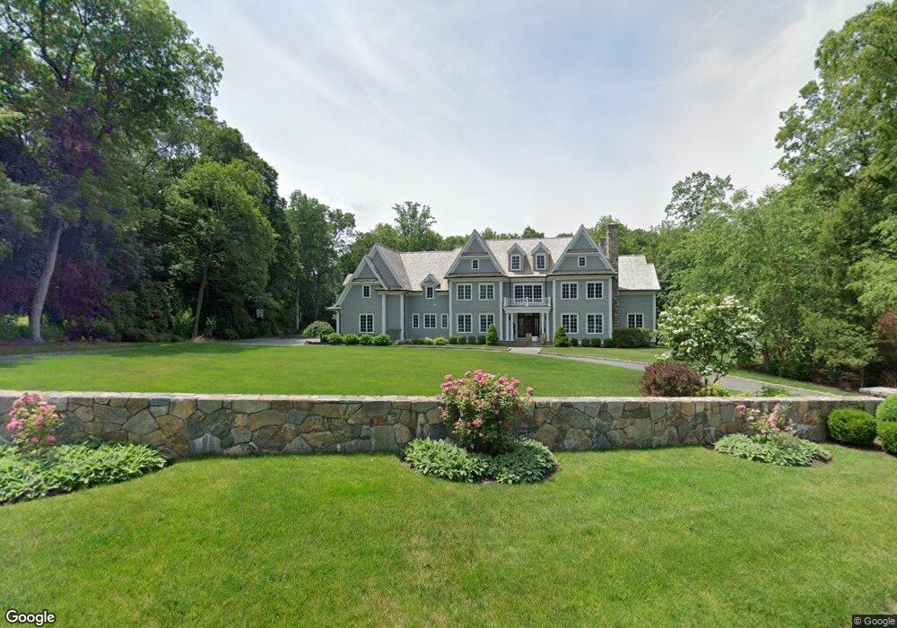
98 Ludlowe Rd New Canaan, CT 06840
Estimated Value: $3,264,000 - $4,701,000
5
Beds
7
Baths
6,700
Sq Ft
$594/Sq Ft
Est. Value
About This Home
This home is located at 98 Ludlowe Rd, New Canaan, CT 06840 and is currently estimated at $3,981,224, approximately $594 per square foot. 98 Ludlowe Rd is a home located in Fairfield County with nearby schools including East Elementary School, Saxe Middle School, and New Canaan High School.
Ownership History
Date
Name
Owned For
Owner Type
Purchase Details
Closed on
Jun 21, 2011
Sold by
Chuchuca Luis
Bought by
Stiles Eric
Current Estimated Value
Purchase Details
Closed on
Nov 3, 2009
Sold by
Schroder Lois A
Bought by
Chuchuca Luis
Create a Home Valuation Report for This Property
The Home Valuation Report is an in-depth analysis detailing your home's value as well as a comparison with similar homes in the area
Home Values in the Area
Average Home Value in this Area
Purchase History
| Date | Buyer | Sale Price | Title Company |
|---|---|---|---|
| Stiles Eric | -- | -- | |
| Chuchuca Luis | $830,000 | -- |
Source: Public Records
Mortgage History
| Date | Status | Borrower | Loan Amount |
|---|---|---|---|
| Previous Owner | Chuchuca Luis | $700,000 |
Source: Public Records
Tax History Compared to Growth
Tax History
| Year | Tax Paid | Tax Assessment Tax Assessment Total Assessment is a certain percentage of the fair market value that is determined by local assessors to be the total taxable value of land and additions on the property. | Land | Improvement |
|---|---|---|---|---|
| 2025 | $39,001 | $2,336,810 | $705,600 | $1,631,210 |
| 2024 | $37,716 | $2,336,810 | $705,600 | $1,631,210 |
| 2023 | $31,996 | $1,689,310 | $679,700 | $1,009,610 |
| 2022 | $31,033 | $1,689,310 | $679,700 | $1,009,610 |
| 2021 | $30,678 | $1,689,310 | $679,700 | $1,009,610 |
| 2020 | $30,678 | $1,689,310 | $679,700 | $1,009,610 |
| 2019 | $30,813 | $1,689,310 | $679,700 | $1,009,610 |
| 2018 | $33,968 | $2,002,840 | $755,230 | $1,247,610 |
| 2017 | $33,387 | $2,002,840 | $755,230 | $1,247,610 |
| 2016 | $32,666 | $2,002,840 | $755,230 | $1,247,610 |
| 2015 | $33,167 | $2,002,840 | $755,230 | $1,247,610 |
| 2014 | $31,124 | $2,002,840 | $755,230 | $1,247,610 |
Source: Public Records
Map
Nearby Homes
- 240 Rosebrook Rd
- 49 Ludlowe Rd
- 262 Brushy Ridge Rd
- 114 Ferris Hill Rd
- 52 Garibaldi Ln
- 61 Smith Ridge Rd
- 145 River St
- 101 Parade Hill Rd
- 48 Brookwood Ln
- 122 Brookwood Ln
- 67 Carter St
- 204 Parade Hill Rd
- 30L Huckleberry Hill Rd
- 561 Smith Ridge Rd
- 79 Locust Ave Unit 212
- 85 Locust Ave Unit 516
- 136L Carter St
- 289 New Norwalk Rd Unit 22
- 140L Carter St
- 152L Carter St
- 102 Ludlowe Rd
- 68 Ludlowe Rd
- 95 Ludlowe Rd
- 56 Bittersweet Ln
- 165 Rosebrook Rd
- 77 Ludlowe Rd
- 64 Ludlowe Rd
- 250L Rosebrook Rd
- 250 Rosebrook Rd
- 46 Ludlowe Rd
- 61 Bittersweet Ln
- 348 Canoe Hill Rd
- 78 Bittersweet Ln
- 143 Rosebrook Rd
- 62 Ludlowe Rd
- 230 Rosebrook Rd
- 362 Canoe Hill Rd
- 83 Bittersweet Ln
- 26 Ludlowe Rd
- 220 Rosebrook Rd