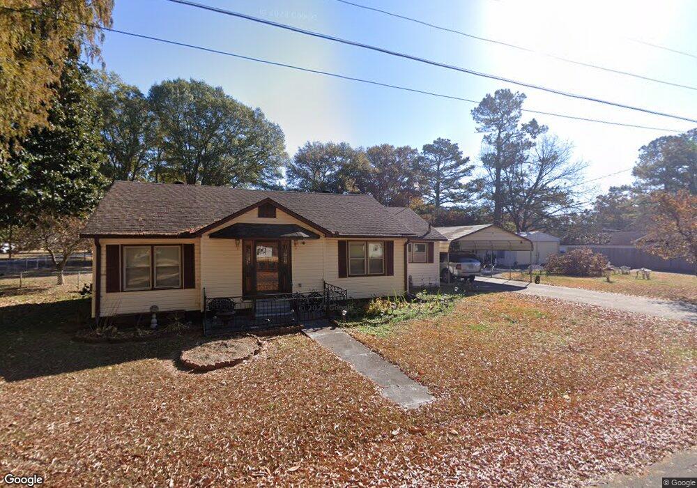
98 Roosevelt St Cedartown, GA 30125
Estimated Value: $178,105 - $220,000
2
Beds
1
Bath
1,503
Sq Ft
$132/Sq Ft
Est. Value
About This Home
This home is located at 98 Roosevelt St, Cedartown, GA 30125 and is currently estimated at $198,526, approximately $132 per square foot. 98 Roosevelt St is a home located in Polk County with nearby schools including Cedar Christian School.
Ownership History
Date
Name
Owned For
Owner Type
Purchase Details
Closed on
Mar 7, 2007
Sold by
Bridges Bobby Earl
Bought by
Bridges Sonja
Current Estimated Value
Purchase Details
Closed on
Feb 21, 2007
Sold by
Not Provided
Bought by
Bridges Sonja
Purchase Details
Closed on
Sep 15, 1972
Sold by
Guice Charlene S
Bought by
Bridges Bobby
Purchase Details
Closed on
Sep 21, 1971
Sold by
Guice Ellis W
Bought by
Guice Charlene S
Purchase Details
Closed on
Apr 30, 1964
Sold by
Dingler James M
Bought by
Guice Ellis W
Purchase Details
Closed on
Jul 24, 1957
Bought by
Dingler James M
Create a Home Valuation Report for This Property
The Home Valuation Report is an in-depth analysis detailing your home's value as well as a comparison with similar homes in the area
Home Values in the Area
Average Home Value in this Area
Purchase History
| Date | Buyer | Sale Price | Title Company |
|---|---|---|---|
| Bridges Sonja | -- | -- | |
| Bridges Sonja | -- | -- | |
| Bridges Sonja | -- | -- | |
| Bridges Sonja | -- | -- | |
| Bridges Sonja | -- | -- | |
| Bridges Bobby | -- | -- | |
| Guice Charlene S | -- | -- | |
| Guice Ellis W | -- | -- | |
| Dingler James M | -- | -- |
Source: Public Records
Tax History Compared to Growth
Tax History
| Year | Tax Paid | Tax Assessment Tax Assessment Total Assessment is a certain percentage of the fair market value that is determined by local assessors to be the total taxable value of land and additions on the property. | Land | Improvement |
|---|---|---|---|---|
| 2024 | $381 | $50,242 | $2,200 | $48,042 |
| 2023 | $97 | $36,102 | $1,210 | $34,892 |
| 2022 | $744 | $30,931 | $1,210 | $29,721 |
| 2021 | $744 | $30,931 | $1,210 | $29,721 |
| 2020 | $423 | $30,931 | $1,210 | $29,721 |
| 2019 | $223 | $21,651 | $1,798 | $19,853 |
| 2018 | $203 | $20,720 | $1,540 | $19,180 |
| 2017 | $197 | $20,720 | $1,540 | $19,180 |
| 2016 | $197 | $20,721 | $1,540 | $19,180 |
| 2015 | $197 | $20,721 | $1,540 | $19,180 |
| 2014 | $201 | $20,829 | $1,540 | $19,288 |
Source: Public Records
Map
Nearby Homes
- 618 Valley Rd
- 645 Valley Rd
- 662 Hillside Dr
- 660 Valley Rd
- 10 Woodglen Dr
- 1101 East Ave
- 202 Ridgewood Rd
- 209 Ridgewood Rd
- 109 Perry St
- 77 Ben Dr W
- 12 Breckenridge Dr
- 292 Kimwood Dr
- 362 Oakwood Dr
- 254 E Girard Ave
- 256 Cuzzort Rd
- 0 Blanche Rd Unit 10609468
- 0 Blanche Rd Unit 7652978
- 462 Oakwood Dr
- 00 Juliette St
- 537 Fletcher St
- 78 Roosevelt St
- 443 Mcarthur St
- 453 Mcarthur St
- 468 Mcarthur St
- 470 Mcarthur St
- 121 Patton St
- 431 Mcarthur St
- 426 Mcarthur St
- 161 Patton St
- 478 Mcarthur St
- 480 Mcarthur St
- 471 Mcarthur St
- 421 Mcarthur St
- 109 Patton St
- 169 Patton St
- 166 Abner Dr
- 162 Abner Dr
- 485 Mcarthur St
- 170 Abner Dr
- 122 Patton St