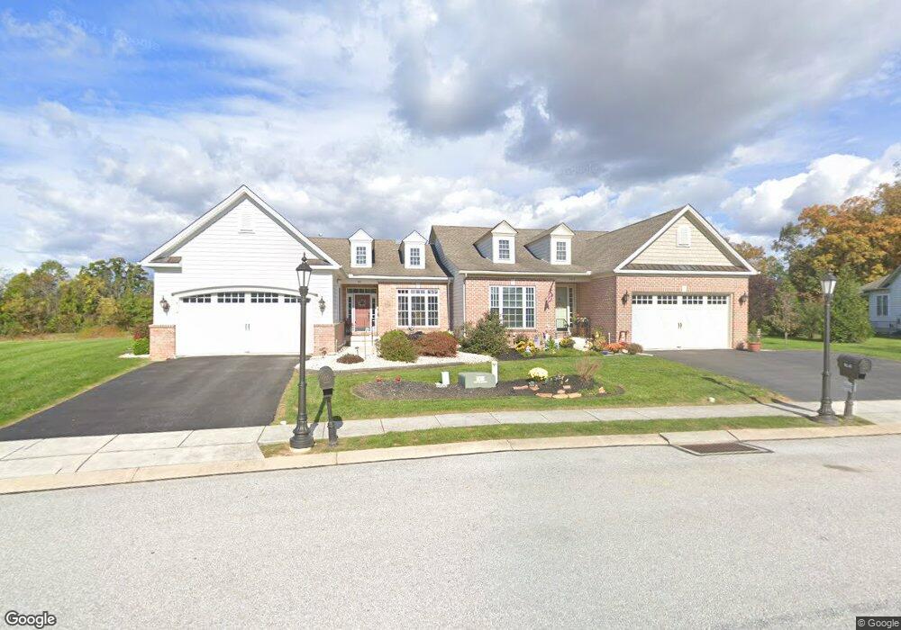
98 St Michaels Way Unit 9 Hanover, PA 17331
Estimated Value: $385,000 - $454,000
3
Beds
2
Baths
2,008
Sq Ft
$204/Sq Ft
Est. Value
About This Home
This home is located at 98 St Michaels Way Unit 9, Hanover, PA 17331 and is currently estimated at $410,113, approximately $204 per square foot. 98 St Michaels Way Unit 9 is a home located in Adams County with nearby schools including New Oxford Senior High School, St. Teresa of Calcutta Catholic School - McSherrystown Campus, and St. Teresa of Calcutta Catholic School - Conewago Campus.
Ownership History
Date
Name
Owned For
Owner Type
Purchase Details
Closed on
Nov 7, 2018
Sold by
Hildt Wayne M and Hildt Winifred A
Bought by
Winifred Ann Hildt Ret
Current Estimated Value
Purchase Details
Closed on
Jul 25, 2008
Sold by
Harvest Investments Group Llc
Bought by
Hildt Wayne M and Hildt Winifred A
Home Financials for this Owner
Home Financials are based on the most recent Mortgage that was taken out on this home.
Original Mortgage
$194,702
Interest Rate
6.4%
Mortgage Type
New Conventional
Create a Home Valuation Report for This Property
The Home Valuation Report is an in-depth analysis detailing your home's value as well as a comparison with similar homes in the area
Home Values in the Area
Average Home Value in this Area
Purchase History
| Date | Buyer | Sale Price | Title Company |
|---|---|---|---|
| Winifred Ann Hildt Ret | -- | -- | |
| Hildt Wayne M | $270,202 | -- |
Source: Public Records
Mortgage History
| Date | Status | Borrower | Loan Amount |
|---|---|---|---|
| Previous Owner | Hildt Wayne M | $194,702 |
Source: Public Records
Tax History Compared to Growth
Tax History
| Year | Tax Paid | Tax Assessment Tax Assessment Total Assessment is a certain percentage of the fair market value that is determined by local assessors to be the total taxable value of land and additions on the property. | Land | Improvement |
|---|---|---|---|---|
| 2025 | $7,325 | $305,900 | $56,700 | $249,200 |
| 2024 | $6,766 | $305,900 | $56,700 | $249,200 |
| 2023 | $6,516 | $305,900 | $56,700 | $249,200 |
| 2022 | $6,317 | $305,900 | $56,700 | $249,200 |
| 2021 | $6,155 | $305,900 | $56,700 | $249,200 |
| 2020 | $6,164 | $305,900 | $56,700 | $249,200 |
| 2019 | $5,887 | $305,900 | $56,700 | $249,200 |
| 2018 | $5,764 | $305,900 | $56,700 | $249,200 |
| 2017 | $5,526 | $305,900 | $56,700 | $249,200 |
| 2016 | -- | $305,900 | $56,700 | $249,200 |
| 2015 | -- | $305,900 | $56,700 | $249,200 |
| 2014 | -- | $305,900 | $56,700 | $249,200 |
Source: Public Records
Map
Nearby Homes
- 152 St Michaels Way Unit 18
- 124 Flint Dr Unit 61
- 111 Eagle Ln Unit 7
- 105 Flint Dr
- 108 Flint Dr
- 5955 Hanover Rd
- 73 Flint Dr
- 11 Flint Dr
- 24 Red Stone Ln Unit 47
- 62 Flint Dr
- 3211 Centennial Rd
- 54 Flint Dr
- 11 Shawl Dr
- 46 Flint Dr
- 84 Red Stone Ln Unit 41
- 92 Red Stone Ln Unit 40
- 9 Westview Dr Unit 2A
- 1 Sease Dr Unit 1
- 49 North St
- 128 North St
- 104 Saint Michaels Way
- 104 St Michaels Way Unit 10
- 95 St Michaels Way Unit 38
- 0 Saint Michaels Way Unit AD7924720
- 0 Saint Michaels Way Unit AD7904309
- 0 Saint Michaels Way Unit 1009685066
- 0 Saint Michaels Way Unit 1009663738
- 0 Saint Michaels Way Unit 1009663608
- 0 Saint Michaels Way Unit 1009663402
- 110 St Michaels Way Unit 11
- 92 St Michaels Way Unit 8
- 116 St Michaels Way Unit 12
- 95 Saint Michaels Way
- 0 Saint Michaels Way Unit AD7904274
- 115 St Michaels Way Unit 39
- 86 Saint Michaels Way
- 116 Saint Michaels Way
- 0 Saint Michaels Way Unit AD7904406
- 115 Saint Michaels Way
- 86 St Michaels Way Unit 7