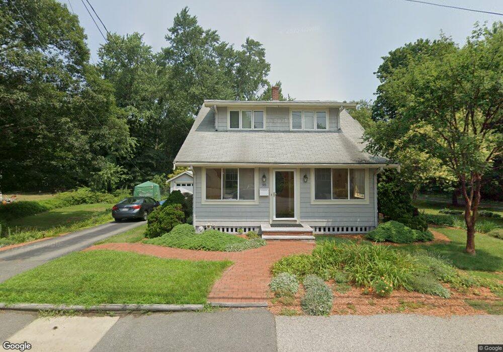
98 Stetson St Braintree, MA 02184
East Braintree NeighborhoodEstimated Value: $630,404 - $720,000
2
Beds
2
Baths
1,486
Sq Ft
$460/Sq Ft
Est. Value
About This Home
This home is located at 98 Stetson St, Braintree, MA 02184 and is currently estimated at $683,601, approximately $460 per square foot. 98 Stetson St is a home located in Norfolk County with nearby schools including Braintree High School, South Shore Christian Academy, and Sacred Heart Elementary School.
Ownership History
Date
Name
Owned For
Owner Type
Purchase Details
Closed on
Oct 27, 2021
Sold by
Zwicker Herbert H and Zwicker Sara M
Bought by
Zwicker Herbert H and Mintz-Zwicker Sara
Current Estimated Value
Purchase Details
Closed on
Sep 14, 1979
Bought by
Zwicker Herbert H and Mintz Sara
Create a Home Valuation Report for This Property
The Home Valuation Report is an in-depth analysis detailing your home's value as well as a comparison with similar homes in the area
Home Values in the Area
Average Home Value in this Area
Purchase History
| Date | Buyer | Sale Price | Title Company |
|---|---|---|---|
| Zwicker Herbert H | -- | None Available | |
| Zwicker Herbert H | -- | -- |
Source: Public Records
Mortgage History
| Date | Status | Borrower | Loan Amount |
|---|---|---|---|
| Previous Owner | Zwicker Herbert H | $100,000 |
Source: Public Records
Tax History
| Year | Tax Paid | Tax Assessment Tax Assessment Total Assessment is a certain percentage of the fair market value that is determined by local assessors to be the total taxable value of land and additions on the property. | Land | Improvement |
|---|---|---|---|---|
| 2025 | $5,852 | $586,400 | $322,200 | $264,200 |
| 2024 | $5,322 | $561,400 | $300,400 | $261,000 |
| 2023 | $5,044 | $516,800 | $269,900 | $246,900 |
| 2022 | $4,882 | $490,700 | $243,800 | $246,900 |
| 2021 | $4,507 | $453,000 | $220,300 | $232,700 |
| 2020 | $4,173 | $423,200 | $200,300 | $222,900 |
| 2019 | $4,038 | $400,200 | $191,600 | $208,600 |
| 2018 | $3,946 | $374,400 | $174,200 | $200,200 |
| 2017 | $3,806 | $354,400 | $165,500 | $188,900 |
| 2016 | $3,528 | $321,300 | $139,300 | $182,000 |
| 2015 | $3,468 | $313,300 | $137,600 | $175,700 |
| 2014 | $3,295 | $288,500 | $125,400 | $163,100 |
Source: Public Records
Map
Nearby Homes
- 37 Lantern Ln
- 41 Lantern Ln
- 140 Commercial St
- 15 Summer St
- 122 Washington St Unit Twenty-two
- 300 Commercial St Unit 23
- 25 Richmond St
- 54 Edgemont Rd
- 26 Tingley Rd
- 15 Dana Rd
- 19 Vine St Unit 2
- 312 Shaw St
- 33 Congress St
- 46 Roosevelt Rd
- 31 Doris Rd
- 82 Lester Ln
- 564 Middle St
- 255 River St
- 36 Chestnut Ave
- 50 Cleveland Ave
Your Personal Tour Guide
Ask me questions while you tour the home.